Abstract
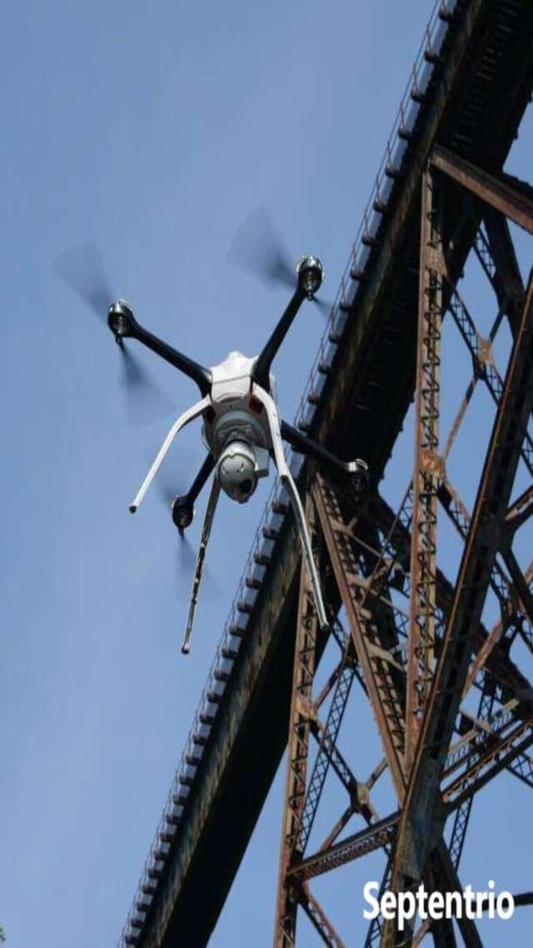
The Septentrio mosaic-G5 P3H is a high-precision GNSS receiver module with integrated dual-antenna heading capability, designed for autonomous navigation and precision environmental monitoring tasks. With its centimeter-level RTK positioning, field-proven anti-jamming and anti-spoofing performance validated in the Norwegian JammerTest, and ultra-low power consumption of only 0.6W, the mosaic-G5 P3H™ serves as the ideal positioning core for environmental monitoring drones. It ensures continuous output of stable and trustworthy position and attitude data under complex electromagnetic environments, harsh weather, and varying terrain conditions, providing a solid foundation for precise spatiotemporal correlation analysis of environmental elements such as atmosphere, water quality, and ecology.
AI Q&A
Why do environmental monitoring drones require GNSS receivers with anti-spoofing capability?
Environmental monitoring often involves sensitive or complex areas such as borders, coastal regions, and industrial zones, where malicious GNSS interference and spoofing may exist. Spoofing signals can cause drone positioning errors, route deviations, and even lead to crashes, resulting in equipment loss, data contamination, and potential environmental secondary risks. The AIM+ technology integrated into the mosaic-G5 P3H has been proven effective against various spoofing attacks in the 2024 Norwegian JammerTest. It can detect and mitigate such threats in real time, ensuring flight safety and the authenticity of collected data.
How does the mosaic-G5 P3H ensure continuous and stable positioning in environments with severe GNSS signal obstruction and reflection, such as mountains, forests, or urban building clusters?
The mosaic-G5 P3H employs APME+ multipath mitigation technology, which effectively distinguishes direct signals from those reflected by terrain, vegetation, and buildings, significantly reducing positioning errors. Simultaneously, its all-frequency, multi-system redundant tracking (supporting all in-orbit signals from GPS, GLONASS, BeiDou, Galileo, and QZSS) provides strong signal robustness. Even if some satellite signals are blocked, signals from other frequency bands and constellations can maintain positioning solutions, ensuring continuous operation in complex terrain.
JammerTest results show that Septentrio receivers maintain positioning under extreme interference. What is the principle behind this, and what significance does it hold for environmental monitoring?
The core lies in the AIM+ advanced interference mitigation technology. This technology uses real-time spectrum monitoring and adaptive filtering algorithms to quickly identify and filter out interference energy when it occurs, maintaining stable tracking of satellite signals. During testing, even when faced with extreme interference up to 10 million times the strength of GNSS signals, mosaic-series receivers continued to output correct positions. This is crucial for drones performing monitoring tasks near potential strong electromagnetic interference sources like industrial areas and substations, ensuring reliable mission execution and data integrity in complex electromagnetic environments.
If sudden or deliberate interference exists in the monitoring area, can the mosaic-G5 P3H ensure uninterrupted mission operation?
Yes. Based on JammerTest field results, Septentrio receivers equipped with AIM+ demonstrated 99.5% positioning availability under various interference forms. Even when encountering common “cigarette lighter-style” low-power jammers (10-15 dBm) or more complex wideband interference, the module can maintain high-precision positioning output. This ensures that the environmental monitoring drone’s mission workflow is not interrupted by external interference, and data collection remains continuous and effective.
Environmental monitoring drones often require long-endurance operations. What is the power consumption performance of the mosaic-G5 P3H?
The mosaic-G5 P3H has a typical power consumption of only 0.6W, with a maximum of 0.785W (in dual-antenna mode). This ultra-low power characteristic significantly reduces the energy burden on the drone platform, directly extending single-sortie flight time. This enables drones to cover larger areas (such as large lakes, watersheds, forests) for continuous monitoring, improving operational efficiency.
Core Advantages of the Septentrio mosaic-G5 P3H GNSS Receiver
Proven Resilience: Outstanding Anti-Jamming and Anti-Spoofing Capabilities
The primary advantage lies in its proven resilience in extreme environments, publicly validated by JammerTest 2024. Under intense interference reaching 10 million times the strength of GNSS signals, this module maintained centimeter-level positioning while competitors exhibited drift of hundreds of meters. Under complex attacks like meaconing (signal replay spoofing), it consistently output authentic trajectories and provided active alerts. This robustness stems from its multi-layered AIM+ protection technology, ensuring data integrity and mission continuity in complex electromagnetic environments like industrial zones and border areas.
Dual-Antenna High-Precision Positioning & Heading: Unlocking Multi-Dimensional Environmental Data Correlation
It innovatively integrates dual-antenna heading with centimeter-level RTK positioning. Within a compact size of only 22.8×16.4 mm, it achieves heading accuracy of 0.03° (1-meter baseline) and horizontal positioning accuracy of 0.6 cm + 0.5 ppm. Combined with APME+ for mitigating terrain multipath and LOCK+ for ensuring tracking stability during flight dynamics, it directly outputs trustworthy position and attitude data. This enables deep correlation between environmental parameters and precise spatial location/observation direction.
A Drone-Optimized Design for Field Long-Endurance Monitoring
While delivering high performance, it features an efficient design with typical power consumption of 0.6 W, a 20 Hz update rate, and RTK initialization in approximately 7 seconds, supporting long-endurance drone operations. Its wide operating temperature range (-40°C to +85°C) and ruggedness adapt to harsh field environments, providing a stable and reliable spatiotemporal reference for long-duration, large-scale environmental monitoring missions.

Integration Advantages of the mosaic-G5 P3H in Environmental Monitoring Drone Platforms
Precise Spatiotemporal Data Synchronization
The 20 Hz high-frequency position and attitude data enables precise time and space synchronization with onboard multispectral cameras, LiDAR, atmospheric sensors, etc. It ensures that every environmental sample or each frame of remote sensing imagery carries a centimeter-level precision geographic location and accurate sensor pointing tag, greatly enhancing the accuracy and value of subsequent data analysis.
Enhancing Monitoring Efficiency and Coverage
Fast startup and positioning initialization shorten mission preparation time. The ultra-low power consumption extends drone endurance, enabling a single sortie to complete larger area surveys or grid monitoring (e.g., entire forests, watersheds), improving operational efficiency.
Adapting to Diverse and Complex Monitoring Scenarios
From scorching deserts to freezing polar regions, from humid rainforests to corrosive coastal salt spray environments, the module’s wide operating temperature range and rugged design ensure reliable operation under various extreme climate and geographical conditions, meeting global environmental monitoring needs.

The mosaic-G5 P3H: The Reliable Spatiotemporal Sensing Foundation for Environmental Monitoring
Empowering High-Quality Environmental Data Assets
Drones integrated with the mosaic-G5 P3H provide high-trust spatiotemporal reference data. This transforms collected atmospheric pollution distribution maps, water quality heat maps, vegetation index maps, etc., from mere “images” into traceable, analyzable, and actionable spatial data assets with precise geographic information and quality tags. These assets serve environmental modeling, trend prediction, and policy-making.
Lowering System Integration and Development Barriers
It provides standard hardware interfaces and comprehensive protocol support, enabling seamless integration into existing drone platforms and mission payloads. Coupled with software tools and technical support from Septentrio, it can significantly accelerate the development and deployment cycle of dedicated environmental monitoring drone systems.
Investing in Long-Term Technological Evolution
Choosing the mosaic-G5 P3H means selecting a platform with continuous upgrade capabilities. Its support for future GNSS services (e.g., HAS, OSNMA) ensures your environmental monitoring system can keep pace with technological advancements and maintain long-term technical relevance.