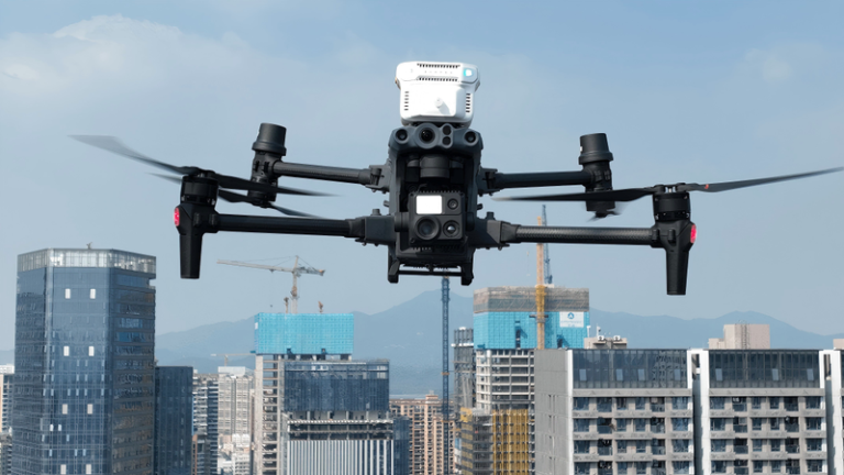
In the rapidly evolving landscape of drones and autonomous systems, the intelligence of flight control platforms (such as PX4 and ArduPilot) heavily relies on high-precision, highly reliable spatiotemporal information. GNSS has evolved from a mere positioning tool into a core state sensor ensuring flight safety and enabling autonomous decision-making. Confronted with complex electromagnetic environments and growing security threats, the performance limitations of traditional GNSS modules are becoming increasingly apparent. Septentrio’s mosaic-X5 GNSS receiver module, with its industry-leading anti-jamming and anti-spoofing capabilities, centimeter-level RTK performance, and ultra-high update rates, constructs an unshakable, precise spatiotemporal foundation for high-end flight control platforms. It is a key enabler for achieving truly reliable, safe, and autonomous flight.
Empowering Flight Control Platforms with High-Precision GNSS Technology
High-precision GNSS technology fundamentally elevates the autonomy, intelligence, and safety of UAV systems by providing flight control platforms with continuous, stable, and highly reliable centimeter-level position, velocity, and time information. It not only enables basic functions such as precise autonomous navigation, waypoint tracking, and auto-return but also, as a core spatiotemporal sensor, provides millisecond-latency real-world feedback for the flight controller’s high-frequency state estimation algorithms, complex path planning, and dynamic obstacle avoidance decisions. This unlocks advanced capabilities such as surveying and modeling, precision agricultural spraying, high-speed logistics delivery, and stable operation in environments with strong electromagnetic interference or poor signal conditions. It is the key enabling cornerstone that transforms flight controllers from “automated script executors” into “intelligent spatial decision-makers.”
Introduction to the Principles and Technologies of UAV Flight Control System Design
The UAV flight control system is one of the core systems of a UAV, often referred to as its “brain.” It is responsible for functions such as stable flight, navigation, and mission execution.
System Overview
The flight control system achieves stable and autonomous UAV flight through precise control of various components (e.g., propulsion system, control surface system, sensor system). The continuous development and optimization of flight control technology have significantly improved UAV flight performance and mission execution capabilities.
Flight Control Principles
Flight control principles are primarily based on aerodynamics and automatic control theory. UAVs control motion in three dimensions—pitch, yaw, and roll—as well as lift (vertical takeoff and landing) through control surfaces or motors. The flight control system acquires information such as the UAV’s attitude, speed, and position via sensors. Based on preset flight plans and algorithms, it calculates the required attitude adjustments and power output to maintain stable flight or accomplish specific flight tasks.
A UAV flight control system mainly consists of the following components:
-Main Controller (Flight Controller Unit – FCU)
Function: The core processor (e.g., STM32, PX4) running control algorithms, responsible for sensor data fusion and control command generation.
Sensor Module & Inertial Measurement Unit (IMU)
Includes a gyroscope (angular velocity), accelerometer (linear acceleration), and magnetometer (heading) for attitude resolution.
Global Navigation Satellite System (GNSS): GPS/BeiDou module providing geographic location and velocity information.
Barometer: Measures altitude (via atmospheric pressure changes).
Vision/Distance Sensors: Cameras (visual positioning), ultrasonic sensors (near-ground altitude), LiDAR (obstacle avoidance).
-Actuators
Motors & Electronic Speed Controllers (ESCs): Multi-rotor UAVs control attitude by adjusting motor RPM.
Servos: Fixed-wing/unmanned helicopters control flight through control surface deflection.
Servo Control Board (optional): Distributes control signals to multiple servos.
-Communication Module
Remote Control Receiver: Receives manual remote control signals (e.g., SBUS, PPM).
Telemetry/4G Module: Enables remote communication with the ground station (transmitting status, receiving commands).
Wi-Fi/Bluetooth: Used for short-range debugging or control.
-Power Management Module (PMU)
Responsible for voltage monitoring, battery management, and ensuring stable power supply to the system.
Embedded Flight Control Software
Real-Time Operating System (RTOS): Such as NuttX (PX4), FreeRTOS, ensuring low-latency control.
Control Algorithms:
Attitude Control: PID, LQR, adaptive control, etc.
Navigation Algorithms: Kalman Filter (EKF) fusing multi-sensor data.
Flight Mode Logic: Manual mode, altitude hold, position hold, autonomous mission, etc.
What GNSS Functions Are Required by Flight Control Platforms
Positioning and Ranging:
Real-time calculation of the UAV’s geographic location and altitude through sensor fusion of GPS/BeiDou, visual-inertial odometry (VIO), inertial navigation (IMU), barometer, etc.
Attitude Resolution:
Calculation of the UAV’s pitch, roll, and yaw angles using data from gyroscopes, accelerometers, magnetometers, etc.
Path Planning:
Generation of optimal flight paths based on mission objectives (e.g., waypoint tracking, obstacle avoidance).
Environmental Perception:
Detection of obstacles via radar, cameras, LiDAR, etc., to enable obstacle avoidance or terrain following.
Core Output:
The UAV’s real-time state (position, velocity, attitude) and mission path.
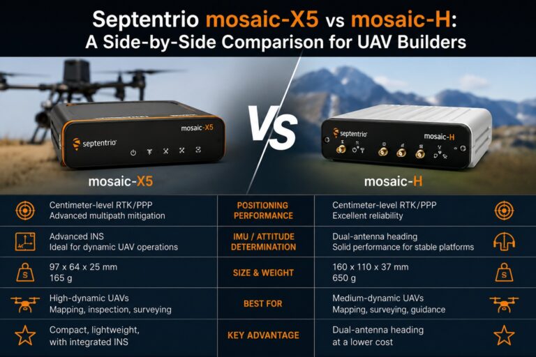
Functional Embodiment of Septentrio Modules in Flight Control Platforms
Ultimate Precision:
Provides centimeter-level RTK accuracy (horizontal: 0.6 cm + 0.5 ppm), meeting the most stringent operational requirements.
Exceptional Robustness:
Proprietary AIM+ technology effectively suppresses narrowband, wideband, and even chirp interference; LOCK+ ensures stable tracking under high vibration and shock; APME+ mitigates multipath effects, ensuring reliability in complex scenarios like urban or forested environments.
Secure and Trustworthy:
Advanced anti-spoofing algorithms identify and resist various spoofing attacks, including simulation and meaconing, ensuring navigation data authenticity.
High-Speed Response:
>100 Hz position update rate and <10 ms latency perfectly match the demands of high-speed UAVs and automatic control systems.
Full-System Support:
Tracks all current and future signals from all global navigation satellite systems (GPS, GLONASS, Galileo, BeiDou, etc.), providing optimal satellite visibility and reliability anywhere on the globe.
Integration Advantages of Septentrio Modules in Flight Control Platforms
Perfect Balance of Size and Performance:
A compact SMT package measuring only 31×31 mm integrates flagship-level performance, facilitating embedding into space-constrained flight control designs.
Ultra-Low Power Consumption:
Typical power consumption of only 0.6W reduces the burden on the UAV’s power system and extends flight time.
Industrial-Grade Reliability:
Operates in a wide temperature range of -40°C to 85°C, complies with ENV-STD-810G vibration standards, and withstands various harsh environments.
Developer-Friendly:
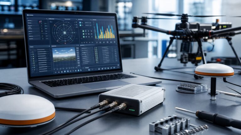
Provides a comprehensive RxTools software suite, detailed documentation, and an SDK, supporting rapid configuration, data logging, and PPK post-processing, significantly shortening the integration and development cycle.
Septentrio Modules: Constructing an Unshakable, Precise Spatiotemporal Foundation for Flight Control Platforms
As UAV systems advance toward deep automation and commercial application, the vulnerability of navigation systems has become a major bottleneck. The advent of the Septentrio mosaic module is precisely aimed at fundamentally solving this problem, building a precise, reliable, and secure spatiotemporal information foundation for flight control platforms.
From “Usable” to “Trustworthy”: Building on Security
Based on publicly available data from Norwegian jamming and spoofing tests, many GNSS receivers experience severe performance degradation or complete failure under strong interference and complex spoofing scenarios. In contrast, the mosaic module equipped with AIM+ technology maintains sufficient satellite tracking and positioning availability under strong interference and effectively identifies and resists spoofing signals, thanks to its unique hardware design and adaptive digital filtering algorithms. This ensures that every piece of positioning information received by the flight control system is authentic and trustworthy—an indispensable safety guarantee for UAVs performing critical missions (e.g., public safety, border patrol, transport of valuable goods).
From “Static” to “High-Dynamic”: Expanding Boundaries with Performance
Whether it’s fixed-wing UAVs conducting high-speed inspections or UAVs performing precision grasping in coordination with robotic arms, extreme demands are placed on the update rate and latency of GNSS. The mosaic module supports raw observation and position output exceeding 100 Hz, combined with system latency below 10 ms. This provides real-time, smooth state feedback for the high-frequency control laws of flight controllers, enabling UAVs to execute complex maneuvers with precision and agility, breaking through the limitations traditional GNSS imposes on system dynamic performance.
From “Component” to “Solution”: Fostering Innovation through Integration
mosaic is more than just a GNSS module; it is a complete positioning solution. Its SMT packaging design facilitates large-scale automated production, reducing integration difficulty and cost. Comprehensive interfaces (multiple UARTs, Ethernet, USB) and protocol support (SBF, NMEA, RTCM) allow flexible adaptation to various flight control architectures. Free lifetime firmware updates ensure the system continuously receives the latest anti-interference algorithms and feature enhancements, protecting long-term investment.
Frequently Asked Questions
What makes the mosaic module suitable for drone flight controller integration?
The mosaic module is designed specifically for embedded integration with flight controllers like PX4 and ArduPilot. It features low power consumption (~0.6-1.5 W), compact SMT packaging, wide temperature range (-40°C to +85°C), and supports standard protocols including NMEA, RTCM, and SBF. Its UART interface connects directly to flight controller GPS ports for straightforward integration.
Why is AIM+ anti-jamming critical for flight control platforms?
AIM+ provides industrial-grade interference detection and mitigation, suppressing narrowband, wideband, and chirp jamming that could otherwise cause positioning loss or drift. For flight controllers relying on GNSS for navigation, this ensures continuous, trustworthy positioning data even in complex electromagnetic environments — critical for autonomous operations in urban areas or near infrastructure.
How does the mosaic-X5 achieve attitude resolution without a magnetometer?
The mosaic-X5 supports dual-antenna heading using carrier phase differencing. By measuring phase differences between two antennas with a fixed baseline, it calculates true north heading and roll/pitch independent of magnetic fields. This is particularly valuable for flight controllers operating near metal structures or power infrastructure where magnetometers become unreliable.
What update rate does the mosaic module support for flight control systems?
The mosaic module supports position and raw measurement output rates exceeding 100 Hz with system latency below 10 ms. This high-speed, low-latency performance enables flight controllers to execute precise high-dynamic maneuvers, real-time path tracking, and responsive attitude control for advanced UAV applications.
Related GNSS Products
- HB21 GNSS Box Receiver — All-in-one RTK receiver with integrated 4G LTE, heading, and data logging.
- HB6 GNSS Box Receiver — Compact quad-constellation RTK receiver powered by Septentrio Mosaic X5.
- EV322 GNSS Receiver — Lightweight RTK receiver for UAVs and autonomous systems.
- AIM+ Anti-Jamming Technology — Advanced interference and spoofing protection.
Browse our full GNSS receiver collection for professional UAV applications.
Further Reading
- NVIDIA Jetson + Septentrio GNSS Integration: ROS 2 Setup Guide – Modern integration approach with ROS 2
- Integrating Septentrio AsteRx-m3 Pro with ArduPilot – ArduPilot-specific integration
- How to Integrate Septentrio GNSS with PX4 and ArduPilot – Universal integration guide
- Septentrio RxTools and RxControl Configuration Guide – Configure the receiver for flight control systems