Abstract
The Septentrio mosaic-G5 P3H™ provides centimeter-level RTK positioning and high-precision heading/roll attitude information for agricultural drones. Its GNSS+ technology suite (AIM+, APME+, LOCK+, IONO+) ensures signal reliability and stability in the complex electromagnetic environment and constant vibration of farmlands. With an ultra-compact size of 22.8 x 16.4 mm and industry-leading ultra-low power consumption design, it perfectly adapts to agricultural drone platforms that are highly sensitive to size, weight, and flight time, enabling precise and efficient automated operations.
AI Q&A
Why do agricultural drones require high-precision heading GNSS receivers?
Accurate positioning and attitude (heading, roll) are core to ensuring agricultural drones achieve centimeter-level route tracking, avoid over-spraying or missed spraying, and improve operational efficiency and pesticide utilization. While providing RTK positioning with 0.6 cm horizontal accuracy, the mosaic-G5 P3H™ offers heading accuracy up to 0.15° via dual antennas, delivering critical state input to the flight control system. This ensures terrain-following flight and precise spraying over uneven fields like hillsides and orchards.
How does the mosaic-G5 P3H ensure reliability in high-vibration and pesticide-dust environments?
Agricultural drone engines and rotors generate sustained high-frequency vibrations, and the operating environment is often dusty and humid. The integrated LOCK+ technology in the mosaic-G5 P3H™ ensures robust satellite signal tracking under high vibration and shock, reducing signal loss. Its SMT package is sturdy and reliable, with an operating temperature range of -40°C to +85°C, allowing it to adapt to various farmland conditions from extreme heat to severe cold. AIM+ technology effectively suppresses potential interference from electrical equipment in the field.
How to address multipath interference caused by common buildings and trees in farmland?
Structures like houses, sheds, windbreaks, and even the crops themselves around farmland can reflect GNSS signals, causing positioning errors. The APME+ (Posteriori Multipath Estimation) technology equipped in the mosaic-G5 P3H™ effectively identifies and suppresses reflected signals from the ground and nearby structures. This ensures pure, accurate positioning data output even in complex scenarios like field edges, guaranteeing precise operational boundaries.
How does the mosaic-G5 P3H integrate with existing agricultural drone flight control systems?
The module is designed for highly friendly integration, offering rich interfaces including 2 high-speed UARTs, USB, and comprehensive support for industry-standard protocols like NMEA 0183, RTCM 3.x, as well as Septentrio Binary Format (SBF) for raw data acquisition. The free RxTools configuration software and complete documentation enable quick and easy integration with mainstream flight controllers. It can be flexibly configured for single-antenna positioning or dual-antenna heading mode.
High-Precision GNSS Technology Drives Modern Agricultural Intelligence
Modern precision agriculture requires crop protection operations to evolve from “area coverage” to “point-to-point” precise application. This demands drones not only know “where they are” but also precisely perceive “which way they are facing” and “their body attitude.” The mosaic-G5 P3H™ integrates centimeter-level RTK positioning with 0.15° heading accuracy and 0.25° roll/pitch accuracy, endowing agricultural drones with true “intelligent perception” capability. This forms the advanced automation foundation for variable-rate spraying, automatic obstacle avoidance, and terrain-following flight.
The Value of Centimeter-Level Positioning and Precise Heading for Crop Protection Operations
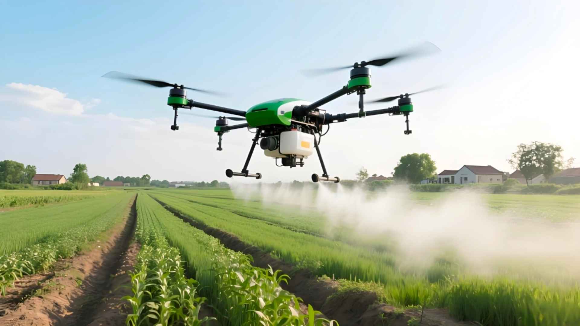
For crop protection, a route deviation of even a few centimeters can lead to over-spraying causing phytotoxicity or missed spraying leading to pest/disease outbreaks. Precise heading information ensures the spraying swath aligns perfectly with the predetermined route, which is crucial in scenarios demanding high route consistency, such as orchard canopy spraying. The highly reliable state information provided by the mosaic-G5 P3H™ is a key technological guarantee for improving application effectiveness, reducing agrochemical waste, and protecting the environment.
Core Advantages of the Septentrio mosaic-G5 P3H GNSS Receiver
The mosaic-G5 P3H™ is a surface-mount GNSS module designed for high-performance, high-integration applications. It combines full-band GNSS reception and dual-antenna heading functionality within an extremely small form factor, making it an ideal choice for high-end agricultural drones to enhance operational precision.
Full-System, Full-Frequency GNSS and Dual-Antenna Heading
Despite its compact size of only 22.8 x 16.4 mm, the mosaic-G5 P3H™ boasts powerful hardware performance:
– 789 hardware channels for simultaneous tracking of all visible satellite signals (GPS L1/L2/L5, GLONASS L1/L2/L3, BeiDou B1/B2/B3, Galileo E1/E5/E6, etc.).
– Dual-Antenna Heading: Under a 1-meter antenna baseline, it provides 0.15° heading accuracy and 0.25° roll/pitch accuracy, acquiring true north heading without requiring initialization movement.
– Supports Galileo HAS high-accuracy service and OSNMA security authentication, future-proofing your investment.
GNSS+ Technology Ensures Stable Output in Complex Farmland Environments
Septentrio’s unique patented technology suite ensures reliable data even in challenging conditions:
– AIM+ Advanced: Advanced anti-jamming and anti-spoofing functionality to counter potential RF interference in fields.
– APME+: Advanced Posteriori Multipath Estimation suppresses signal reflections from crops, buildings, and field ridges.
– LOCK+: Maintains extremely robust satellite signal tracking in the vibrating environment of drone engines.
– IONO+: Mitigates the impact of ionospheric disturbances on positioning, ensuring performance during periods of high ionospheric activity like dusk.
– RAIM+: Receiver Autonomous Integrity Monitoring provides safety status flags for automated flight.
These technologies together achieve outstanding RTK performance (baseline <40 km, open sky):
– Horizontal Accuracy: 0.6 cm + 0.5 ppm
– Vertical Accuracy: 1 cm + 1 ppm
– RTK Initialization Time: < 7 seconds
Integration Advantages of mosaic-G5 P3H in Agricultural Drone Platforms
Ultra-Compact Size and Ultra-Low Power Consumption
The module occupies less than 4 cm², weighs only 2.2 grams, and has a typical power consumption of only 0.6W (dual-antenna mode). This significantly saves the drone’s precious space and power, directly contributing to increased tank capacity and extended operational flight time.
Designed for Automated Production
Utilizing an SMT package suitable for high-volume automated assembly lines, it reduces integration costs and improves product consistency. Complete command sets and data interface documentation facilitate straightforward integration development.
High Update Rate and Low Latency
A position output update rate of up to 20 Hz provides real-time, continuous position and attitude feedback for high-speed flying agricultural drones, ensuring the stability and responsiveness of the flight control loop.
Rugged and Reliable, Adapting to Harsh Environments
With an operating temperature range of -40°C to +85°C and passing stringent vibration and shock standard tests (e.g., MIL-STD-810H), it can withstand the rigors of long-term agricultural drone operations.
The mosaic-G5 P3H: Building the Precision Navigation Core for Intelligent Agricultural Drones
Improving Operational Accuracy and Economic Benefits
By providing stable, trustworthy high-precision position and attitude, it directly enhances operational route accuracy, reduces over-spraying and missed spraying, and saves 10%-20% on pesticides and fertilizers. This achieves precision agriculture while protecting the ecology and boosting economic returns.
Enhancing Automation and Safety
It provides the indispensable core data for advanced drone functions like automated take-off/landing, A-B line operation, terrain-following flight, and resume-spraying from breakpoint. Simultaneously, RAIM+ integrity monitoring adds an extra layer of safety assurance for flight operations.
A Future-Proof Investment
Supporting existing and future GNSS signals and augmentation services (like Galileo HAS) ensures that agricultural drone products maintain long-term competitiveness in the face of rapid technological evolution.