Precision GNSS Positioning for Bridge Structural Monitoring with UAVs
Bridges are critical infrastructure assets that require regular structural health monitoring to ensure safety and longevity. Unlike point-in-time inspections, structural monitoring involves repeated measurements over weeks, months, or years to detect subtle changes in deformation, settlement, and alignment. Unmanned Aerial Vehicles (UAVs) equipped with high-precision GNSS receivers are transforming how engineers approach bridge monitoring, offering centimeter-level repeatability without disrupting traffic or requiring extensive scaffolding.
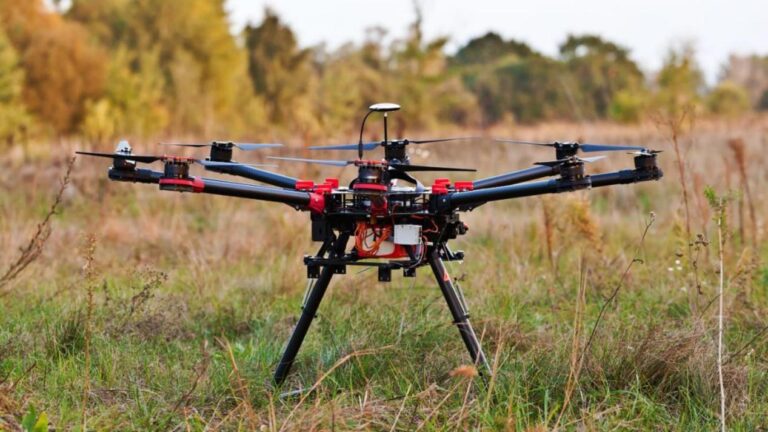
At the heart of this capability is the Septentrio Mosaic-G5 P3H GNSS module, a compact, multi-frequency receiver that delivers RTK-fixed positioning with centimeter accuracy. When integrated into UAV platforms for bridge monitoring, it enables surveyors and civil engineers to capture consistent, georeferenced measurements over repeated flights — data that reveals structural drift, thermal expansion effects, and early signs of instability long before they become visible to the naked eye.
Why Bridge Monitoring Demands More Than Inspection-Grade Accuracy
Bridge inspection focuses on visible defects: cracks, corrosion, spalling concrete. Bridge monitoring goes deeper — it tracks the structure’s geometric behavior over time. A bridge that shifts 5 mm at a critical load-bearing joint over six months may indicate foundation settlement or bearing degradation. Detecting this requires positioning repeatability at the centimeter level, flight after flight, season after season.
Standard consumer-grade GNSS receivers cannot deliver this consistency. Their single-frequency positioning drifts by meters under changing atmospheric conditions and satellite geometry. The Septentrio Mosaic-G5 inside the EV322 GNSS receiver overcomes these limitations with multi-constellation, multi-frequency tracking (GPS L1/L2/L5, GLONASS, BeiDou, Galileo), coupled with an RTK engine that locks phase ambiguities to deliver fixed solutions with 1-2 cm horizontal accuracy.
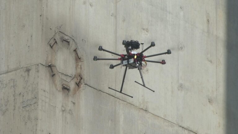
The P3H Advantage: Dual-Antenna Heading for Consistent Cross-Track Positioning
The “P3H” designation in the Mosaic-G5 P3H indicates support for dual-antenna heading. This is particularly valuable for bridge monitoring UAVs flying in confined corridors alongside or beneath bridge decks, where GPS satellite visibility may be partially obstructed. Dual-antenna heading provides an absolute, GNSS-based yaw reference that remains stable even when the UAV is hovering at low velocity — conditions where single-antenna systems struggle to maintain heading accuracy.
Research published in the ISPRS Archives demonstrates that UAV-based bridge inspection systems integrating RTK positioning and dual-antenna GNSS achieve localization errors below 2 cm, even in challenging multi-path environments under bridge superstructures. The Mosaic-G5 P3H brings this level of performance to a module weighing just 19 grams — small enough for any UAV payload budget.
Real-World Applications in Bridge Monitoring Workflows
Repeated Photogrammetric Surveys
By mounting a high-resolution camera on a UAV equipped with the Mosaic-G5 P3H, engineers can fly the same waypoint path at monthly or quarterly intervals. RTK-tagged images produce dense point clouds that are compared across epochs using cloud-to-cloud distance analysis. The AIM+ resilient GNSS anti-jamming technology ensures that positioning remains reliable even near power lines, radio towers, or other sources of electromagnetic interference commonly found on bridge structures.
Deformation Monitoring of Suspension Bridge Cables and Towers
Long-span suspension bridges are sensitive to thermal expansion, wind loading, and traffic-induced vibration. UAVs flown along cable planes and around towers capture centimeter-precision positions that, when compared with finite element models, reveal whether the structure is behaving within design parameters. The Septentrio receiver’s low-signal tracking capability maintains lock even when the UAV maneuvers between cable stays where sky visibility is limited.
Post-Earthquake Rapid Structural Assessment
After a seismic event, rapid assessment of bridge displacement is critical for reopening transport corridors. Deploying a UAV with RTK GNSS within hours provides immediate measurement of pier displacement, deck offset, and approach settlement — data that informs whether a bridge is safe for emergency vehicles. The Mosaic-G5’s fast RTK initialization, typically under 10 seconds, is essential in these time-critical scenarios.
GPS Spoofing and Jamming Protection for Infrastructure UAVs
Bridge monitoring UAVs operate in urban and industrial environments where GNSS interference is increasingly common. The Septentrio Mosaic-G5 incorporates built-in AIM+ anti-jamming and anti-spoofing technology that filters out narrow-band and wide-band interference while maintaining phase lock on authentic satellite signals. This is especially important for long-term monitoring programs where data integrity across multiple flight campaigns must be guaranteed. The HB6 GNSS box receiver offers similar protection in a rugged enclosure suitable for ground-based reference stations used in differential processing.
Comparison with Traditional Monitoring Methods
Traditional bridge monitoring relies on total stations, inclinometers, and prism-based survey networks. These methods are accurate but expensive, slow, and often require lane closures. UAV-based GNSS monitoring offers:
- Speed: A 500-meter bridge can be surveyed in under 15 minutes of flight time
- Repeatability: Automated flight paths ensure identical camera stations across surveys
- Cost: Eliminates scaffolding, traffic control, and survey crew mobilization costs
- Safety: Keeps personnel away from traffic and heights
The HB21 GNSS box receiver serves as an ideal base station for differential correction, providing a stable reference that anchors the entire monitoring network across years of data collection.
Key GNSS Performance Metrics for Bridge Monitoring
For structural monitoring to detect meaningful deformation, the GNSS system must deliver specific performance characteristics:
- Horizontal accuracy: ≤ 2 cm RMS in RTK fixed mode
- Vertical accuracy: ≤ 3 cm RMS (vertical is typically 1.5x worse than horizontal in GNSS)
- Time-to-first-fix: Under 15 seconds from cold start
- Heading accuracy (dual-antenna): ≤ 0.1° at 1 m baseline
- Update rate: 10 Hz or higher for capturing dynamic displacement
The Septentrio Mosaic-G5 P3H meets or exceeds all these specifications, making it one of the most capable GNSS modules available for bridge monitoring UAV applications today.
Conclusion: The Future of Bridge Structural Health Monitoring
As infrastructure ages and monitoring budgets tighten, UAV-based structural health monitoring with high-precision GNSS will become the standard for bridge management agencies worldwide. The Septentrio Mosaic-G5 P3H, with its dual-antenna heading, RTK positioning, and anti-jamming resilience, provides the positioning backbone that makes this possible.
For teams already using UAVs for bridge inspection, adding long-term monitoring capability requires only the GNSS hardware upgrade — the same UAV platform, the same pilot, the same software workflow. The result is a quantum leap in the quality and quantity of structural data available to engineers.
Explore the EV322 receiver or the AIM+ GNSS resilience module for your bridge monitoring program. For the full range of GNSS solutions for UAV infrastructure inspection, visit uav-gnss.com.
External reference: ISPRS Archives — “A seamless LiDAR/IMU/RTK fused localization method for UAV-Based bridge inspection” (2025). Available at: https://isprs-archives.copernicus.org/articles/XLVIII-G-2025/937/2025/
External reference: MDPI Sensors — “Reliability of Real-Time Kinematic (RTK) Positioning for Low-Cost Drones’ Navigation across GNSS Critical Environments” (2024). Available at: https://www.mdpi.com/1424-8220/24/18/6096