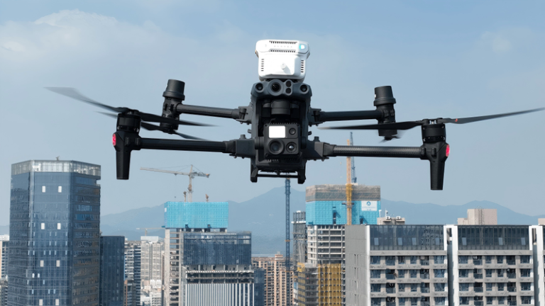
Why Aerial Cinematography Drones Need Precision GNSS Positioning
Tourism and promotional drone operations demand more from a GNSS receiver than any other application. When capturing breathtaking landscapes for destination marketing or filming cinematic aerial footage, flight stability and positioning accuracy directly determine the quality of the final product.
Traditional GNSS receivers struggle in scenic areas with complex terrain, dense buildings, and strong electromagnetic interference. Signal blockage by mountains causes positioning drift. Reflections off water surfaces introduce multipath errors. Wireless devices in tourist-dense areas generate interference that causes image jitter. A positioning error of even a few centimeters can mean the difference between a perfectly framed golden-hour shot and a ruined take.
This is why the Septentrio mosaic-X5 — the same GNSS receiver used in the Skydio X10 RTK module for professional mapping — has become the standard for precision aerial cinematography. For a complete overview of solutions, explore Septentrio-powered GNSS receivers at uav-gnss.com.
The Septentrio Mosaic-X5: Built for Cinematic Drone Operations
Compact Hardware with Professional-Grade Performance
Within its ultra-compact 31 × 31 × 4 mm footprint and lightweight 7 g design, the mosaic-X5 integrates 448 hardware channels supporting GPS, GLONASS, BeiDou, and Galileo. This ensures exceptional signal quality across diverse scenic environments — from deep mountain valleys to coastal cliffs and urban tourism districts.
Products like the HB21 GNSS Box Receiver integrate this module for portable aerial cinematography deployments worldwide.
Centimeter-Level RTK Accuracy for Repeatable Flight Paths
The mosaic-X5 delivers exceptional RTK positioning with centimeter-level accuracy, initializes in just 7 seconds, and supports update rates up to 100 Hz with sub-10 ms latency. This enables near-real-time precise position feedback for flight control systems — critical for stable hovering, precise path tracking, complex camera movements, and automated route navigation used in promotional drone cinematography.
Whether capturing sunrise shots over mountain peaks or tracking extreme sports traversing canyons, the mosaic-X5 ensures drones consistently maintain preset flight paths.
GNSS+ Technology for Challenging Filming Environments
Septentrio’s proprietary GNSS+ suite provides comprehensive protection for aerial cinematography in complex environments:
- AIM+ Anti-Interference: Suppresses interference from wireless devices, communication base stations, and tourist electronics in crowded hotspots — preventing positioning drift during critical shots. Learn more about AIM+ resilient GNSS technology.
- APME+ Multipath Suppression: Separates direct signals from reflections off water surfaces, glass facades, and rock walls — preventing altitude errors in reflective environments like lake reflections and canyon traversals.
- LOCK+ Tracking Stability: Maintains stable satellite lock during valley winds, sharp tracking turns, and complex camera movements — eliminating jelly effects caused by body shake.
- IONO+ Ionospheric Compensation: Counters ionospheric disturbances affecting signal propagation during early/late hours and seasonal variations, ensuring consistent performance for cross-seasonal filming projects.
Key Applications in Tourism and Promotional Drone Operations
Cinematic Aerial Filming for Destination Marketing
The mosaic-X5’s 100 Hz update rate and sub-10 ms latency ensure every frame is tagged with precise geographic coordinates — enabling post-production teams to precisely reconstruct flight paths for complex composite shots. The HB6 GNSS Receiver offers a compact RTK solution for professional aerial cinematography workflows.
Event Coverage and Promotional Campaigns
Rapid initialization (cold start under 45 seconds, RTK in 7 seconds) enables quick deployment for event coverage — from destination weddings and music festivals to sports events and tourism campaigns. Ultra-low power consumption (0.6 W) extends flight time for extended shoots.
Time-Lapse and Multi-Season Documentation
For tourism destinations documenting seasonal changes or construction progress, the mosaic-X5’s consistent centimeter-level accuracy enables precise route repetition across multiple flights — even months apart. This allows for perfectly aligned time-lapse sequences that showcase a destination’s transformation.
Low Power and Easy Integration for Drone Manufacturers
With typical power consumption of just 0.6 W, the mosaic-X5 extends flight duration significantly — enabling creators to capture extended golden-hour footage without battery anxiety. Its SMT surface-mount packaging supports automated mass production, and rich peripheral interfaces including 4 high-speed UARTs, Ethernet, USB 2.0, and SDIO facilitate integration with gimbal cameras, flight controllers, and video transmission systems.
Like the mosaic-X5 used in professional drone inspection applications, this receiver shares the same GNSS+ technology suite and integration flexibility for demanding operational environments.
For further reading, refer to the Skydio X10 RTK module white paper which validates the mosaic-X5’s centimeter-level accuracy for professional drone operations.
Why the Mosaic-X5 Is the Right GNSS Receiver for Tourism Drones
- Centimeter-level RTK accuracy for precise camera positioning and repeatable flight paths
- AIM+ anti-interference for crowded tourist hotspots
- APME+ multipath suppression for reflective environments (water, glass, rock)
- LOCK+ tracking stability for vibration-free footage in windy conditions
- 100 Hz update rate for real-time camera geotagging
- Ultra-compact 31 × 31 × 4 mm, 7 g for lightweight drone integration
- 0.6 W power consumption for extended shooting endurance
- Same receiver trusted by Skydio for the X10 RTK module
For cinematographers, tourism operators, and content creators seeking professional-grade aerial footage, the Septentrio mosaic-X5 GNSS receiver delivers the precision, reliability, and creative freedom that modern promotional drone operations demand.
Frequently Asked Questions
Q: What GNSS accuracy is needed for professional aerial cinematography?
A: Cinematic drone operations require centimeter-level accuracy for precise camera positioning and repeatable flight paths. The mosaic-X5 delivers 0.6 cm + 0.5 ppm horizontal RTK accuracy, enabling frame-accurate shot repetition across multiple flights.
Q: How does the mosaic-X5 handle interference in crowded tourist areas?
A: AIM+ anti-interference technology actively filters RF interference from wireless devices, radio towers, and other sources common in tourist-dense areas, maintaining centimeter-level positioning accuracy throughout the shoot.
Q: Can the receiver maintain accuracy when flying near reflective surfaces like water?
A: Yes. APME+ multipath suppression technology specifically removes signal reflections from water surfaces, glass facades, and rock walls — common sources of positioning drift in scenic aerial filming environments.
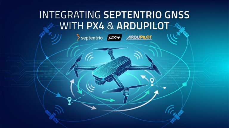
Q: Is the mosaic-X5 compatible with existing drone platforms?
A: Yes. The module uses standard UART interfaces and is compatible with PX4 and ArduPilot flight controllers. Its compact 31 × 31 × 4 mm footprint and 7 g weight make it suitable for virtually any professional drone platform.
Related GNSS Products
- HB21 GNSS Box Receiver — All-in-one RTK receiver with integrated 4G LTE, heading, and data logging
- HB6 GNSS Box Receiver — Compact quad-constellation RTK receiver powered by Septentrio Mosaic X5
- EV322 GNSS Receiver — Lightweight RTK receiver for UAVs and autonomous systems
- AIM+ Anti-Jamming Technology — Advanced interference and spoofing protection
Browse our full GNSS receiver collection for professional UAV applications.