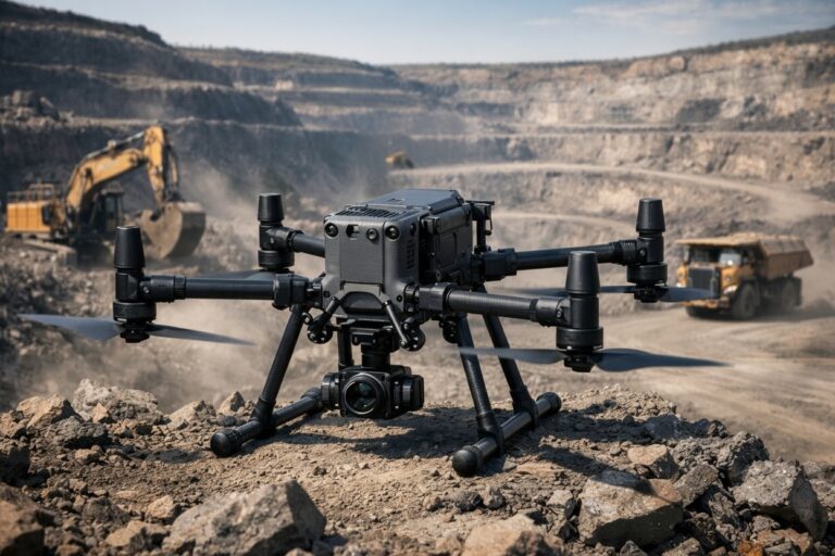
Industrial drone inspection has become the standard for monitoring critical infrastructure. Power lines, pipelines, wind turbines, bridges, and cell towers are all inspected by UAVs that must navigate close to large metal structures while maintaining precise positioning. The Septentrio Mosaic-X5 GNSS receiver delivers the accuracy and reliability these missions demand.
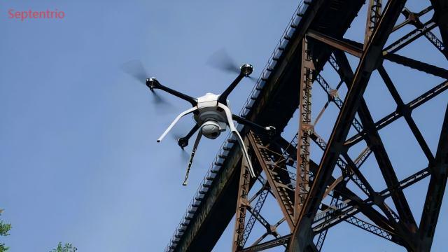
When an inspection drone flies within meters of a steel bridge or high-voltage transmission line, standard GNSS receivers frequently lose lock or produce unreliable positions. The Mosaic-X5 addresses these challenges with multi-frequency, multi-constellation tracking and built-in interference mitigation that keeps the inspection on course.
The GNSS Challenges of Infrastructure Inspection
Multipath Interference Near Metal Structures
Bridges, towers, and pipelines are built from steel and concrete — materials that reflect GNSS signals. When a satellite signal bounces off a steel girder before reaching the receiver’s antenna, the reflected path introduces a ranging error that can be meters or even tens of meters. The Mosaic-X5’s APME+ multipath mitigation technology analyzes the correlation function of each satellite signal to detect and reject these reflected signals, preserving centimeter-level accuracy even in the most reflective environments.
Electromagnetic Interference from High-Voltage Infrastructure
Power line inspection drones operate in the near-field of high-voltage conductors. The electromagnetic fields generated by transmission lines radiate across the GNSS frequency bands, creating interference that degrades signal-to-noise ratios. The AIM+ anti-jamming technology built into the Mosaic-X5 monitors the full GNSS spectrum and applies adaptive filtering that suppresses this interference while maintaining lock on authentic satellite signals.
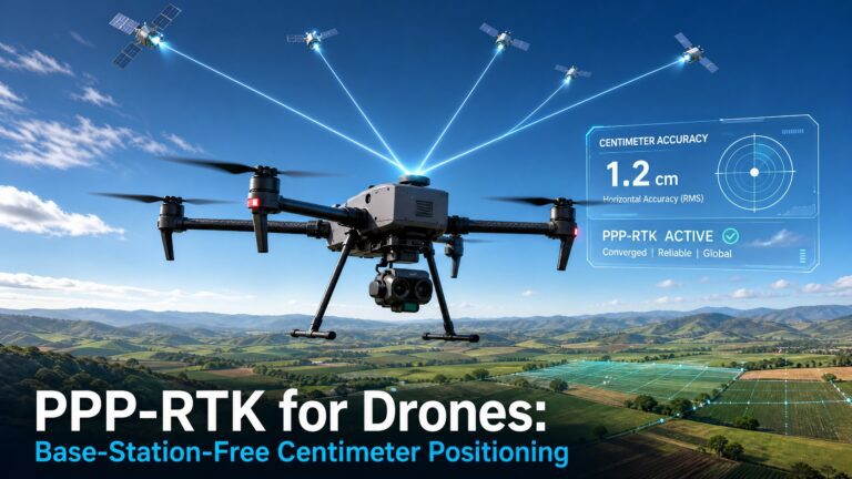
Centimeter-Level RTK for Defect Localization
An inspection report is only as good as its geolocation accuracy. When a thermographic image shows a hot connection on a transmission line, the utility company needs to know exactly which tower and which phase the defect is on. The Mosaic-X5’s RTK engine provides centimeter-level positioning that geotags every inspection image with coordinates accurate enough to direct a repair crew to the precise hardware component.
This precision enables automated defect tracking across multiple inspection cycles. When the same tower is inspected six months later, the drone retraces the exact flight path, and the software compares images at the same pixel locations. Without centimeter-level RTK, the position error between flights would create false positives — detecting displacement that is actually positioning drift rather than structural change.
Multi-Constellation Tracking for Obstructed Skies
Inspection drones frequently navigate under bridges, inside power station yards, and through industrial facilities where sky visibility is limited. The Mosaic-X5 tracks GPS, GLONASS, Galileo, and BeiDou simultaneously, providing access to 30 or more satellites at any time. In a congested environment where a single-constellation receiver might see only 4 to 5 satellites, the Mosaic-X5 maintains lock on 12 to 15, ensuring continuous RTK positioning throughout the inspection.
Multi-frequency tracking on L1, L2, and L5 bands also corrects for ionospheric errors that degrade single-frequency solutions. This is particularly important for inspection flights lasting more than 30 minutes, where atmospheric changes accumulate into significant positioning drift.
Related Inspection Drone Applications
For building-specific inspection missions, see our guide on building inspection drones with the mosaic-X5. Bridge inspections benefit from the mosaic-X5 for precise bridge assessment. For general industrial inspection, the mosaic-G5 P3H offers dual-antenna heading for comprehensive inspection coverage.
All inspection configurations benefit from the EV322 GNSS receiver as a base station for RTK corrections.
Why the Mosaic-X5 Is the Right GNSS Receiver for Inspection Drones
- APME+ multipath mitigation for accurate positioning near steel structures
- AIM+ anti-jamming for interference from high-voltage power lines
- Centimeter-level RTK accuracy for precise defect geolocation
- Multi-constellation tracking for obstructed sky environments
- Multi-frequency correction for long-duration inspection flights
- Compatible with Pixhawk, Cube, and ArduPilot/PX4 flight controllers
- Compact form factor for payload-constrained inspection platforms
For authoritative research on drone-based infrastructure inspection, refer to the MDPI Remote Sensing journal for peer-reviewed studies on UAV inspection methodologies and positioning accuracy requirements.