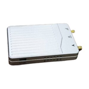
EV322 GNSS Receiver – Powered by Septentrio mosaic G5
Lightweight 14g RTK GNSS receiver with triple-band, 789 channels, and integrated compass. Powered by Septentrio mosaic-G5 P3H for UAVs and precision agriculture.
Description
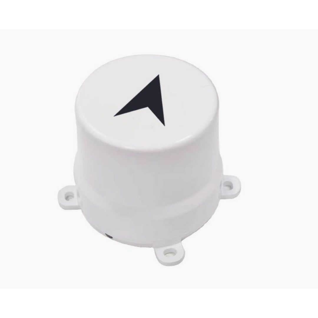
Product Overview EV322 GNSS RTK Receiver
All-Constellation All-Frequency RTK GNSS Receiver | 789 Channels | 0.6cm RTK | Integrated Compass | 14g | Φ44mm | UAV · Precision Agriculture · Autonomous Vehicles · Robotics · Intelligent Transport
The EV322 GNSS RTK Receiver — powered by Septentrio Mosaic G5 (mosaic-G5 P3H) — is a compact, all-constellation RTK GNSS receiver delivering centimeter-level positioning accuracy, real-time dual-antenna heading, and industrial-grade signal integrity in one of the most weight-efficient and cost-effective professional RTK modules available. With 789 synchronized tracking channels covering GPS L1C/A/L1C/L2C/L2PY/L5, BeiDou B1I/B1C/B2a/B2I/B2b/B3I, GLONASS L1C/A/L2CA/L2P/L3 CDMA, Galileo E1/E5a/E5b/E6, and QZSS L1C/A/L1C/B/L2C/L5/L6 — the EV322 provides the most complete multi-constellation signal coverage available in a 14-gram UAV and autonomous platform module.
RTK horizontal accuracy of 0.6cm + 0.5ppm and vertical accuracy of 1cm + 1ppm, combined with a fast 7-second RTK initialization time, cold start in under 35 seconds, hot start in under 10 seconds, and 1-second signal reacquisition, ensure that the EV322 achieves and maintains RTK fix rapidly and reliably across all application scenarios. The 20Hz positioning data update rate provides the real-time dynamic positioning output required for UAV flight control, autonomous vehicle guidance, and precision agriculture machine control.
A standout feature of the EV322 is its exceptional timing performance — PPS resolution of 1.4 nanoseconds and event accuracy under 3 nanoseconds — making it one of the most precise timing sources available in a compact GNSS module. This sub-nanosecond timing capability enables synchronized multi-sensor data logging, time-stamped event recording, and precision timing applications including intelligent transportation infrastructure, traffic signal coordination, and geological monitoring time-series data — all from a 14-gram module operating on 3 to 5.5V DC.
The integrated IST8310 compass via I²C interface provides magnetic heading output without requiring a separate compass module — reducing BOM cost, integration complexity, and total system weight for UAV autopilot and autonomous vehicle navigation systems. ALM+ automatic interference and deception detection combined with APME+ multipath mitigation ensures stable satellite tracking in complex environments including urban canyons, forest areas, and terrain with strong multipath, while industrial-grade low-noise RF circuits further enhance signal reception quality.
Three typical deployment architectures are supported: short-to-medium range RTK (under 3km) using local radio data transmission between base station and multiple mobile stations; medium-to-long range RTK (under 10km) using 4G network NTRIP server architecture for expanded coverage and simultaneous multi-rover operation; and reference-station-free high-precision positioning using nationwide differential data services for applications where base station deployment is impractical.
Key Applications
- UAV / Drone Precision Navigation & Positioning
- Precision Agriculture & Smart Farming Equipment
- Autonomous / Unmanned Ground Vehicle GNSS
- Intelligent Lawn Mower RTK Guidance
- Geological Hazard & Landslide Monitoring
- Intelligent Transportation & Traffic Monitoring
- Tachograph & Vehicle Fleet Positioning
- Red Light & Traffic Intersection Monitoring
- Surveying & Mapping
- Pixhawk / APM Autopilot GNSS Integration
- RTK Base Station & Mobile Station Deployment
- 4G NTRIP Network RTK Applications
Key Features
GNSS Performance
| Feature | Detail |
|---|---|
| GNSS Chip | Septentrio Mosaic G5 (mosaic-G5 P3H) |
| Tracking Channels | 789 channels — synchronized tracking across all constellations |
| Data Update Rate | 1 to 20 Hz (default 1 Hz) |
| Cold Start TTFF | Less than 35 seconds |
| Hot Start TTFF | Less than 10 seconds |
| Signal Reacquisition | Less than 1 second |
| RTK Initialization Time | 7 seconds |
| Tracking Sensitivity | 20 dB-Hz |
| Acquisition Sensitivity | 30 dB-Hz |
| Integrated Compass | IST8310 via I²C (RM3100 interface) |
| Working Modes | Mobile station (rover) and base station — user selectable |
| Autopilot Compatibility | Pixhawk and APM — fully compatible |
Positioning Accuracy
| Mode | Horizontal | Vertical |
|---|---|---|
| RTK | 0.6 cm + 0.5 ppm | 1 cm + 1 ppm |
| Single Point | 1.2 m | 1.9 m |
| DGNSS | 0.4 m | 0.7 m |
| Speed Accuracy (RMS) | 0.03 m/s | — |
Timing Accuracy
| Parameter | Value |
|---|---|
| PPS Resolution | 1.4 nanoseconds |
| Event Accuracy | Less than 3 nanoseconds |
Heading & Attitude Accuracy (Dual Antenna)
| Antenna Spacing | Heading Accuracy | Roll / Pitch Accuracy |
|---|---|---|
| 1 meter | 0.15° | 0.25° |
| 5 meters | 0.03° | 0.05° |
Satellite System Support
| Satellite System | Supported Signals |
|---|---|
| GPS | L1C/A, L1C, L2C, L2PY, L5 |
| BeiDou (BDS) | B1I, B1C, B2a, B2I, B2b, B3I |
| GLONASS | L1C/A, L2CA, L2P, L3 CDMA |
| Galileo | E1, E5a, E5b, E6 |
| QZSS | L1C/A, L1C/B, L2C, L5, L6 |
Detailed Technical Specifications
Output Data & Communication
| Parameter | Value |
|---|---|
| Output Interface | TTL — dual UART (3.3V TTL) + I²C |
| Baud Rate | 115,200 bps default — optional 4,800 to 921,600 bps |
| Output Protocol | NMEA 0183 v2.3, v3.03, v4.0 |
| Differential Input | RTCM v3.x (including MSM) |
| Carrier Phase Output | Supported — RAWX statement output |
| Flash Memory | Built-in FLASH |
| Connector | GH1.25mm 8-pin |
PIN Interface Reference
| Pin No. | Signal Name | Description |
|---|---|---|
| 1 | VCC | Main power input +3.3V to 5V |
| 2 | GND | Module ground |
| 3 | TX1 | UART1 output — 3.3V TTL |
| 4 | RX1 | UART1 input — 3.3V TTL |
| 5 | SCL | I²C Serial Clock (RM3100 compass) |
| 6 | SDA | I²C Serial Data (RM3100 compass) |
| 7 | TX2 | UART2 output — 3.3V TTL |
| 8 | RX2 | UART2 input — 3.3V TTL |
Electrical & Physical Specifications
| Parameter | Value |
|---|---|
| Dimensions | Φ44 × 40.6 mm |
| Weight | 14 grams |
| Operating Voltage | 3V to 5.5V DC |
| Power Consumption | Less than 800 mW |
| Operating Temperature | -35°C to +80°C |
| Storage Temperature | -40°C to +85°C |
Typical Deployment Architectures
Short to Medium Range RTK — Under 3km Radio Link
The EV322 operates as a stationary base station broadcasting RTCM differential corrections via radio data transmission module to multiple mobile station EV322 units simultaneously. Minimal external circuitry required — one base station supports an unlimited number of mobile stations within radio range. The base station automatically computes and records antenna coordinates within approximately 5 minutes if coordinates are not pre-surveyed. Ideal for precision agriculture operations, construction site monitoring, and UAV operations within a localized field area.
Medium to Long Range RTK — Under 10km via 4G Network
The base station transmits RTCM differential corrections to a server via wired network. Mobile stations access corrections via 4G network cards connected to the server — eliminating the packet loss problems of long-range radio links and enabling simultaneous access by an unlimited number of mobile stations bounded only by server performance. Mobile stations can simultaneously transmit positioning results back to the server for real-time fleet tracking and logistics coordination.
Reference-Station-Free RTK via Nationwide NTRIP
For applications where base station deployment is impractical, the EV322 pairs with a 4G/3G communication module to access nationwide NTRIP differential data services — providing high-precision centimeter-level RTK positioning anywhere within network coverage without any base station infrastructure investment.
Anti-Interference Technology
ALM+ (Automatic Interference and Deception Detection)
Automatic interference and spoofing detection monitors the RF environment in real time, identifying and characterizing both unintentional interference and deliberate spoofing signals. ALM+ provides the EV322 with robust positioning performance in urban canyons, industrial zones, and complex electromagnetic environments where standard GNSS modules lose accuracy or fix. Critical for intelligent transportation applications, geological monitoring in remote areas, and precision agriculture in regions with high cellular RF density.
APME+ (Advanced Phase Multipath Estimation)
Patented multipath mitigation algorithm that separates direct GNSS signals from reflected signals caused by buildings, terrain, vehicles, and infrastructure. Enables stable satellite tracking in forest areas, urban environments, and near farm buildings and structures — directly improving carrier phase measurement quality and RTK ambiguity resolution reliability for all EV322 applications.
Industrial-Grade Low-Noise RF Circuit
Industrial-grade low-noise RF front-end circuitry provides strong multipath suppression and improves received signal quality across all supported GNSS frequency bands — enhancing positioning accuracy and signal availability in the challenging RF environments encountered by precision agriculture, autonomous vehicle, and geological monitoring applications.
Competitive Advantages
- 789-channel synchronized all-constellation tracking — highest channel count per gram of any compact GNSS RTK module
- Septentrio Mosaic G5 engine — proven Septentrio signal processing architecture in an ultra-compact 14g module
- Only 14 grams — lightest RTK GNSS receiver with full multi-constellation tracking and integrated compass
- Integrated IST8310 compass via I²C — eliminates separate magnetometer module reducing weight, cost, and integration complexity
- 1.4ns PPS timing resolution and sub-3ns event accuracy — precision timing for synchronized multi-sensor systems
- Galileo E6 support — future-ready for Galileo HAS satellite PPP-RTK corrections without CORS dependency
- QZSS L6 support — enhanced positioning for Japan and Asia-Pacific GNSS correction services
- Three RTK deployment architectures — radio base station, 4G NTRIP, and nationwide differential service in one module
- Pixhawk and APM compatible — plug-and-play precision GNSS upgrade for most widely deployed UAV autopilots
- Dual UART + I²C interfaces — simultaneous GNSS data and compass data on separate channels
- RAWX carrier phase output — enables PPK post-processing for highest-accuracy survey workflows
- GH1.25mm 8-pin connector — industry-standard lightweight connector used across Pixhawk and drone autopilots
- 7-second RTK initialization — fast fix for time-critical agricultural, logistics, and monitoring applications
- 3V to 5.5V wide voltage input — compatible with 3.3V and 5V autopilot power rails without regulators
Standards & Compatibility
- Output Protocol: NMEA 0183 v2.3 / v3.03 / v4.0
- Differential Input: RTCM v3.x (including MSM)
- Carrier Phase: RAWX statement output for PPK post-processing
- Interface: Dual UART (3.3V TTL) + I²C — GH1.25mm 8-pin connector
- Baud Rate: 115,200 bps default — 4,800 to 921,600 bps configurable
- Compass: IST8310 via I²C (RM3100 interface)
- Autopilot: Pixhawk, APM — fully compatible
- RTK Modes: Mobile station (rover), base station — user configurable
- Network: 4G / 3G NTRIP compatible for network RTK correction access
- Platform Integration: Compatible with UAV autopilots, ROS, autonomous vehicle systems, agricultural machine controllers, geological monitoring systems, intelligent transportation platforms
Disclaimer
Specifications subject to change without notice. All accuracy values are nominal under open-sky conditions unless otherwise stated.
This ev322 gnss receiver powered by septentrio mosaic g5 is powered by advanced Septentrio GNSS receivers. For more options, browse all GNSS receivers or contact us for pricing.
This OEM GNSS module is part of the Septentrio GNSS receivers family. For integration support and OEM pricing, request a quote. Learn more in our Septentrio Mosaic-X5 technology overview.
This OEM GNSS module is part of the Septentrio GNSS receivers family. For integration support and OEM pricing, request a quote. Learn more in our Septentrio Mosaic-X5 technology overview.