How GNSS Heading Works
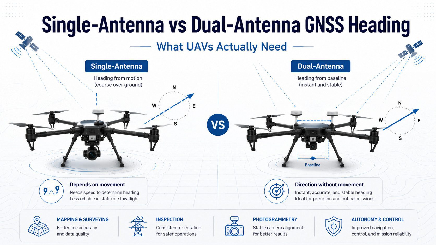
GNSS receivers can estimate heading (yaw) through several methods. The choice between single-antenna and dual-antenna configurations significantly impacts accuracy, especially for professional UAV applications.
Single-Antenna Heading (Course Over Ground)
A single-antenna receiver estimates heading from the direction of travel. This requires the drone to be moving at sufficient speed and is inaccurate during hover, vertical flight, or slow-speed maneuvers. Typical accuracy is 1-5 degrees depending on speed.
Dual-Antenna Heading (Carrier Phase Differencing)
With two physically separated antennas, the receiver measures the carrier phase difference between them to calculate true heading. The accuracy depends on the baseline length: 0.15 degrees with a 1-meter baseline (Septentrio G5 P3H) or 0.08 degrees with 2 meters.
When You Need Dual-Antenna Heading
- Precision spraying: Wind compensation requires accurate heading for straight swaths
- LiDAR mapping: Point cloud georeferencing needs precise attitude data
- Bridge inspection: Near steel structures where magnetometers fail
- Delivery: Precision landing with heading alignment
When Single-Antenna Is Enough
- General navigation and waypoint following
- Fixed-wing mapping where the aircraft is always moving
- Cost-sensitive consumer drones
- Platforms that can’t accommodate dual antennas
Related GNSS Products
- HB21 GNSS Box Receiver — All-in-one RTK receiver with 4G LTE, heading, and data logging
- HB6 GNSS Box Receiver — Compact RTK receiver powered by Septentrio Mosaic X5
- EV322 GNSS Receiver — Lightweight RTK receiver for UAVs and autonomous systems
- AIM+ Anti-Jamming Technology — Advanced interference and spoofing protection
Browse our full GNSS receiver collection for professional UAV applications.
Frequently Asked Questions
What accuracy can I expect from this GNSS solution?
Septentrio GNSS receivers deliver 0.6 cm + 0.5 ppm horizontal and 1.0 cm + 1 ppm vertical accuracy with RTK. The exact performance depends on satellite geometry, atmospheric conditions, and correction data quality.
Does this work with ArduPilot or PX4 flight controllers?
Yes. Septentrio receivers output SBF protocol which is natively supported by both ArduPilot (GPS_TYPE=9) and PX4 (GPS_TYPE=9). Simply connect the UART interface and configure the GPS parameter for plug-and-play operation.
Can I use this receiver without an RTK base station?
Yes. You can use NTRIP corrections via a cellular connection, or use Galileo HAS (free satellite-delivered corrections on supported modules). For post-processing, the receiver logs raw data for PPK processing.
How do I order or get technical support?
Contact our sales team at sales@uav-gnss.com for pricing and availability. Technical documentation, integration guides, and configuration tools are available through our website resources section.