Abstract
The Septentrio mosaic-X5 provides centimeter-level RTK positioning capability for traffic management drones. Its GNSS+ technology suite (AIM+, APME+, LOCK+, IONO+) ensures signal reliability in complex environments. The 448-channel, all-frequency design supports all current and future navigation signals. With a 100 Hz update rate and <10 ms low latency, it is suitable for high-dynamic traffic scenarios. Its rugged design and low power consumption make it ideal for long-duration, large-scale traffic inspection missions.
Q&A
What type of GNSS receiver should be chosen for traffic management drones?
The Septentrio mosaic-X5 is the ideal choice, as it offers centimeter-level RTK accuracy, powerful anti-interference capability, a compact size, and low-power design, perfectly adapting to drone platforms.
Why is centimeter-level GNSS accuracy needed for traffic management?
Centimeter-level accuracy is fundamental for ensuring accurate accident scene reconstruction, reliable traffic flow analysis, and error-free facility positioning, directly impacting management efficiency and public safety.
What role does AIM+ technology play in traffic drones?
AIM+ effectively suppresses intentional interference and spoofing signals, ensuring continuous and stable GNSS reception in complex urban electromagnetic environments, thereby guaranteeing mission continuity and data authenticity.
How does the mosaic-X5 ensure uninterrupted GNSS signals and prevent positioning drift in complex traffic environments with dense high-rises and overpasses?
The mosaic-X5 ensures stable, reliable centimeter-level positioning in complex urban environments with dense buildings and overpasses through all-frequency, multi-system redundancy, APME+ for suppressing building reflections, AIM+ for anti-interference and anti-spoofing, high-sensitivity rapid reacquisition, and LOCK+ for vibration-resistant tracking. This ensures uninterrupted drone traffic management missions and prevents data drift.

High-Precision GNSS Technology Empowers Modern Traffic Management
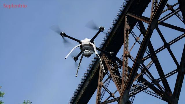
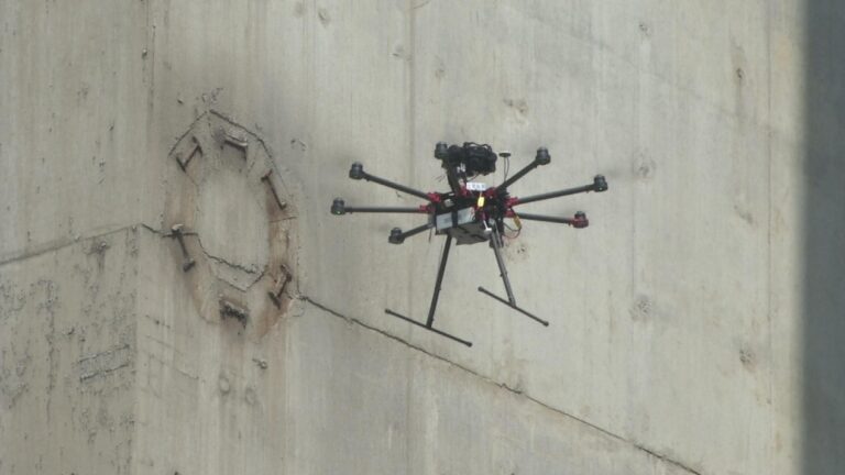
In modern traffic management, drones have evolved from simple monitoring tools into intelligent aerial platforms integrating real-time surveillance, accident investigation, flow analysis, and road inspection. As transportation systems become increasingly complex, traditional navigation solutions can no longer meet the demands for precision, reliability, and anti-interference capability required in high-dynamic, high-density urban traffic scenarios.
Why Centimeter-Level GNSS Accuracy is Crucial for Traffic Management
In urban roads, highways, or complex interchange areas, even a few centimeters of positioning deviation can cause drones to deviate from their flight paths, lead to mismatched data collection, affect the accuracy of accident scene reconstruction, compromise the reliability of traffic flow analysis, and even pose safety risks. High-precision spatiotemporal data is the foundation for decision-making in Intelligent Transportation Systems (ITS).
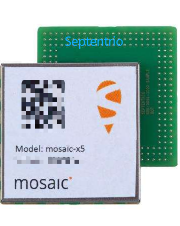
Core Advantages of the Septentrio mosaic-X5 GNSS Receiver
The Septentrio mosaic-X5 is not just a navigation module; it is a high-precision, high-reliability positioning system built for high-dynamic traffic environments. Its design philosophy integrates a compact size, all-frequency support, and advanced anti-interference technology, making it perfectly suited for the stringent requirements of traffic management drones.
All-System, All-Frequency GNSS Performance
Despite its compact size of 31×31×4 mm, the mosaic-X5 features:
-448 hardware channels for simultaneous tracking of all visible satellite signals.
-Full constellation support: GPS, BeiDou, Galileo, GLONASS, QZSS, NavIC, SBAS.
-Multi-frequency reception enhances signal reliability, adapting to complex electromagnetic environments like overpasses and tunnel entrances.
-OSNMA support enhances signal security and trustworthiness.
GNSS+ Technology Ensures Stable Positioning in Complex Traffic Environments
Septentrio’s unique GNSS+ technology suite maintains high accuracy even in urban settings rich with interference and multipath:
-AIM+: Industry-leading anti-jamming and anti-spoofing technology to counter intentional interference and imitation signals.
-APME+: Multipath suppression reduces the impact of signals reflected from buildings and vehicles.
-LOCK+: Maintains stable tracking under high vibration and windy conditions.
-IONO+: Protects against ionospheric disturbances, ensuring all-weather reliability.
These technologies work together to deliver sustained centimeter-level RTK accuracy:
-Horizontal accuracy: 0.6 cm + 0.5 ppm
-Vertical accuracy: 1.0 cm + 1 ppm

Integration Advantages of mosaic-X5 in Traffic Management Drone Platforms
High Update Rate and Low Latency Response
The mosaic-X5 supports a 100 Hz update rate with less than 10 ms latency, ensuring every image frame captured during high-speed inspection or rapid accident response is synchronized with precise geographic coordinates. This is suitable for dynamic traffic flow monitoring and real-time traffic event annotation.
Accurate 3D Scene Reconstruction
In applications like 3D reconstruction of traffic accident scenes or road infrastructure modeling, its high-precision positioning provides a stable spatial reference for image data, significantly improving modeling quality and the validity of legal evidence.
High Efficiency and Extended Endurance Support
Fast RTK initialization (<7 seconds) improves mission response speed. With a typical power consumption of only 0.6 W, it extends drone flight time, making it suitable for large-scale road network patrols and long-duration monitoring tasks.
Strong Environmental Adaptability
Compliant with the MIL-STD-810G vibration resistance standard and an operating temperature range of -40°C to +85°C, it adapts to various traffic management environments, from summer heat to winter cold, and from urban to suburban areas.

mosaic-X5: The Precise Spatiotemporal Foundation for Traffic Management Drones
Enhancing Data Credibility and Decision-Making Basis
Drones equipped with the mosaic-X5 provide highly credible spatial data, strengthening the scientific basis and traceability of traffic flow analysis, accident liability determination, and facility management decisions.
Easy Integration and Complete Development Ecosystem
Comprehensive interface support (4×UART, Ethernet, USB, SDIO), full protocol compatibility (NMEA, RTCM, RINEX), and free SDKs and APIs significantly reduce system integration and drone platform development cycles.
A Future-Proof GNSS Investment
Choosing the mosaic-X5 means providing traffic management authorities with long-term stable, technologically advanced positioning capability, supporting current and future navigation signals and security standards.