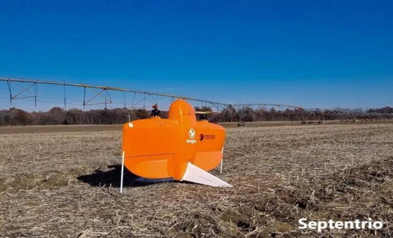
High-Precision GNSS Technology Drives Modern Agricultural Intelligence
Modern precision agriculture requires crop protection operations to evolve from “area coverage” to “point-to-point” precise application. This demands drones not only know where they are but also precisely perceive their heading and attitude. The mosaic-G5 P3HT integrates centimeter-level RTK positioning with 0.15° heading accuracy and 0.25° roll/pitch accuracy, endowing agricultural drones with true “intelligent perception” capability for variable-rate spraying, automatic obstacle avoidance, and terrain-following flight.
The Value of Centimeter-Level Positioning and Precise Heading for Crop Protection
For crop protection, even a few centimeters of route deviation can lead to over-spraying causing phytotoxicity or missed spraying leading to pest outbreaks. Precise heading information ensures the spraying swath aligns perfectly with the predetermined route, crucial in scenarios demanding high route consistency such as orchard canopy spraying.
Core Advantages of the Septentrio mosaic-G5 P3H GNSS Receiver
The mosaic-G5 P3HT is a surface-mount GNSS module designed for high-performance, high-integration applications, combining full-band GNSS reception and dual-antenna heading within an extremely small form factor.
Full-System, Full-Frequency GNSS and Dual-Antenna Heading
Despite its compact size of only 22.8 x 16.4 mm, the mosaic-G5 P3HT features:
- 789 hardware channels for simultaneous tracking of all visible satellite signals (GPS L1/L2/L5, GLONASS L1/L2/L3, BeiDou B1/B2/B3, Galileo E1/E5/E6, etc.)
- Dual-antenna heading: 0.15° heading accuracy and 0.25° roll/pitch accuracy with 1m antenna baseline, true north heading without initialization movement
- Supports Galileo HAS and OSNMA for future-proof accuracy and security
GNSS+ Technology for Complex Farmland Environments
Septentrio’s patented GNSS+ suite ensures reliable data in challenging conditions:
- AIM+ Advanced: Anti-jamming and anti-spoofing to counter RF interference in fields
- APME+: Multipath estimation suppressing signal reflections from crops, buildings, and field ridges
- LOCK+: Robust satellite tracking under vibration from drone engines
- IONO+: Mitigates ionospheric disturbances for reliable performance during high-activity periods
- RAIM+: Receiver Autonomous Integrity Monitoring for safety status flags in automated flight
Outstanding RTK performance (baseline <40 km, open sky):
- Horizontal Accuracy: 0.6 cm + 0.5 ppm
- Vertical Accuracy: 1 cm + 1 ppm
- RTK Initialization: < 7 seconds
Integration Advantages in Agricultural Drone Platforms
Ultra-Compact Size and Low Power Consumption
The module occupies less than 4 cm², weighs only 2.2 grams, and has typical power consumption of only 0.6 W (dual-antenna mode), significantly saving drone space and power for increased tank capacity and extended flight time.
Designed for Automated Production
SMT package suitable for high-volume automated assembly, with complete command sets and data interface documentation for straightforward integration.
High Update Rate and Low Latency
Position output up to 20 Hz provides real-time position and attitude feedback for high-speed agricultural drones.
Rugged and Reliable
Operating temperature range of -40°C to +85°C, ENV-STD-810H compliant for vibration and shock.
Building the Precision Navigation Core for Intelligent Agricultural Drones
Improving Operational Accuracy and Economic Benefits
Stable high-precision position and attitude directly enhance route accuracy, reduce over-spraying and missed spraying, and save 10%-20% on pesticides and fertilizers.
Enhancing Automation and Safety
Provides core data for automated takeoff/landing, A-B line operation, terrain-following flight, and resume-spraying from breakpoint, with RAIM+ integrity monitoring for safety assurance.
Related GNSS Products
- HB21 GNSS Box Receiver — All-in-one RTK receiver with integrated 4G LTE, heading, and data logging
- HB6 GNSS Box Receiver — Compact quad-constellation RTK receiver powered by Septentrio Mosaic X5
- EV322 GNSS Receiver — Lightweight RTK receiver for UAVs and autonomous systems
- AIM+ Anti-Jamming Technology — Advanced interference and spoofing protection
Browse our full GNSS receiver collection for professional UAV applications.
Frequently Asked Questions
Why do agricultural drones require high-precision heading GNSS receivers?
Accurate positioning and attitude are core to ensuring agricultural drones achieve centimeter-level route tracking, avoid over-spraying or missed spraying, and improve operational efficiency. The mosaic-G5 P3HT offers heading accuracy up to 0.15° via dual antennas, enabling terrain-following flight and precise spraying over uneven fields like hillsides and orchards.
How does the mosaic-G5 P3H ensure reliability in high-vibration and dusty environments?
LOCK+ technology ensures robust satellite signal tracking under sustained high-frequency vibrations from drone engines and rotors. The SMT package is sturdy and reliable with an operating temperature range of -40°C to +85°C. AIM+ suppresses potential RF interference from electrical equipment in the field, ensuring continuous positioning in dusty and humid farmland conditions.
How to handle multipath interference from buildings and trees around farmland?
APME+ technology identifies and suppresses reflected signals from houses, sheds, windbreaks, and crops around farmland. This ensures pure positioning data output even at field edges, guaranteeing precise operational boundaries and preventing spray drift in complex agricultural environments.
How does the mosaic-G5 P3H integrate with existing agricultural drone flight controllers?
The module offers 2 high-speed UARTs, USB, and support for NMEA 0183, RTCM 3.x, and Septentrio Binary Format (SBF). Free RxTools configuration software and complete documentation enable quick integration with mainstream flight controllers. It can be flexibly configured for single-antenna positioning or dual-antenna heading mode.