Why Disaster Relief Drones Depend on Precision GNSS
Disaster relief drones operate in some of the most challenging environments for GNSS positioning. Smoke, collapsed debris, radio interference from emergency communication equipment, and rapidly changing terrain all degrade standard GPS accuracy. When lives depend on centimeter-level positioning, a reliable GNSS receiver for disaster relief drones isn’t optional — it’s mission-critical.
A positioning error of even a few meters could mean rescuers missing trapped victims entirely, while a sudden signal loss could halt an entire search operation. Severe multipath effects caused by steel and concrete debris further compromise positioning reliability. These limitations — acceptable in normal environments — can become fatal in disaster rescue scenarios where every second counts.
This is where the Septentrio mosaic-X5 GNSS module changes the game, delivering the resilience and precision that emergency response UAVs require. For a comprehensive overview of available platforms, explore uav-gnss.com for Septentrio-powered receiver solutions.
What Makes the Septentrio Mosaic-X5 the Right GNSS Receiver for Disaster Relief
Compact Hardware with Industrial-Grade Power
Within its ultra-compact 31 × 31 × 4 mm form factor, the mosaic-X5 integrates 448 hardware channels, full multi-constellation tracking (GPS, GLONASS, Galileo, BeiDou), and multi-frequency support across L1, L2, and L5 bands. This enables reliable positioning even under heavy canopy or in urban canyon environments typical of disaster zones.
Products like the HB6 GNSS Receiver package this module for field-ready deployments.
GNSS+ Technologies Purpose-Built for Rescue Environments
- AIM+ Anti-Interference: Protects against radar, emergency communication, and electronic jamming signals commonly found in disaster response zones. Learn more about AIM+ Resilient GNSS Technology.
- APME+ Multipath Suppression: Removes signal reflections from metal structures, rubble, and collapsed buildings for reliable positioning in cluttered environments.
- LOCK+ Tracking Stability: Maintains satellite lock through wind, rain, smoke, and rotor vibration — conditions that cause standard receivers to lose position.
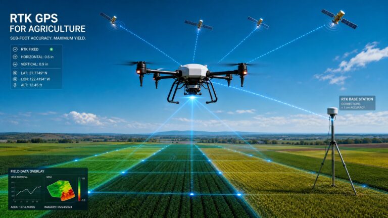
Centimeter-Level RTK Accuracy When It Matters Most
- Horizontal accuracy: 0.6 cm + 0.5 ppm
- Vertical accuracy: 1 cm + 1 ppm
- RTK initialization: just 7 seconds from cold start
- Cold start: under 45 seconds
Key Applications in Disaster Response
Precise Life Detection and Victim Localization
With a 100 Hz update rate and less than 10 ms latency, the mosaic-X5 provides real-time geolocation data for thermal imaging cameras and life-detection sensors. Rescuers can pinpoint victims with centimeter accuracy, even through smoke and debris. The HB21 GNSS Box Receiver is an ideal portable solution for search-and-rescue drone deployments.
Precision Delivery of Critical Supplies
Centimeter-level airdrop accuracy enables drones to deliver medical supplies, water, and communication equipment directly to rooftop landing zones or confined spaces, overcoming line-of-sight obstructions that would defeat standard GPS navigation.
Rapid Large-Scale Disaster Assessment
A cold start time of under 45 seconds and RTK lock in just 7 seconds means drones can deploy immediately after a disaster event. Low power consumption of only 0.6 W extends flight time for extended search operations.
Built for Extreme Conditions
The mosaic-X5 is ENV-STD-810G certified for ruggedness, with an operating temperature range of -40°C to +85°C. It resists vibration, humidity, and shock — environments that would disable consumer-grade GNSS modules. This makes it the preferred GNSS receiver for disaster relief drones used by government agencies and emergency response teams worldwide.
For applications requiring dual-antenna heading in addition to positioning, the EV322 GNSS Receiver offers multi-constellation RTK with Septentrio mosaic-G5 technology.
For further reading on how GNSS technology supports emergency response operations, refer to the UN-SPIDER knowledge portal for disaster management and space-based technologies.
Technical Specifications at a Glance
- 448 hardware channels
- GPS, Galileo, GLONASS, BeiDou
- L1/L2/L5 multi-frequency
- 100 Hz update rate
- <10 ms latency
- Cold start: <45 s
- RTK initialization: 7 s
- 0.6 W power consumption
- AIM+ / APME+ / LOCK+
- -40°C to +85°C operating range
- ENV-STD-810G ruggedness
- 31 × 31 × 4 mm form factor
Conclusion
The Septentrio mosaic-X5 GNSS receiver empowers disaster relief drones with centimeter-level RTK accuracy, 448 channels, full-constellation multi-frequency tracking, and GNSS+ technologies including AIM+ anti-interference, APME+ multipath suppression, and LOCK+ tracking stability. With a 100 Hz update rate, 7-second RTK initialization, and ENV-STD-810G rugged design, it provides ultra-reliable positioning for search-and-rescue, supply delivery, and damage assessment in extreme post-disaster environments.
If you’re equipping drones for emergency response, choosing the right GNSS receiver for disaster relief drones can mean the difference between life and death. The mosaic-X5 delivers the reliability your missions demand.
Frequently Asked Questions
Q: How does the mosaic-X5 maintain GNSS lock in smoke and debris?
A: The mosaic-X5 uses AIM+ anti-interference technology to filter out signal degradation from smoke, dust, and RF interference. Combined with LOCK+ tracking, it maintains satellite lock in conditions where standard GNSS receivers fail.
Q: Can the mosaic-X5 be integrated into existing disaster response drones?
A: Yes. The module uses standard UART serial communication and is compatible with PX4 and ArduPilot flight controllers. Most drone platforms can integrate it with minimal hardware changes. See our integration guide for PX4 and ArduPilot setup details.
Q: What is the real-world accuracy in urban disaster zones?
A: With RTK corrections, the mosaic-X5 achieves 0.6 cm + 0.5 ppm horizontal accuracy even in cluttered urban environments, thanks to APME+ multipath suppression that removes reflections from steel and concrete structures.
Q: How quickly can the receiver get a position fix after deployment?
A: Cold start takes under 45 seconds, and RTK initialization requires just 7 seconds — allowing drones to deploy rapidly following a disaster event.