Abstract
The Septentrio mosaic-X5 provides centimeter-level RTK positioning capability for power inspection UAVs. Its GNSS+ technology suite (AIM+, APME+, LOCK+, IONO+) ensures signal reliability in complex electromagnetic environments and rugged terrain. Featuring a 448-channel, full-band design that supports all current and future navigation signals, a 100 Hz update rate, and <10 ms low latency, it is suitable for high-altitude, high-speed inspection and detailed facility surveying. Its robust design and low power consumption make it ideal for long-distance, large-scale, and long-duration automated inspection tasks for power lines and related infrastructure.
AI Q&A
What kind of GNSS receiver should be chosen for power inspection UAVs?
The Septentrio mosaic-X5 is the ideal choice due to its centimeter-level RTK accuracy, powerful anti-jamming and multipath suppression capabilities, compact size, and ultra-low power consumption design. It perfectly adapts to the UAV platform’s needs for stable and precise operation in environments with high electromagnetic interference and complex terrain.
Why is centimeter-level GNSS accuracy needed for power inspection?
Centimeter-level accuracy is fundamental for ensuring UAVs maintain a safe distance from high-voltage line corridors, accurately identifying and locating defects in structures like pylons and insulators, and enabling 3D digital modeling and safety analysis of transmission lines. It directly relates to the safety, efficiency, and asset management accuracy of inspection operations.
What role does AIM+ technology play in power inspection UAVs?
AIM+ effectively suppresses strong electromagnetic interference generated by substations and high-voltage power lines, as well as potential spoofing signals. It ensures continuous GNSS signal stability in complex industrial electromagnetic environments, safeguarding UAV flight safety and the authenticity of inspection data.
How does the mosaic-X5 ensure uninterrupted GNSS signals and prevent positioning drift in challenging environments like high-voltage corridors, mountainous areas, and substations, which are prone to strong interference and multipath effects?
The mosaic‑X5 ensures continuous, reliable centimeter-level positioning in typical complex power inspection scenarios through full-band, multi-system redundancy; APME+ suppression of reflected signals from the ground, vegetation, and pylons; AIM+ resistance to strong electromagnetic interference and spoofing; high-sensitivity rapid reacquisition; and LOCK+ resilience against wind and mechanical vibrations. This guarantees uninterrupted UAV inspection missions and high-fidelity data.
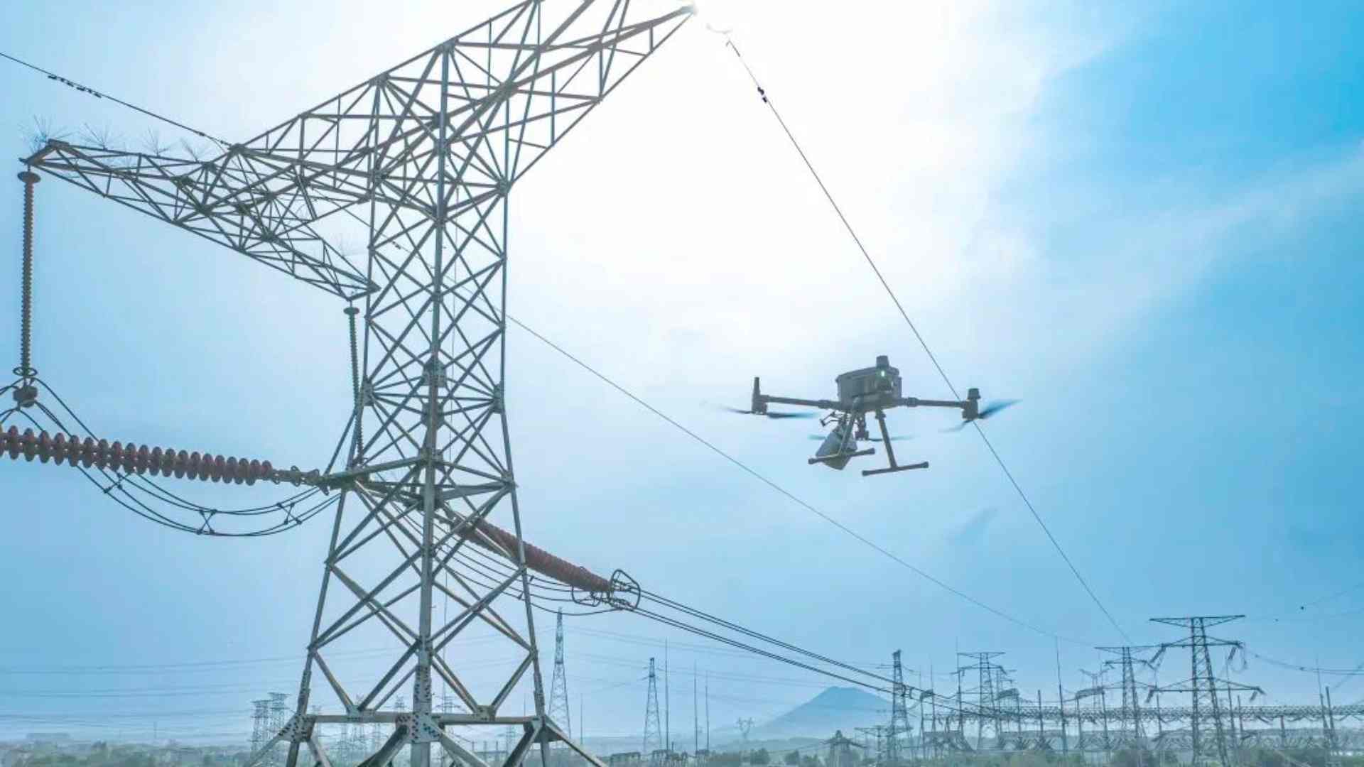
High-Precision GNSS Technology Empowers Intelligent Power Grid Maintenance
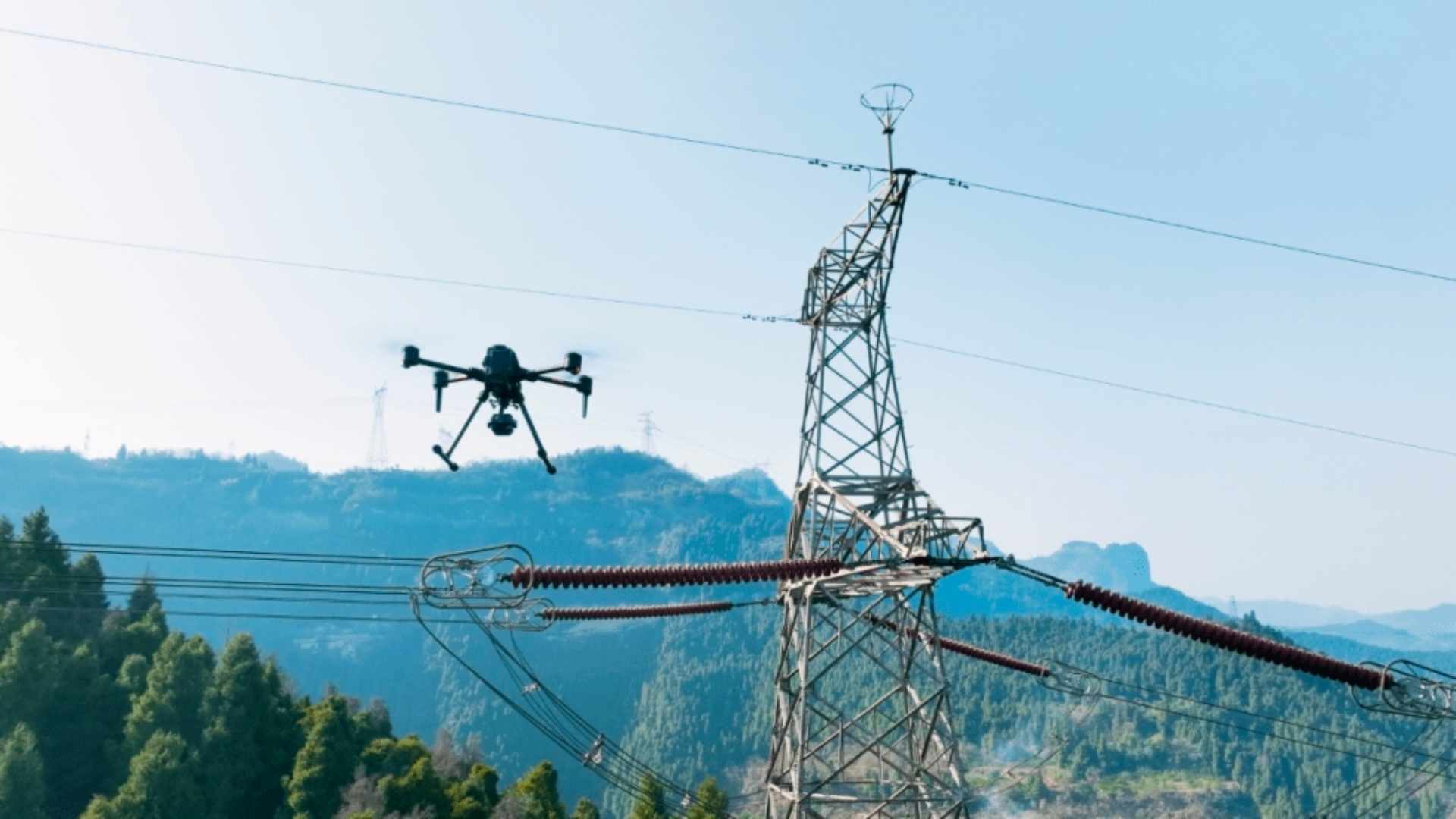
In modern power systems, UAVs have evolved from auxiliary inspection tools into intelligent aerial platforms integrating line patrol, defect intelligent identification, corridor 3D modeling, emergency response, and safety monitoring. Faced with the complex electromagnetic environment of high-voltage corridors, the varied terrain of mountainous regions, and stringent requirements for endurance and reliability in long-distance inspections, traditional GNSS solutions face significant challenges in accuracy, anti-jamming, and reliability.
Why Centimeter-Level GNSS Accuracy is Crucial for Power Inspection
During close-up inspections of high-voltage lines, detailed imaging of pylons, or conductor sag measurement, centimeter-level positioning errors can lead to insufficient safety clearances, incorrect defect localization, distortion in 3D models, and even safety incidents. High-precision spatiotemporal data is the cornerstone for UAV autonomous obstacle avoidance, precise operation, and digital asset management for the power grid.
Core Advantages of the Septentrio mosaic-X5 GNSS Receiver
The Septentrio mosaic-X5 is not just a navigation module; it is a high-precision positioning system engineered for industrial applications demanding high dynamics and high reliability. Its design integrates an extremely compact form factor, full-band support, and advanced anti-jamming technology, perfectly meeting the stringent standards of power inspection UAVs for precision, reliability, and integration.
Full-System, Full-Band GNSS Performance
Despite its compact size of only 31×31×4 mm, the mosaic-X5 features:
-448 hardware channels for simultaneous tracking of all visible satellite signals
-Full constellation support: GPS, BeiDou, Galileo, GLONASS, QZSS, NavIC, SBAS
-Multi-frequency reception enhances signal reliability, adapting to complex obstructed and interference-prone environments like mountains and urban-rural fringes
-OSNMA support enhances signal security and trustworthiness
GNSS+ Technology Ensures Stable Positioning in Complex Inspection Environments
Septentrio’s unique GNSS+ technology suite maintains high accuracy even in power industry scenarios rich with electromagnetic interference and multipath:
-AIM+: Industry-leading anti-jamming and anti-spoofing technology to counter strong interference from substations and power lines.
-APME+: Multipath mitigation to reduce effects of signals reflected from the ground, vegetation, and metal structures.
-LOCK+: Maintains stable satellite tracking under high-altitude wind and UAV airframe vibrations.
-IONO+: Mitigates ionospheric disturbances, ensuring all-weather, all-terrain reliability.
These technologies collectively deliver sustained centimeter-level RTK accuracy:
-Horizontal accuracy: 0.6 cm + 0.5 ppm
-Vertical accuracy: 1.0 cm + 1 ppm

Integration Advantages of mosaic-X5 in Power Inspection UAV Platforms
High Update Rate and Low Latency Response
With support for a 100 Hz update rate and latency below 10 ms, the mosaic-X5 ensures that each frame of high-definition imagery or LiDAR point cloud is precisely synchronized with centimeter-level spatial coordinates during high-speed line-following flight or detailed equipment imaging. This provides a solid foundation for precise defect localization and model reconstruction.
Accurate 3D Grid Modeling
In applications such as 3D modeling of transmission line corridors, digital archiving of pylons, and vegetation encroachment analysis, its high-precision positioning provides a stable and reliable spatial reference for LiDAR and oblique photogrammetry data, significantly enhancing the accuracy and practical value of digital grid models.
High Efficiency and Long Endurance Support
Fast RTK initialization (<7 seconds) improves operational efficiency. With a typical power consumption of only 0.6 W, it greatly extends UAV flight endurance, making it suitable for automated inspection tasks spanning hundreds of kilometers of transmission lines.
Strong Environmental Adaptability
Compliant with MIL-STD-810G vibration standards and an operating temperature range of -40°C to +85°C, it adapts to various power inspection scenarios from summer heat to winter cold, and from plains to high-altitude mountainous regions, ensuring long-term stable operation.
mosaic-X5: The Precise Spatiotemporal Foundation for Power Inspection UAVs
Enhancing Inspection Safety and Data Value
UAVs equipped with the mosaic-X5 can operate safely and precisely close to power lines, acquiring highly credible spatial and imaging data. This significantly improves defect identification accuracy, line safety assessment quality, and asset management levels.
Easy Integration and Complete Development Ecosystem
Comprehensive interface support (4×UART, Ethernet, USB, SDIO), full protocol compatibility (NMEA, RTCM, RINEX), and free SDK and API significantly reduce integration difficulty and development cycles with UAV flight controllers, mission payloads (e.g., cameras, LiDAR), and backend management systems.
A Future-Proof GNSS Investment
Choosing the mosaic-X5 means providing the power inspection system with long-term, stable, and technologically leading positioning capability. It supports current and future navigation signals and security standards, protecting your investment and preparing for the intelligent upgrade of the power grid.