The evolution of precision agriculture has placed unprecedented demands on unmanned aerial vehicles (drones) to perform tasks such as automated crop spraying, field mapping, and data collection with exceptional accuracy and reliability. At the heart of these advanced drone systems lies the need for a high-performance GNSS solution that delivers not only precise positioning but also robust operation in challenging environments. The Septentrio mosaic-G5 P3H stands out as a cutting-edge resilient GNSS receiver specifically engineered to meet these demands — integrating multi-constellation, multi-frequency signal tracking with dual-antenna heading capability for agricultural applications where centimeter-level accuracy and directional stability are paramount.
For a complete overview of solutions, explore Septentrio-powered GNSS receivers at uav-gnss.com.
Why Precision GNSS Matters for Agricultural Drones
In precision agriculture, the ability to maintain precise flight paths and orientation is critical for optimizing resource use and ensuring uniform application of inputs. The mosaic-G5 P3H delivers RTK positioning with horizontal accuracy of 0.6 cm + 0.5 ppm and vertical accuracy of 1 cm + 1 ppm. Such high precision enables drones to follow predetermined routes with minimal deviation, reducing overlaps and gaps in spraying or seeding operations.
The dual-antenna design provides heading accuracy of up to 0.03° and pitch/roll accuracy of 0.05° with a 1-meter antenna separation. This ensures that the aircraft can accurately determine its attitude, enhancing stability during flight and improving performance in windy conditions or over uneven terrain. The module’s support for GPS, GLONASS, BeiDou, Galileo, and QZSS constellations ensures continuous and reliable satellite coverage, which is essential for operations in remote or obstructed areas.
Advanced Anti-Jamming and Spoofing Protection
Agricultural drones are increasingly vulnerable to GNSS jamming and GPS spoofing, which can disrupt navigation and lead to operational failures. The mosaic-G5 P3H incorporates anti-jamming GNSS technologies to counteract these threats. Its AIM+ Advanced system actively detects and mitigates jamming and spoofing signals, ensuring that the receiver maintains reliable positioning even in hostile RF environments.
This capability is crucial for countering devices such as GPS jammers and drone jammers, which are becoming more prevalent near agricultural operations. By leveraging these advanced protections, the module provides a secure and dependable navigation solution, minimizing the risk of signal loss or manipulation during critical farming operations.
Learn more about AIM+ resilient GNSS technology for interference-free agricultural drone operations.
Multipath and Ionospheric Resilience for Agricultural Environments
Agricultural environments often include structures like silos, trees, and buildings that can cause signal reflections, leading to multipath errors. The Septentrio receiver addresses this with APME+ technology, which estimates and mitigates multipath effects on both code and phase measurements. This ensures the RTK GPS module delivers consistent accuracy even in complex scenarios.
Additionally, ionospheric disturbances can degrade GNSS performance, particularly during periods of high solar activity. The IONO+ feature provides advanced correction mechanisms to counteract ionospheric delays, enhancing positioning reliability across diverse geographic and atmospheric conditions. This makes the mosaic-G5 P3H not only an anti-jamming GNSS solution but also a robust system against environmental signal degradations.
High Update Rates and Low Latency for Dynamic Operations
Agricultural drones often operate at high speeds and require real-time responsiveness for variable-rate application or obstacle avoidance. The mosaic-G5 P3H supports position update rates of up to 20 Hz, ensuring that navigation data refreshes rapidly to keep pace with the drone’s movements. The module’s low latency, with event accuracy under 3 nanoseconds, allows for precise timestamping of actions, vital for synchronizing spraying mechanisms or capturing geotagged imagery.
The fast re-acquisition time of 1 second ensures that the drone receiver can quickly recover signal after temporary blockages, maintaining continuous operation throughout the mission. Like the mosaic-G5 P3H used in industrial inspection applications, this receiver shares the same reliable positioning core for demanding operational environments.
Software Integration with RxTools
To maximize the utility of the mosaic-G5 P3H in agricultural drones, Septentrio provides the RxTools software suite. This comprehensive tool allows users to configure, monitor, and analyze the GNSS module with ease. Operators can set optimal parameters for RTK and heading outputs, monitor satellite visibility and signal health, and log raw measurement data for post-processing or quality assurance. The software’s user-friendly interface simplifies integration into existing drone systems, reducing development time and enhancing operational efficiency.
Durability for Harsh Agricultural Environments
Agricultural operations expose equipment to extreme conditions including temperature variations, humidity, and mechanical vibrations. The mosaic-G5 P3H is built to withstand these challenges, with an operating temperature range of -40°C to +85°C and compliance with ENV-STD-810H standards for vibration and shock resistance. Its compact SMT package, measuring just 22.8 × 16.4 × 2.4 mm and weighing 2.2 grams, facilitates seamless integration into space-constrained drone designs. The module’s low power consumption — typically 0.6 W for dual-antenna operation — helps extend flight times by minimizing energy drain on the drone’s battery.
Our EV322 GNSS Receiver, integrating the mosaic-G5 P3H, provides plug-and-play compatibility for agricultural drone integration. The HB21 GNSS Box Receiver adds dual-antenna heading and 4G NTRIP connectivity for RTK corrections without a local base station.
For further reading, refer to the MDPI Sensors research on RTK positioning reliability for drones operating in critical GNSS environments, directly applicable to agricultural operations near structures and tree lines.
Our u-blox to Septentrio upgrade guide explains why the mosaic-X5 achieves RTK fix 40-60% faster than competing modules — relevant for time-sensitive agricultural spraying operations.
Why the Mosaic-G5 P3H Is the Right GNSS Receiver for Agricultural Drones
- Centimeter-level RTK accuracy for precise spraying and seeding route execution
- Dual-antenna heading with 0.03° accuracy for stable operation in wind and uneven terrain
- AIM+ anti-interference protection against GPS jamming and spoofing
- APME+ multipath suppression near silos, trees, and farm buildings
- IONO+ ionospheric compensation for reliable performance across seasons
- Ultra-compact 2.2 g, 22.8 × 16.4 × 2.4 mm for weight-sensitive agricultural platforms
- Ultra-low 0.6 W power consumption for extended spray missions
- RxTools software suite for easy configuration and monitoring
- ENV-STD-810H compliant for harsh agricultural environments
As precision agriculture continues to evolve, the Septentrio mosaic-G5 P3H stands as a trusted RTK GPS module that empowers farmers to achieve higher efficiency, reduced waste, and improved crop yields through advanced autonomous drone operations.
5 Ways the Mosaic-X5 Optimizes Agricultural Spray Drones
1. Faster RTK Convergence Reduces Pre-Flight Wait Time
The mosaic-X5 achieves RTK fix in 7 seconds compared to 30-60 seconds for competing modules. For agricultural operations covering hundreds of hectares, this time saving adds up significantly over a full spray season. When every spraying window matters — especially during optimal weather conditions for chemical application — minimizing pre-flight delays directly improves operational efficiency and crop coverage.
Our u-blox to Septentrio upgrade guide explains why the mosaic-X5 achieves RTK fix 40-60% faster, with detailed comparison data for agricultural spray drone operators.
2. Superior Multipath Rejection in Field Conditions
Agricultural environments present unique GNSS challenges: tree lines, buildings, irrigation structures, and uneven terrain all create signal reflections. AIM+ technology filters out these reflections, maintaining centimeter accuracy where standard receivers lose lock. The mosaic-X5’s APME+ multipath suppression is particularly valuable near shelter belts, farm buildings, and undulating terrain common in agricultural landscapes.
Learn more about AIM+ resilient GNSS technology for interference-free agricultural drone operations.
3. Reliable Positioning Near Power Infrastructure and Irrigation Systems
Many agricultural fields border power lines, pump stations, and irrigation systems that generate electromagnetic interference. The mosaic-X5’s AIM+ advanced interference rejection maintains position lock in these challenging RF environments. For spray drones that must operate near overhead power cables when treating field margins, this reliable positioning is essential for both safety and application accuracy.
4. Multi-Constellation Tracking for Maximum Coverage
With GPS, GLONASS, Galileo, and BeiDou support across 448 hardware channels, the mosaic-X5 maintains strong satellite geometry even in partially obstructed fields, tree canopies, valley locations, or areas near farm structures where single-constellation receivers struggle. This robust tracking translates to fewer positioning dropouts and more consistent spray coverage across diverse agricultural terrain.
Products like the HB21 GNSS Box Receiver combine the mosaic-X5 with dual-antenna heading and 4G NTRIP for permanent agricultural base station setups, while the EV322 GNSS Receiver offers a lightweight solution for spray drone integration.
5. Dual-Antenna Heading for Precise Swath Control
The mosaic-X5 supports dual-antenna heading with accuracy up to 0.08°, providing true heading without magnetic compass interference. This enables precise swath control and parallel flight lines for efficient spray coverage, eliminating gaps and overlaps that waste chemicals and reduce crop protection effectiveness.
Like the mosaic-G5 P3H used in agricultural drone applications, the mosaic-X5 shares the same GNSS+ technology suite for reliable performance in precision farming environments.
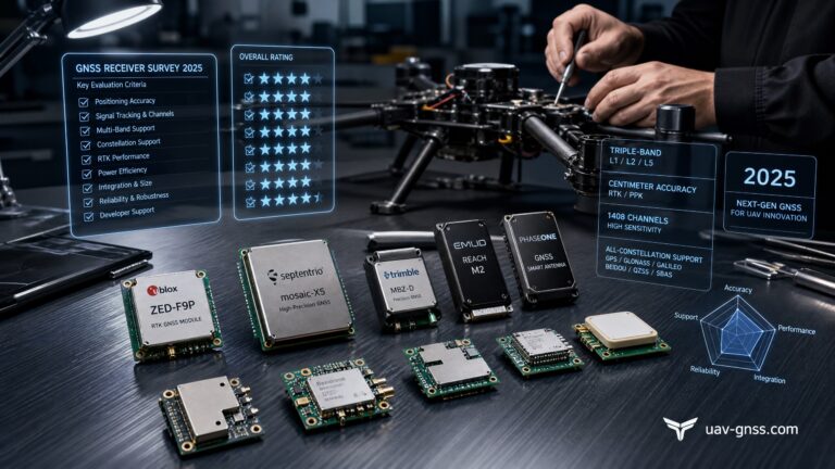
Performance Comparison: Mosaic-X5 vs Standard GNSS for Agricultural Spraying
| Feature | Septentrio Mosaic-X5 | Standard GNSS (u-blox F9P) |
|---|---|---|
| RTK Fix Time | 7 seconds | 30-60 seconds |
| Horizontal Accuracy (RTK) | 0.6 cm + 0.5 ppm | 1 cm + 1 ppm |
| Anti-Jamming | AIM+ included | None |
| Multipath Rejection | APME+ advanced | Basic |
| Update Rate | 100 Hz | 20 Hz |
| Power Consumption | 0.6 W | ~1 W |
For further reading on RTK positioning in agricultural environments, refer to MDPI Sensors research on RTK positioning reliability for drones operating in GNSS-critical environments.
Why the Mosaic-X5 Is the Right GNSS Receiver for Agricultural Spray Drones
- 7-second RTK convergence minimizes pre-spray wait times
- APME+ multipath rejection maintains accuracy near trees and farm buildings
- AIM+ anti-interference protects against power line and irrigation interference
- Multi-constellation tracking ensures reliable lock in all field conditions
- Dual-antenna heading for precise swath control and overlap minimization
- Ultra-low 0.6 W power consumption extends spray mission endurance
- Compact 31 × 31 × 4 mm, 7 g for weight-sensitive spray platforms
For precision agricultural operators seeking to maximize chemical efficiency, reduce overlaps, and extend spray mission coverage, the Septentrio mosaic-X5 delivers the performance edge that modern precision farming demands.
The Mosaic-G5 P1: Cost-Effective Precision for Spraying Operations
Abstract
The Septentrio mosaic-G5 P1 delivers centimeter-level RTK positioning for agricultural spraying drones, with its GNSS+ technology suite (AIM+ Basic, APME+, LOCK+, RAIM+) ensuring reliable operation in challenging farmland environments. Featuring 789 channels, triple-frequency tracking, and ultra-low power consumption of just 0.44 W, it is specifically designed for large-scale, long-endurance agricultural spraying operations.
High-Precision GNSS Technology Empowers Modern Precision Agriculture
In modern agricultural spraying operations, drones have evolved from auxiliary tools into highly efficient and precise platforms for pesticide application and monitoring. Critical processes such as precise spraying, route planning, and operation logging place extremely high demands on positioning accuracy. Traditional meter-level or decimeter-level accuracy can no longer meet the three core requirements of precision agriculture: chemical savings, environmental friendliness, and operational efficiency.
Why Is Centimeter-Level GNSS Accuracy Crucial for Spraying Operations?
Quad-constellation GNSS receivers achieve centimeter-level accuracy by simultaneously tracking GPS, GLONASS, Galileo, and BeiDou satellites with RTK corrections. Precise GNSS positioning is the foundational technology ensuring that drone spraying operations are efficient, environmentally friendly, and repeatable.
Core Advantages of the Septentrio mosaic-G5 P1 GNSS Receiver
The mosaic-G5 P1 is more than just a navigation module; it is a high-precision spatiotemporal positioning system specifically designed for agricultural spraying drones. Its design philosophy delivers reliable centimeter-level positioning capability within an extremely compact footprint, making it particularly suitable for large-scale, high-frequency agricultural operations.
Full-Constellation, Multi-Frequency GNSS Performance for Complex Farm Environments
Despite its compact size of 22.8 x 16.4 x 2.4 mm, the mosaic-G5 P1 features:
- 789 hardware channels for simultaneous tracking of all visible satellite signals
- Support for all major constellations: GPS, GLONASS, BeiDou, Galileo, and QZSS
- Triple-frequency tracking (L1/L2/L5 bands) enhances signal lock robustness
- Maintains stable positioning in complex terrains such as farmland, orchards, and hills
GNSS+ Technology Ensures Reliable Operation in Interference-Prone Environments
Septentrio’s patented GNSS+ technology suite ensures signal integrity under real-world field conditions with electromagnetic interference and multipath reflections:
- AIM+ Basic: Jamming and spoofing signal detection with manual mitigation
- APME+: Multipath mitigation to reduce reflections from crops and structures
- LOCK+: Maintains stable tracking under high vibration and mechanical shock
- RAIM+: Receiver autonomous integrity monitoring for positioning reliability
These technologies combine to deliver consistent and reliable centimeter-level RTK positioning accuracy:
- Horizontal Accuracy: 0.6 cm + 0.5 ppm
- Vertical Accuracy: 1.0 cm + 1 ppm
Integration Advantages of mosaic-G5 P1 in Agricultural Drone Platforms
Efficient and Precise Route Execution
With a maximum update rate of 5 Hz and latency of less than 10 ms, the mosaic-G5 P1 ensures drones can accurately follow pre-defined flight paths even at high speeds, avoiding over-spraying or missed areas.
Low Power Consumption and Extended Flight Time
Typical power consumption is only 0.44 W, with a maximum of 0.57 W, significantly extending the drone’s single-flight duration and making it ideal for large-area, continuous operations.
Strong Environmental Resilience
With an operating temperature range of -40°C to +85°C and compliance with ENV-STD-810H vibration and shock standards, it is well-suited for harsh field conditions involving heat, humidity, and dust.
Fast Startup and High Reliability
Cold start time is under 35 seconds, warm start under 10 seconds, and reacquisition is just 1 second, improving operational efficiency and responsiveness.
The mosaic-G5 P1: The Precision Positioning Foundation for Agricultural Drones
Enhances Operational Efficiency and Chemical Utilization
Centimeter-level positioning accuracy ensures every droplet of chemical is delivered precisely to the target area, reducing waste and improving application effectiveness.
Easy Integration and Rapid Deployment
Comprehensive interface documentation, SDKs, and API support, along with compatibility with protocols like SBF, NMEA, and RTCM, facilitate quick integration into existing drone systems.
A Future-Proof Positioning Solution for Agricultural Drones
Choosing the mosaic-G5 P1 provides agricultural drones with long-term stability and high-precision GNSS performance, adapting to the ongoing evolution of precision agriculture.
Related GNSS Products
- HB21 GNSS Box Receiver — All-in-one RTK receiver with integrated 4G LTE, heading, and data logging
- HB6 GNSS Box Receiver — Compact quad-constellation RTK receiver powered by Septentrio Mosaic X5
- EV322 GNSS Receiver — Lightweight RTK receiver for UAVs and autonomous systems
- AIM+ Anti-Jamming Technology — Advanced interference and spoofing protection
Browse our full GNSS receiver collection for professional UAV applications.
Frequently Asked Questions
Q: What RTK accuracy does the mosaic-G5 P3H provide for agricultural drones?
A: The module delivers horizontal accuracy of 0.6 cm + 0.5 ppm and vertical accuracy of 1 cm + 1 ppm with RTK corrections, enabling precise flight path execution for spraying and seeding operations.
Q: How does the receiver protect against GPS jamming on farmland?
A: AIM+ anti-interference technology actively detects and mitigates jamming and spoofing signals from GPS jammers and drone jammers, ensuring reliable positioning even in hostile RF environments near agricultural operations.
Q: Can the dual-antenna heading improve spraying accuracy in windy conditions?
A: Yes. The dual-antenna design provides heading accuracy up to 0.03° with 1-meter antenna separation, significantly improving stability in windy conditions and enabling consistent spray pattern coverage.
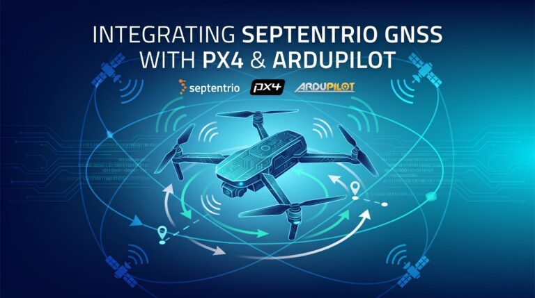
Q: Is the EV322 GNSS Receiver compatible with PX4 and ArduPilot for agricultural drones?
A: Yes. The EV322 works with any drone running PX4 or ArduPilot firmware via standard UART interface, providing plug-and-play integration for agricultural drone manufacturers.
Related GNSS Products
- EV322 GNSS Receiver — Lightweight RTK receiver for agricultural drones and autonomous systems
- HB21 GNSS Box Receiver — All-in-one RTK receiver with integrated 4G LTE, heading, and data logging
- HB6 GNSS Box Receiver — Compact quad-constellation RTK receiver powered by Septentrio Mosaic X5
- AIM+ Anti-Jamming Technology — Advanced interference and spoofing protection
Browse our full GNSS receiver collection for professional agricultural UAV applications.