For decades, robotic lawn mowers have relied on a simple but limiting technology: the boundary wire. You bury a copper loop around your lawn, and the mower follows it like a train on rails. It works, but it’s fragile, inflexible, and a nightmare to install — especially on large properties, commercial landscapes, or multi-zone lawns. As the global autonomous lawn mower market pushes past $3 billion in 2026, manufacturers are increasingly turning to RTK GNSS as the wire-free alternative that delivers real centimeter-level navigation without perimeter loops.
In this article, we break down how RTK GNSS is transforming the lawn mowing industry — from the technology behind wire-free mowing to the exact receivers that make it possible, and which Septentrio-powered products are already being integrated by leading mower OEMs.
Why Boundary Wires Are Holding Back Commercial Lawn Mowing
Consumer robotic mowers have been around for over two decades, but the boundary wire approach has several fundamental limitations that prevent adoption in commercial and large-scale residential applications:
- Installation labor: Burying boundary wire around a 2-acre property takes 6–12 hours of manual trenching. For commercial landscapes (10+ acres), it can take days.
- Wire breaks: Rodents, lawn aerators, and landscaping equipment routinely damage buried wires. Each break means finding and repairing the fault — sometimes requiring the entire perimeter to be retrenched.
- Zoning headaches: Multi-zone properties require wire loops for each zone, with switching relays and complex wiring. Adding or removing a zone means digging again.
- Navigation limits: Even with wire guidance, consumer mowers lack precision positioning. They bump into obstacles, miss edges, and cannot execute planned lawn coverage patterns efficiently.
RTK GNSS eliminates every one of these pain points. No wires, no trenching, no breaks to repair — just satellite-guided precision that works on any property size, from 1,000 sq ft residential lawns to 50-acre commercial estates and golf courses.
How RTK GNSS Enables Wire-Free Lawn Mowing
An RTK GNSS lawn mower uses satellite positioning to know exactly where it is — within 1–3 cm — at all times. Here is how the system works:
1. The Virtual Boundary
Instead of a buried wire, the operator walks the mowing perimeter once with a GNSS receiver, recording GPS waypoints. This creates a geofenced “virtual boundary” that lives in the mower’s software. The mower knows precisely where the lawn starts and ends — no physical installation required.
To create the virtual boundary, the operator uses mapping software (often running on a tablet or smartphone) with a GNSS receiver in RTK mode. As they walk the perimeter, the system records centimeter-accurate waypoints. These waypoints are saved as a polygon boundary that the mower references during every mowing session.
2. RTK Corrections for Real-Time Accuracy
Standalone GNSS (like a phone GPS) is accurate to 2–5 meters — too imprecise for lawn mowing where the mower needs to reach the edge without crossing into flower beds. RTK corrections improve this to 1–3 cm. The corrections come from one of three sources:
- Private base station: A dedicated GNSS base station installed on the property, broadcasting RTCM corrections via 900 MHz radio or 4G LTE. The most reliable option for large commercial properties.
- Network RTK (NTRIP): Corrections streamed over cellular internet from a regional CORS (Continuously Operating Reference Station) network. Works anywhere with cellular coverage, with a subscription ($200–$1,200/year depending on region).
- Galileo HAS (free PPP): Free satellite-delivered corrections from the European Galileo system, providing 10–20 cm accuracy without any base station or subscription. Sufficient for most lawn mowing applications where flower bed clearance tolerances are 15–30 cm.
3. Coverage Path Planning
Once the boundary is mapped and RTK corrections are flowing, the mower’s navigation software calculates the most efficient mowing path. Modern RTK mowers support multiple coverage patterns:
| Pattern | Best For | Coverage Efficiency | Striping Quality |
|---|---|---|---|
| Parallel passes | Rectangular lawns | 95–98% | Excellent (straight lines) |
| Spiral in/out | Irregular, non-rectangular lawns | 85–92% | Good |
| Random (Zamboni) | Very complex shapes with many obstacles | 70–80% | Low (no visible pattern) |
| Adaptive contour | Sloped or terraced lawns | 90–95% | Follows terrain contours |
For commercial lawn care providers mowing multiple properties per day, the parallel pass pattern with RTK guidance delivers the fastest, most professional-looking results — eliminating the inefficient random-bounce patterns of traditional boundary-wire mowers.
Comparing GNSS-Based vs. Boundary-Wire Mowing
| Feature | Boundary Wire Mower | RTK GNSS Mower |
|---|---|---|
| Installation time (2-acre lawn) | 6–12 hours of trenching | 15–20 minutes of perimeter walking |
| Accuracy at boundary | 5–15 cm (wire signal strength) | 1–3 cm (RTK fixed) |
| Zoning | Requires separate wire loops + relays | Software-defined zones, unlimited count |
| Maintenance | Wire breaks need digging/tracing | Software update only |
| Property changes | Rebury wire at new perimeter | Re-walk perimeter (10 minutes) |
| Multi-property | One wire per property; mower cannot drive between | Single mower fleet works any mapped property |
| Obstacle handling | Bump sensors + random bounce | RTK + IMU + optional vision for planned avoidance |
| Per-property cost | $200–500 in wire + labor per acre | One-time software mapping |
| Best property size | Under 1 acre | Any size — scales to 50+ acres |
Septentrio GNSS Receivers for Autonomous Lawn Mowers
The ideal GNSS receiver for a lawn mower must balance weight, power consumption, accuracy, and cost. Unlike drones, lawn mowers have generous payload capacity (most mower chassis can handle several kilograms) and ample battery capacity (often 5–20 Ah), so the tight SWaP constraints of drone GNSS integration are relaxed. However, production cost matters — mower OEMs building at volume need receiver solutions that fit within tight BOM budgets.
Here are the Septentrio-powered options best suited for lawn mower integration:
| Product | Module | Weight | RTK Accuracy | Heading | Best For |
|---|---|---|---|---|---|
| HB6 GNSS Box Receiver | Mosaic-X5 | 85 g | 0.6 cm + 0.5 ppm | No | Mid-range mowers; USB/UART; IP67 enclosure |
| HB21 GNSS Box Receiver | Mosaic-X5 | 165 g | 0.6 cm + 0.5 ppm | Yes (dual-ant) | Premium mowers; 4G LTE + heading + logging |
| EV322 GNSS Receiver | Mosaic-G5 | 48 g | 0.6 cm + 0.5 ppm | No | Compact mowers; smallest enclosure |
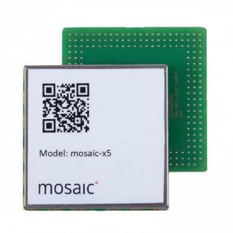
| Mosaic-X5 module (OEM) | Mosaic-X5 | 18 g | 0.6 cm + 0.5 ppm | No | Volume production; PCB-integrated; lowest BOM |
| Mosaic-G5 P3H module (OEM) | Mosaic-G5 | 18 g | 0.6 cm + 0.5 ppm | Yes | Volume mowers needing heading without compass |
For commercial lawn care service fleets: The HB21 with 4G LTE is ideal — the mower self-maps its own perimeter, streams corrections via the onboard LTE modem, and logs 30+ days of mowing data for service verification.
For residential mower OEMs: The bare mosaic-X5 module offers the lowest cost at volume, with the same centimeter-level RTK accuracy as the boxed receivers. OEMs can integrate it directly onto their main PCB, saving space and cost.
Key Technical Requirements for Lawn Mower GNSS
Multi-Constellation, Multi-Frequency Tracking
Lawn mowers operate near buildings, trees, fences, and other structures that can obstruct satellite visibility. A multi-constellation receiver tracking GPS, GLONASS, Galileo, and BeiDou simultaneously maintains reliable positioning even with partial sky view. The Septentrio mosaic-X5 tracks all major constellations across 448 channels, ensuring lock stability in suburban backyards and urban gardens alike.
AIM+ Anti-Jamming
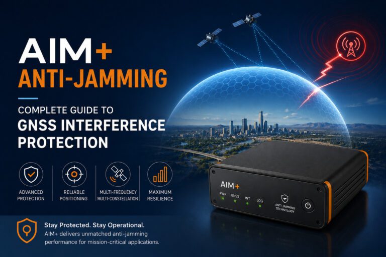
Lawn mowers face unique interference challenges: Wi-Fi routers, power lines, underground sprinkler controllers, and nearby radio transmitters can all degrade GNSS reception. Septentrio’s AIM+ (Advanced Interference Mitigation) technology filters out interference in real time, maintaining centimeter-level accuracy even in suburban RF environments that would confuse consumer-grade GNSS chips.
Low Power and Fast Startup
The mosaic-X5 consumes approximately 1.0 W in full multi-constellation RTK mode — well within the power budget of any battery-powered lawn mower. Time to first RTK fix from a warm start is under 20 seconds, meaning the mower can begin mowing almost immediately after leaving its charging station.
Update Rate and Path Smoothing
For lawn mowing, a 5–10 Hz update rate is sufficient (mowers travel at 0.3–1.0 m/s, much slower than drones). The mosaic-X5 supports configurable update rates up to 100 Hz. When combined with IMU dead reckoning, the path remains smooth even during brief GNSS dropouts under dense tree cover.
RTK Correction Options for Lawn Mower Fleets
One of the biggest decisions for lawn mower manufacturers is how to deliver RTK corrections to the mower in the field. Each approach has tradeoffs:
| Correction Source | Accuracy | Cost | Cellular Required | Setup Complexity | Best For |
|---|---|---|---|---|---|
| Private base station | 1–3 cm | $500–$2,000 equipment | No (radio link) | Medium | Single high-end property; golf courses |
| Network RTK (NTRIP) | 2–5 cm | $200–$1,200/yr subscription | Yes | Low | Commercial fleets; multi-property service |
| Galileo HAS (free PPP) | 10–20 cm | Free | No (satellite-delivered) | Very low | Residential; budget mowers; backup source |
| SSR (Satellite corrections) | 5–15 cm | $500–$1,500/yr | No | Low | Mowers in remote areas with no cell coverage |
For commercial lawn care providers operating a fleet of mowers across multiple properties, Network RTK (NTRIP) is the most practical choice. Each mower has an onboard 4G LTE modem (built into the HB21 or added as a module), connects to the nearest CORS station, and receives RTCM corrections without any property-side infrastructure. The property owner installs nothing.
Autonomous Lawn Mower Market Trends
The shift from boundary-wire to RTK GNSS mowers is accelerating. Key market developments in 2026 include:
- Residential adoption: Brands like Husqvarna, Worx, and Segway are launching RTK-enabled mowers for the premium residential segment ($2,000–$5,000), offering wire-free installation as a key differentiator.
- Commercial service fleets: Lawn care companies are switching to RTK mowers to reduce setup time at client properties. A single mower can service 20+ properties per week without any property-specific infrastructure.
- Golf course maintenance: Precision RTK mowing on fairways and greens reduces overlap and improves turf quality. Several golf courses in the US and Europe now use RTK-guided mower fleets exclusively.
- Integration with smart irrigation: RTK GNSS mowers share position data with sprinkler systems, allowing zone-based watering that adapts to mowing schedules and grass growth patterns.
Industry analysts project that by 2028, over 60% of new robotic mowers above $1,500 will use RTK GNSS instead of boundary wires. For mower OEMs, this means the integration decision needs to be made now — the hardware design cycle for a new mower platform is typically 12–18 months.
Related GNSS Products
- HB21 GNSS Box Receiver — All-in-one RTK receiver with 4G LTE, heading, and data logging — ideal for LTE-connected commercial mower fleets
- HB6 GNSS Box Receiver — Compact RTK receiver powered by Septentrio Mosaic X5 — perfect for mower OEM prototyping and mid-range integration
- EV322 GNSS Receiver — Lightweight RTK receiver for compact mowers and embedded autonomous systems
- AIM+ Anti-Jamming Technology — Military-grade interference and spoofing protection for mowers operating in suburban RF environments
Browse our full GNSS receiver collection for professional autonomous vehicle applications.
Frequently Asked Questions
Q: What RTK accuracy do I need for autonomous lawn mowing?
For reliable edge mowing without crossing into flower beds or driveways, 5–10 cm accuracy is sufficient for most residential lawns. For commercial properties and golf courses where striping quality and edge precision matter, sub-5 cm RTK accuracy (achievable with Septentrio mosaic-X5 receivers) is recommended. Galileo HAS at 10–20 cm is adequate for budget residential mowers with wider flower bed clearance tolerances.
Q: Can I retrofit my existing boundary-wire mower with RTK GNSS?
Yes, if your mower has an accessible UART, USB, or CAN bus interface for external GNSS input. You would need to add an RTK-capable receiver (like the HB6), disable the boundary wire sensor, and update the mower’s navigation firmware to accept RTK position data. For DIY retrofits, mowers running ArduPilot or PX4 firmware (many open-source mowers) are the easiest platforms. Commercial mower retrofits typically require firmware access from the OEM.
Q: How does RTK GNSS handle tree cover and suburban obstructions?
The Septentrio mosaic-X5 tracks over 40 satellites simultaneously across GPS, GLONASS, Galileo, and BeiDou. Even with 50–60% sky obstruction from trees or buildings, enough satellites remain visible for a reliable RTK fix. For denser tree cover, the receiver’s internal IMU fusion (GNSS+INS) maintains sub-meter positioning during brief outages, recovering RTK fix within 5–15 seconds once sky view returns.
Q: What happens if the mower loses cellular signal for NTRIP corrections?
Most RTK mowers implement a graceful degradation strategy: when NTRIP corrections are lost, the receiver falls back to standalone GNSS (2–5 meter accuracy) or Galileo HAS (10–20 cm accuracy via satellite-delivered free corrections). The mower continues mowing at reduced precision — it may leave a wider margin at edges — but does not stop operation. When cellular connectivity returns, RTK fix re-converges within 10–30 seconds. The HB21 receiver’s 4G LTE modem includes automatic reconnection retry logic.
Q: Is RTK GNSS lawn mowing legal and safe?
Yes. RTK GNSS receivers operate on licensed or license-exempt frequencies (GNSS bands are passive receive-only). No transmission equipment is required on the mower for positioning — the GNSS receiver only listens to satellite signals. RTCM correction data can be transmitted over standard cellular data (4G/LTE) or license-free ISM band radios (900 MHz / 2.4 GHz). Safety systems like obstacle detection, lift sensors, and tilt switches remain separate from the GNSS system. All standard lawn mower safety certifications (IEC 60335-2-107, UL 3300, etc.) apply regardless of navigation technology.