Abstract
The Septentrio Mosaic-G5 P3H GNSS module, integrated with the ArduPilot flight control system, provides a professional-grade navigation solution for UAVs operating in complex electromagnetic environments. Featuring AIM+ anti-jamming and anti-spoofing technology, full-constellation multi-frequency support, and built-in inertial sensors, it delivers reliable centimeter-level positioning even under high-intensity interference. At Norway’s JammerTest facility, Septentrio receivers maintained 99.5% positioning availability under simulated attack conditions — a benchmark that sets professional equipment apart from consumer-grade alternatives.
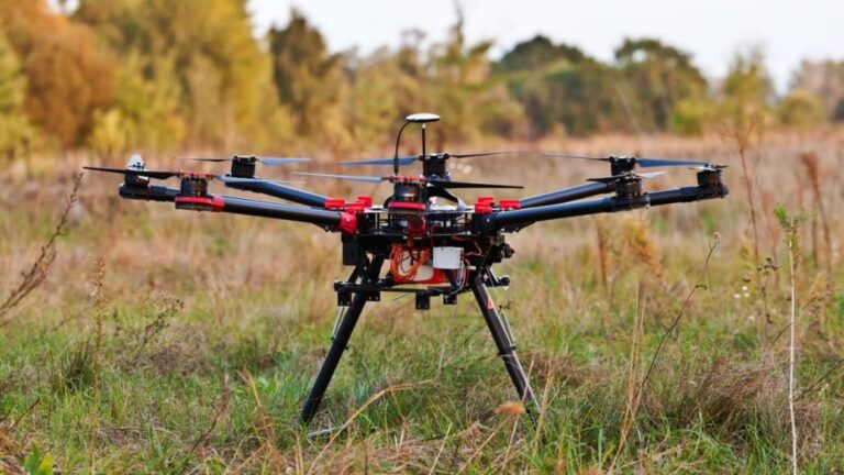
Selecting Core Navigation for Professional UAVs
At the interference test site on Andoya Island, Norway, facing malicious attacks with power ten million times higher than normal signals, the positioning trajectories of most GNSS receivers collapsed instantly, while equipment equipped with Septentrio technology maintained precise and stable routes. For UAV platforms performing mapping, logistics, or critical inspection tasks, the GNSS receiver is the core of their navigation system. In recent years, as the electromagnetic environment has become increasingly complex, pure positioning accuracy is no longer the sole criterion — the ability to maintain continuous, reliable positioning under interference and spoofing has become the key differentiator.
Core Challenges in UAV GNSS Integration
UAV GNSS integration faces multi-dimensional challenges:
- Signal Interference and Spoofing: Various types of RF interference can cause receivers to lose positioning, while spoofing attacks can guide UAVs off course or enable hijacking. Receivers must have active signal defense and identification capabilities.
- Size, Weight, and Power (SWaP) Constraints: For UAV applications, size, weight, and power consumption are decisive factors. Designers must find solutions that are both powerful and compact within limited onboard space.
- Vibration and Environmental Adaptability: The unique vibration spectrum of UAVs can affect the stability of the GNSS module’s internal oscillator, while sudden temperature changes from air flow can impact high-precision positioning.
- Flight Control System Compatibility: Different flight control systems like ArduPilot have specific requirements for GNSS data format, protocol matching, and advanced feature utilization.
Mosaic-G5 P3H: A High-Performance GNSS Module for Harsh Environments
As a high-performance compact module from Septentrio, the Mosaic-G5 P3H integrates the company’s core technological advantages and is a targeted solution to the above challenges:
Full-Constellation and Multi-Frequency Support
Supports GPS, GLONASS, Galileo, and BeiDou. By simultaneously tracking signals from multiple constellations in multiple frequency bands, it maximizes satellite visibility and improves positioning reliability — especially in areas with partially obscured skies such as urban canyons.
AIM+ Anti-Interference and Anti-Spoofing Technology
This is the foundation of the Mosaic-G5 P3H. AIM+ works in both the digital and analog domains through adaptive notch filters, pulse blanking, and frequency band remapping, effectively detecting and suppressing various interferences from narrowband to broadband.
Built-in Inertial Sensors for Safety Redundancy
The module integrates inertial sensors that provide heading, pitch, and roll information. This function provides continuous attitude data when GNSS signals are temporarily interrupted due to tunnels or interference, combined with dead reckoning for additional safety redundancy.
Proven Performance Under Real-World Jamming
In public interference tests organized by the Norwegian government, Septentrio receivers equipped with AIM+ technology maintained 99.5% positioning availability throughout dynamic scenarios against common jammers, with continuous and precise trajectories. With the same antenna and AIM+ turned off, the receiver immediately lost signal tracking.
In-Depth Analysis of AIM+ Advanced Protection Technology
Multi-Layer Dynamic Anti-Interference Mechanism
AIM+ functions like an intelligent “signal filter.” Its adaptive notch filter automatically identifies and suppresses continuous wave interference of specific frequencies; pulse blanking eliminates sudden high-energy pulse signals; frequency band remapping intelligently allocates computing resources to clean frequency bands. The built-in software spectrum analyzer monitors the RF environment in real time and provides users with an intuitive spectrum view.
Anti-Spoofing System — From Detection to Authentication
Spoofing protection employs a defense-in-depth strategy:
- Uses the inherent consistency of multi-frequency signal tracking for cross-validation
- Analyzes subtle contradictions in signal characteristics (power, Doppler shift, angle of arrival) through advanced anomaly detection algorithms
- Supports Galileo’s OSNMA (Open Service Navigation Message Authentication) for the highest level of protection, using encryption technology to verify satellite signal legitimacy at the source
Additional Value: Environmental Perception and Reconnaissance
The spectrum monitoring capability of AIM+ enables UAVs equipped with the Mosaic-G5 P3H to act as “signal scouts.” During flight, it can not only resist attacks but also record, identify, and locate illegal jammers — providing key data for spectrum management, security patrols, and jammer investigation.
In-Depth Integration with ArduPilot Flight Control System
Key Points of Hardware Connection
- Power Supply and Antenna: Provide stable 5V power. Connect dual-frequency or multi-frequency GNSS antenna to the “RF-IN” port.
- Data Interface: Connect the receiver to the GPS serial port of Pixhawk series flight controllers via UART.
- Shock Absorption: Add appropriate shock absorption between the module and UAV body to isolate harmful vibrations. Add a simple shell to avoid sudden temperature changes from air flow.
Key Steps of Software Configuration
In Mission Planner or QGroundControl:
- Set the serial port protocol to “GPS” with baud rate typically at 115200 or higher
- Critical: Set GPS_TYPE2 parameter to 10 to select Septentrio Binary Format (SBF), enabling full access to all advanced features including dual-antenna heading
- For dual-antenna heading: pull antennas apart along the longitudinal axis (recommended greater than 50 cm) with phase centers on the same horizontal plane. Enable external heading source in flight control parameters (e.g., EK3_SRC1_YAW)
Practical Optimization and Troubleshooting
Performance Optimization Tips
- Antenna Placement: Single antenna on top of UAV, away from propellers and electronics. For dual antennas, ensure spacing and avoid multipath from metal objects.
- Parameter Fine-Tuning: Adjust antenna lever arm parameters (GPS_POS1, GPS_POS2) in ArduPilot based on flight logs for improved integrated navigation.
- Environmental Benchmark Test: Compare positioning accuracy and noise when static and at full engine speed to evaluate vibration isolation.
Troubleshooting Guide
- Check Satellites: First check visible satellite count and signal-to-noise ratio. Low quality may indicate antenna problems, shielding, or module failure.
- Distinguish Drift from Jumps: Slow continuous drift may relate to vibration or multipath effects; sudden position jumps suggest unsuppressed intermittent interference.
- Verify Settings: Confirm all parameters (especially GPS_TYPE and baud rate) are saved and check firmware compatibility between flight control and GNSS module.
Industry Applications
- Critical Infrastructure Inspection: Near substations and base stations, anti-interference ensures continuous automatic inspection operations.
- Precision Agriculture and Mapping: Combined with RTK, provides stable centimeter-level positioning for accurate aerial survey and precision spraying.
- Public Security and Border Patrol: Enables uninterrupted monitoring in complex electromagnetic environments and counter-interference operations.
Related GNSS Products
- HB21 GNSS Box Receiver — All-in-one RTK receiver with integrated 4G LTE, heading, and data logging
- HB6 GNSS Box Receiver — Compact quad-constellation RTK receiver powered by Septentrio Mosaic X5
- EV322 GNSS Receiver — Lightweight RTK receiver for UAVs and autonomous systems
- AIM+ Anti-Jamming Technology — Advanced interference and spoofing protection
Browse our full GNSS receiver collection for professional UAV applications.
Frequently Asked Questions
What is the most irreplaceable value of the Septentrio Mosaic-G5 P3H compared to other GNSS modules?
Its most irreplaceable value is the top-tier comprehensive anti-interference and anti-spoofing protection. AIM+ technology acts as both an “immune system” — real-time suppression of high-intensity RF interference — and a “detective” — identifying concealed spoofing attacks through multi-frequency verification, anomaly algorithms, and OSNMA signal authentication. This ensures navigation credibility in complex electromagnetic environments where consumer or most industrial-grade modules fail.
What is the most critical software configuration step when integrating the Mosaic-G5 P3H into ArduPilot?
Set the GPS_TYPE2 parameter to 10 so that ArduPilot can correctly parse Septentrio’s native SBF (Septentrio Binary Format). If set to generic NMEA format, key data such as high-integrity attitude and raw observations — including dual-antenna heading — will be unavailable, leading to significant performance degradation.
What unique value beyond protection does the Mosaic-G5 P3H bring to UAV systems?
Its built-in spectrum analyzer transforms the UAV into a mobile spectrum scanner. During flight, it continuously monitors, records, and locates abnormal RF sources. This is valuable for border patrol, event security, radio management, and electromagnetic environment mapping — upgrading the UAV from a mission platform to an intelligence collection node.
What benefits does this solution provide for precision agriculture UAVs?
Combined with RTK, the Mosaic-G5 P3H provides stable centimeter-level positioning for accurate aerial survey mapping and precise pesticide spraying. Its anti-interference capability resists various field wireless devices, ensuring every aerial image has an accurate geographic tag. This eliminates re-flights from positioning drift, ensures variable rate fertilization accuracy, and improves agricultural outcomes at the source.