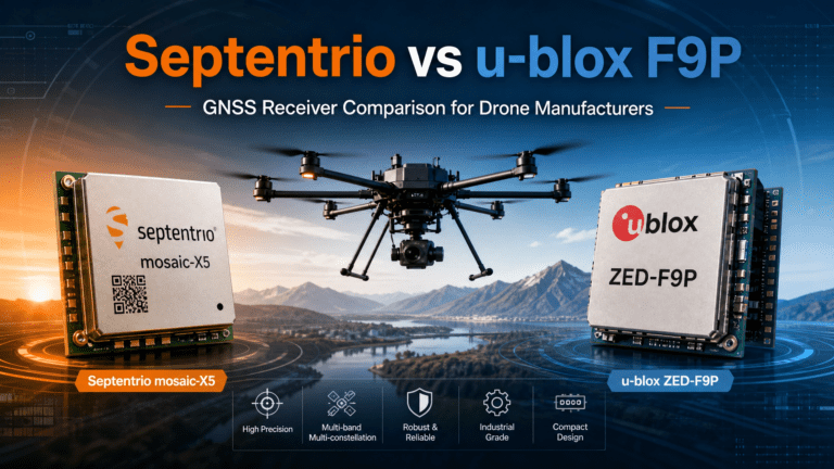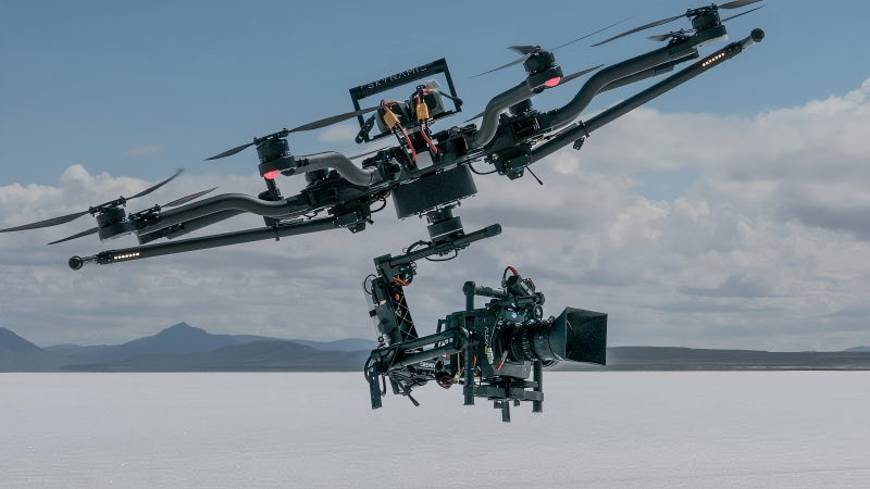
Introduction
In an era where the film and television industry is reaching unprecedented heights, professional-grade drone aerial photography has become an indispensable visual language tool for creating content across movies, TV series, documentaries, and even short videos. The precision, stability, and repeatability of its flight directly determine the expressive power of cinematography, the visual impact of shots, and the flexibility of post-production.
However, traditional GNSS modules often fall short on film sets pursuing ultimate image quality. Shooting amid dense urban buildings faces severe multipath interference and signal blockage, causing unpredictable micro-shakes in footage. While majestic outdoor locations like mountains, canyons, or coastlines offer stunning backdrops, they also carry risks of weak signals and frequent signal loss.
Complex special effects shots demand drones to repeat predetermined trajectories with centimeter-level precision, while dynamic sequences like high-speed vehicle tracking or aerial circling push the system’s real-time responsiveness and latency tolerance to their limits. Furthermore, extended outdoor shoots and tight production schedules pose severe challenges to device endurance and reliability.
Core Technical Advantages of the Septentrio mosaic-X5
These creative pain points were fundamentally resolved only with the advent of the Septentrio mosaic-X5 GNSS module. Compared to other positioning modules on the market, the mosaic-X5 establishes four dimensions of overwhelming technical superiority in aerial cinematography applications: First, its unparalleled signal reception capability and robustness, achieved through 448 hardware channels enabling simultaneous tracking of multi-frequency signals across all constellations including GPS, GLONASS, BeiDou, Galileo, and QZSS.
This “omnidirectional, seamless” reception capability ensures stable, continuous centimeter-level satellite positioning for drones—whether navigating dense urban skyscrapers or remote natural landscapes with weak signals—providing a robust technical foundation for directors and cinematographers to execute complex camera movements.
Advanced GNSS+ Interference Suppression Technologies
Second is its proprietary GNSS+ intelligent anti-interference and error suppression technology suite. The AIM+ advanced anti-interference and anti-spoofing technology acts as an “electronic guardian on set,” automatically identifying and suppressing electromagnetic interference from other electronic devices, communication base stations, or radio equipment at the filming location. This ensures flight control commands and positioning data remain precise and error-free even in complex electromagnetic environments.
APME+ multipath suppression technology acts as a “master of image stability,” precisely filtering out misleading signals reflected off architectural glass facades, vehicle paintwork, or water surfaces. This fundamentally eliminates core hazards causing minor image jitter and flight path drift. Meanwhile, LOCK+ technology ensures the core tracking loop maintains exceptional robustness during high-speed S-curve maneuvers, rapid ascents/descents, or sudden gusts, providing foundational stability for capturing cinematic-grade smooth footage.
RTK Precision & Ultra-Low Power Performance
Most groundbreaking is its industry-leading RTK performance, achieving astonishing horizontal accuracy of 0.6cm + 0.5ppm with initialization in just 7 seconds. This enables film drones to achieve true centimeter-level precision hovering, repeat complex flight paths, and precisely recreate scenes across multiple shooting days. It delivers unprecedented spatial consistency for special effects shot stitching, multi-camera synchronization, and post-production. Furthermore, its ultra-low power consumption and extensive interface configuration perfectly accommodate the multi-device collaboration and extended outdoor operation demands common in film production.
Real-World Film & Broadcast Applications
The powerful performance of the Septentrio mosaic-X5 GNSS module, when applied to real-world filmmaking scenarios, delivers revolutionary creative freedom and efficiency gains. During the filming of large-scale cinematic effects shots, the module’s ultra-high 100Hz positioning update rate and event marking accuracy of less than 20 nanoseconds ensure that every frame captured by the high-frame-rate cinematography camera mounted on the drone achieves microsecond-level synchronization with centimeter-level spatial position, aircraft attitude, and gimbal angle data.
This not only provides visual effects teams with flawlessly consistent spatial data for compositing CG elements and integrating virtual environments, but also empowers cinematographers to boldly design and precisely execute once-impossible shots—such as “flying through narrow windows,” “ground-hugging high-speed car chases,” or “complex trajectories circling protagonists.” This dramatically expands the boundaries of cinematic storytelling.
For a focused overview of shooting drones specifically, see our post on Septentrio Mosaic-X5 for film and television shooting drones. In documentary or commercial filming, centimeter-level absolute positioning accuracy combined with rapid system response enables drones to precisely replicate identical flight paths over the same scene under varying times and lighting conditions. This ensures seamless continuity in footage across tone, lighting, and composition, substantially boosting production efficiency and visual quality.
During large-scale live broadcasts or aerial filming for variety shows, the drone’s exceptional dynamic performance and rapid reacquisition capability (averaging 1 second) ensure stable positioning and attitude recovery when navigating dense obstacles or experiencing temporary signal blockage. This guarantees smooth and secure live footage, preventing broadcast mishaps.
Crucially, the Septentrio mosaic-X5 GNSS module’s ultra-low power consumption (typical power draw of just 0.6W) directly translates to extended flight durations. This allows drones to capture more fleeting golden moments or execute complex long-take designs without interrupting creative flow through frequent battery swaps. Its broad industrial-grade operating temperature range (-40°C to +85°C) ensures stable drone performance across global extreme climates—from frozen wildernesses to tropical deserts—providing robust technical assurance for production teams shooting across regions and seasons.
Industry Value & Competitive Advantage
Therefore, integrating the Septentrio mosaic-X5 GNSS module is far more than upgrading a navigation component for film drones—it injects a powerful “precision control core” and “visual language enabler” into the entire filmmaking workflow. In today’s fiercely competitive film industry, where audiences demand increasingly sophisticated visual quality, absolute image stability, precise controllable shots, and efficient, reliable filming have become critical factors determining a production’s success and a team’s professionalism.
With its top-tier performance validated across numerous professional film projects, exceptional robustness in extreme shooting environments, and seamless integration into industrialized film workflows, the Septentrio mosaic-X5 GNSS module offers a strategic tool for film studios, professional aerial teams, advertising agencies, and content creators.
It significantly elevates visual quality, reduces shooting risks, and expands creative horizons. While competitors struggle with budget overruns due to positioning drift causing shot imperfections or shooting interruptions from unstable signals, you can leverage the stable, precise positioning of the Septentrio mosaic-X5 to create aerial shots that set the standard in visual impact and artistic expression.
This establishes an absolute technological advantage and brand reputation in highly demanding fields such as high-end film production, large-scale brand advertising, and top-tier documentary filming. It represents not merely an innovation in navigation technology, but a solemn commitment to the ultimate pursuit of cinematic artistry: a promise that every flight precisely executes the director’s vision, every shot achieves cinematic-grade stability, and every capture becomes a defining moment that elevates the work’s value.
Mosaic-X5 for Film and Television Shooting: Precision in Every Frame
High-Precision Cinematic Positioning
In Hollywood’s burning game, the more shocking the camera, the more positioning can not fall off the chain – “Game of Thrones” in the dragon mother driving a dragon to 100 km / h swooping 500 crowd acting head, the flame column is 10 meters wide, the drone as long as the deviation of 10 centimeters may hit the rocker arm; “Spy Kids 6” in Paris from the Presidential Palace of the subway above 500 meters Aerial photography, magnetic interference so that the compass completely failed, but the director bet on a piece of only 31 × 31 × 4 mm, 7 grams of Septentrio mosaic-X5 GNSS receiver. It is built-in 448-channel GNSS full constellation full-frequency, GPS, BeiDou, Galileo, GLONASS, QZSS, NavIC all in one, urban canyons, the bottom of the well, the iron frame-lined set can still be locked 30 + satellites, RTK plane accuracy of 0.6 cm + 0.5 ppm, elevation of 1 cm + 1 ppm, initialization in only 7 seconds, the dragon flame heat wave or rainstorms ionospheric scintillation in a fixed High rate; Septentrio AIM+ engine real-time excision of narrowband/broadband/pulse/sweep interference from intercom, mapping, high voltage line, subway magnetic field, take off in magnetic storm area without magnetic compass; Septentrio LOCK+ anti-vibration, IONO+ second modeling correction of the ionosphere, APME+ stripping of the rampart/well wall multipath to put the reflected ” Ghost signals” to remove the bones and skin, leaving only the true value, 100 Hz update, <10 ms delay, high-speed inverted flight screen without frame lag, and later dragon flame effects according to the GPS timestamp 5 ns level alignment, a synthesis without the need to stay up all night to work overtime.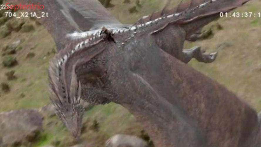
Under the same budget, the traditional “big brick” program to carry receiver + external radio + spare base station + magnetic calibration compass, total weight of more than 500 g, power consumption of 8 W, aerial photography in 20 minutes on the power, the format is closed into the late first turn RINEX and then manually aligned time code; Septentrio mosaic-X5 GNSS receiver directly SMD soldered to the flight control. Receiver directly patch welded to the back of the flight control, 0.6 W ultra-low power consumption of the same type of battery life of 40% more, UART, USB, Ethernet, CAN full open, SBF, RINEX, NMEA, RTCM one-key output, PPK SDK support for Python/C++ a line of code to run through the timecode and the footage of the frame frame alignment, to save a total station of the money mosaic P3H. more flavorful. What’s more, it is the strategy of “one board, three to eat”: the site has a base station to run centimeter-level RTK; away from the base station 10 to 100 km automatically switch 2 cm PPP-RTK; overseas deserts without network can also be converged in 20 minutes to 5 cm PPP, free lifetime upgrade of new signals, new constellations, the same hardware all over the world, and no longer be branded ecological “kidnapping”. “Kidnapped”.
The actual operations report card let the director of a line on the shout “over” – “power trip” S7 “train robbery” 3 hours to shoot 2 km high-speed swoop, 500 crowd acting zero accident, post-dragon and real shooting! Background pixel-level alignment, to take two visual effects union awards; “Spy Kids” Paris Grand Palais magnetic interference area 3 hours to shoot 1,000 aerial film, POS error average value of 0.8 cm, three-dimensional modeling to save 2 days of outside work; Septentrio mosaic-X5 GNSS receiver into your drone, skid steer or traversing machine, that is, the Oscar-level centimeter accuracy into the weight of 7 grams! –The next time you shoot a car chase, explosion, dragon flame or avalanche, a line over, no longer because of the “positioning drift” and burn money to re-fly, so that every frame of shocking images have the bottom of the “centimeter-level” signature.
Browse our full GNSS receiver collection for professional UAV applications.
Mosaic-G5 P3H GNSS for Cinematography Drones
Cinematography drones capture the aerial shots you see in films, TV shows, commercials, and sports broadcasts. Unlike a standard drone flight, a cinematography shot needs to be repeatable — the drone must fly the exact same path and speed take after take until the director gets the shot.
This repeatability depends entirely on the GNSS receiver. The Septentrio Mosaic-G5 P3H delivers the centimeter-level positioning and sub-degree heading accuracy that professional cinematography drones need for precise, repeatable camera moves.
Why Film Drone Cinematography Needs Better GNSS
A film shoot might need the same orbit shot five times — once for the wide master, once for a close-up on the actor, once for a VFX pass, and a couple more for safety. If the drone’s position drifts between takes, the shots don’t match in editing. The editor sees the background shift slightly from clip to clip, and the illusion breaks.
The Mosaic-G5 P3H solves this with centimeter-level RTK positioning. Every time the drone flies the shot, it returns to within centimeters of the previous pass. The footage lines up perfectly in post-production.
Dual-Antenna Heading for Smooth Camera Movement
The P3H variant adds dual-antenna GNSS compass capability. This measures true heading directly from satellite signals, independent of the drone’s direction of travel. When a cinematography drone is orbiting a subject, the camera gimbal needs to know exactly which way the drone is pointing to keep the subject framed correctly.
With heading accuracy of 0.07 to 0.11 degrees, the P3H provides yaw data that is stable and reliable. The camera operator can focus on composition instead of fighting drift.
Real-World Cinematography Applications
Car Commercial Aerial Tracking
Tracking a car driving along a mountain road requires the drone to maintain a precise offset — 20 meters behind, 30 meters above, looking down at a 45-degree angle. The Mosaic-G5 P3H holds this position in three dimensions while the car accelerates and brakes through corners. The result is a smooth tracking shot that sells the car’s performance.
High-Rise Building Reveal Shots
A building reveal starts low, tilts up, and rises while pulling back. The drone traces an arc that must be perfectly repeated for each take. The P3H records the flight path using RTK coordinates, and the autopilot flies the exact same arc every time.
Sports Stadium Establishing Shots
Sports broadcasts use drones for dramatic establishing shots that enter the stadium, circle the field, and land on the center logo. These shots are pre-programmed waypoint missions flown on autopilot. The P3H ensures the drone hits every waypoint within centimeters, producing a polished, professional result.
AIM+ Anti-Jamming for Set Safety
Film sets are RF-heavy environments. Walkie-talkies, video transmitters, wireless cameras, and broadcast trucks all emit radio signals. The AIM+ technology monitors the GNSS spectrum and filters out interference before it reaches the positioning engine. This keeps the drone stable and safe, even when surrounded by production equipment.
Related Cinematography Solutions
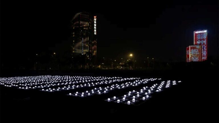
For production teams using the mosaic-X5, see our guide on mosaic-X5 in film and television drone cinematography. The lighting drone GNSS solutions cover related entertainment applications.
The EV322 receiver can serve as a base station for providing RTK corrections on set.
Why the Mosaic-G5 P3H for Cinematography Drones
- Centimeter-level RTK for repeatable camera paths across multiple takes
- Dual-antenna heading for smooth gimbal control during orbits
- AIM+ anti-jamming for RF-heavy film set environments
- Multi-constellation tracking for obstructed city skylines
- Compact 19 g form factor for payload-constrained cinema drones
- Compatible with Pixhawk, Cube, and professional autopilots
For published research on GNSS in aerial cinematography, the MDPI Drones journal covers UAV positioning accuracy for media production applications.
Summary
• Application: Professional film, television, documentary, and commercial aerial cinematography.
• Accuracy: 0.6 cm + 0.5 ppm RTK horizontal accuracy, 7 s RTK initialization.
• Performance: 100 Hz update rate, <20 ns event marking accuracy.
• Technologies: AIM+ anti-interference, APME+ multipath suppression, LOCK+ anti-vibration.
• Hardware: 448 channels, multi-constellation & multi-frequency GNSS.
• Endurance: 0.6 W ultra-low power, -40°C to +85°C industrial-grade operation.
Frequently Asked Questions
1. What GNSS accuracy is needed for professional film drone cinematography?
With RTK corrections, the mosaic-X5 delivers 2.5 cm horizontal accuracy and 100 Hz update rate, enabling repeatable camera paths and smooth cinematic shots even in complex environments.
2. How does the mosaic-X5 handle interference on film sets?
AIM+ anti-jamming technology actively filters interference from wireless video transmitters, walkie-talkies, and other RF equipment commonly found on professional film sets, maintaining centimeter-level positioning accuracy.
3. Can it maintain accuracy near large metal structures and water surfaces?
Yes. APME+ multipath mitigation technology filters reflected signals from water surfaces, glass buildings, and metal structures — common challenges in film locations like waterfronts, urban canyons, and architectural shoots.
4. What is the weight and size for drone integration?
The mosaic-X5 module measures just 31x31x4 mm and weighs 7 grams, making it ideal for lightweight cinematography drones where payload capacity is at a premium.