Power Line Inspection UAVs: Septentrio Mosaic-X5 GNSS Receiver for Accurate Infrastructure Surveys
Power line inspection UAVs with the Septentrio mosaic-X5 GNSS receiver: accurate RTK positioning for infrastructure surveys and corridor mapping.
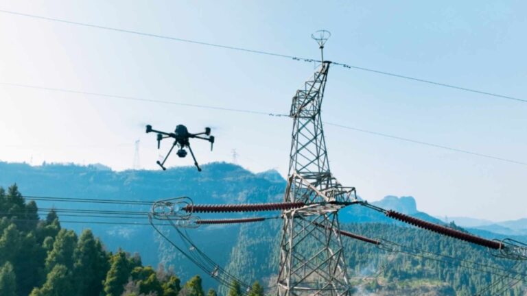
Power line inspection UAVs with the Septentrio mosaic-X5 GNSS receiver: accurate RTK positioning for infrastructure surveys and corridor mapping.

The Septentrio AsteRx-m3 Pro+ and mosaic-X5 high-precision GNSS receivers provide centimeter-level RTK positioning and robust anti-jamming capabilities for the PX4 open-source flight controller. With two models tailored to meet diverse needs—from prototyping to professional surveying—they enable seamless integration, supporting industrial UAVs in achieving stable, reliable high-dynamic flight and precision operations.

Equip your cinematography drone with the Septentrio Mosaic-G5 P3H: dual-antenna heading, centimeter-level RTK and AIM+ anti-jamming for repeatable shots.

How Septentrio GNSS receivers enable drone swarm navigation: RTK positioning, timing synchronization and multi-constellation tracking for formation flight.

The Septentrio mosaic-X5 high-precision GNSS receiver delivers core navigation power for your ArduPilot open-source flight control system. With full-system, full-band support, anti-interference capability, and centimeter-level RTK positioning, its 100 Hz high-frequency output enables precise control at high speeds. Seamlessly integrated with hardware such as Pixhawk, it is the ideal positioning solution for professional applications including agricultural mapping and power line inspection.

The mosaic-G5 P3 GNSS receiver features a compact size and low power consumption. It supports all-frequency, multi-system signal tracking and raw data output, and is equipped with anti-interference and multipath suppression capabilities, delivering stable centimeter-level RTK positioning performance. It is suitable for drone aerial surveying, enhancing the quality of mapping data and operational reliability, and adapts well to various complex environments and high-dynamic scenarios.

Multi-band GNSS for UAVs explained: why L1, L2 and L5 signals deliver survey-grade accuracy for professional drone mapping and inspection.
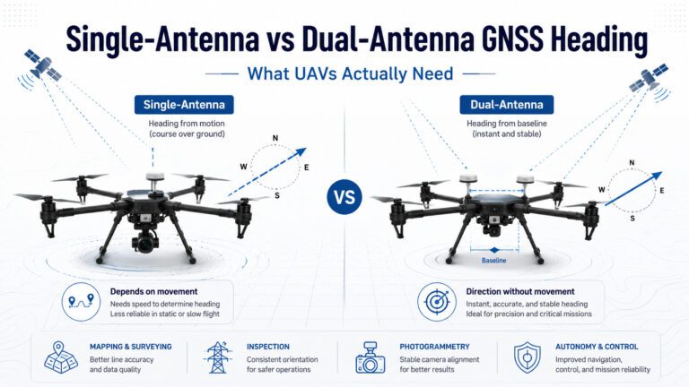
How GNSS receivers calculate heading: single-antenna Doppler vs dual-antenna carrier phase for UAVs.
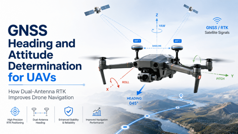
Standard GNSS receivers provide position — latitude, longitude, and altitude. But for autonomous UAV operations, knowing exactly where you are is…
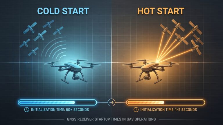
GNSS cold start vs hot start for UAV operations: how receiver initialization, signal reacquisition and RTK convergence affect flight readiness.