Abstract
Traffic surveillance drones require precise lane-level positioning to track vehicle movements, monitor intersections, and enforce traffic regulations from the air. The Septentrio mosaic-X5 GNSS receiver delivers centimeter-level RTK accuracy, multi-constellation tracking, and AIM+ anti-jamming protection that traffic monitoring missions demand. When a drone must distinguish between vehicles in adjacent lanes traveling at highway speeds, every centimeter matters.
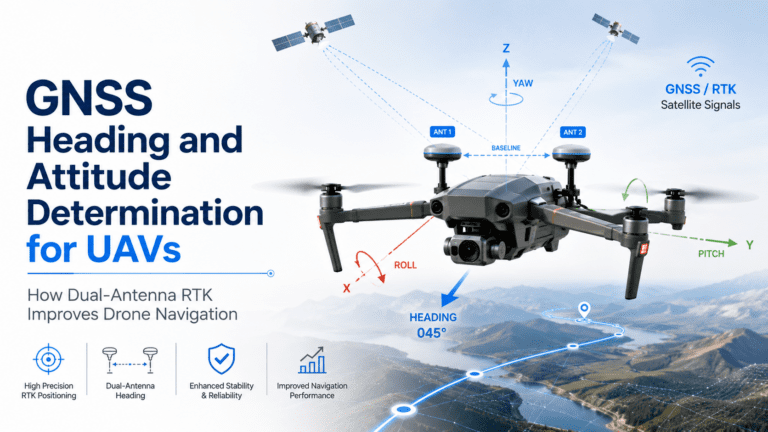
Lane-Level RTK Accuracy for Traffic Monitoring
Standard GNSS receivers provide meter-level accuracy, which cannot distinguish between lanes on a multi-lane highway. The mosaic-X5 achieves centimeter-level RTK accuracy, enabling the drone to know its exact lateral position relative to road markings. With real-time kinematic corrections, the mosaic-X5 locks onto a fixed solution that places the drone within a few centimeters of its true position, allowing traffic surveillance systems to geolocate vehicles with corresponding precision.
- Lane-level precision — A vehicle identified on the left lane remains distinguishable from a vehicle in the right lane
- Application ready — Essential for toll enforcement, accident reconstruction, and traffic flow analysis
- High-speed tracking — Maintains lock on fast-moving vehicles from a moving drone platform
Urban Canyon Performance for City Traffic
City traffic monitoring presents severe GNSS challenges. Highway overpasses, tunnel entrances, and skyscrapers block satellite signals and produce multipath reflections. The mosaic-X5’s multi-constellation tracking across GPS, GLONASS, Galileo, and BeiDou provides more signal diversity to maintain lock in these conditions. In a dense urban corridor, a single-constellation receiver might track only 4-6 satellites while the mosaic-X5 tracks 30+ satellites simultaneously, rejecting weak and reflected signals while maintaining accurate positioning with the clean ones. This reliability means traffic drones can operate over complex interchanges and urban freeways without losing positional accuracy.
AIM+ Anti-Interference for Reliable Operations
Traffic surveillance areas are electrically noisy environments. Vehicle radars, traffic signal controllers, cellular towers, and power infrastructure all produce radio frequency interference. The Septentrio AIM+ technology built into the mosaic-X5 detects and cancels this interference in real time. Without interference protection, a GNSS receiver might lose lock or drift during data collection. AIM+ ensures that the traffic data collected is reliable and accurate.
Multi-Frequency Tracking for Highway Speeds
Tracking vehicles from a moving drone requires high update rates and consistent signal lock. The mosaic-X5 tracks all GNSS frequency bands including L1, L2, L5, E5a, E5b, and E6. Multi-frequency operation provides better correction of ionospheric delays, which is essential for maintaining accuracy during high-speed flight. The receiver outputs position data at rates up to 100 Hz, enabling the traffic surveillance system to compute precise vehicle trajectories even on curved or graded roads.
- 100 Hz update rate for real-time trajectory computation
- Multi-band tracking for ionospheric correction at speed
- Sub-10 ms latency for instant positioning feedback
Real-Time Data for Law Enforcement Applications
For law enforcement traffic monitoring, real-time data is critical. The mosaic-X5 provides instant centimeter-level positions that can be streamed to ground stations or dashboards. Officers receive immediate alerts when violations are detected, enabling rapid response. The receiver also logs raw GNSS data for evidentiary purposes, ensuring traffic data meets the documentation standards required for citation or prosecution.
Related GNSS Products
- HB21 GNSS Box Receiver — All-in-one RTK receiver with integrated 4G LTE, heading, and data logging for field-deployed traffic monitoring stations
- HB6 GNSS Box Receiver — Compact quad-constellation RTK receiver powered by Septentrio Mosaic X5
- EV322 GNSS Receiver — Lightweight RTK receiver for UAVs and autonomous systems
- AIM+ Anti-Jamming Technology — Advanced interference and spoofing protection
Browse our full GNSS receiver collection for professional UAV applications.
Frequently Asked Questions
What RTK accuracy does the Septentrio mosaic-X5 provide for traffic surveillance drones?
The mosaic-X5 provides centimeter-level RTK accuracy, enabling drones to distinguish between vehicles in adjacent highway lanes. This lane-level precision is essential for toll enforcement, accident reconstruction, and traffic flow analysis.
How does the mosaic-X5 handle urban canyon environments near highways?
The mosaic-X5 tracks GPS, GLONASS, Galileo, and BeiDou simultaneously, providing access to 30+ satellites. This signal diversity enables it to reject reflected signals from buildings and maintain accurate positioning where single-constellation receivers would fail.
Does AIM+ anti-interference protect traffic surveillance GNSS from interference?
Yes, AIM+ detects and cancels interference from vehicle radars, traffic signal controllers, cellular towers, and power infrastructure in real time. This ensures traffic data remains reliable even in electrically noisy urban environments.
What update rate does the mosaic-X5 support for tracking fast-moving traffic?
The mosaic-X5 outputs position data at rates up to 100 Hz across multiple frequency bands. This enables precise vehicle trajectory computation even on curved or graded roads at highway speeds.