Updated November 2026
Does a drone need GNSS/INS fusion, or does the flight controller already do it? Your autopilot already blends GPS with its own accelerometers — that is what keeps the aircraft level when the fix drops. What it cannot do is improve the measurements it was handed. GNSS-aware sensor fusion starts one level lower, inside the receiver, and decides which satellite measurements deserve to reach the estimator at all.
Short version: FUSE+ is Septentrio’s GNSS-aware sensor fusion. It weighs the reliability of each GNSS measurement before fusing it with inertial and motion data, so the navigation solution stays continuous through short outages and stays clean under multipath instead of inheriting the bias. On an airframe the visible effects are fewer position jumps, attitude that survives a signal gap, and a faster return to a usable fix. For attitude during normal flight with no INS on board, a dual-antenna heading receiver does the job from the antenna baseline alone.
What actually happens when a drone loses GNSS
The moment the fix degrades, three things start happening at once, and they are not the same problem.
- The estimator starts coasting. The flight controller’s state estimator propagates on its inertial sensors, using the last good position as an anchor. It is designed for seconds, not minutes, and its error grows with every manoeuvre in the gap.
- Attitude authority weakens. Without a GNSS heading or velocity reference to correct against, yaw and horizontal velocity drift. The aircraft still flies; the navigation solution it is flying on stops matching the world.
- Confidence decouples from reality. A filter that was fed a biased fix does not know it was biased. It reports a covariance that looks reasonable while the position is quietly wrong — the failure mode that matters most for inspection work, where the aircraft is expected to return to the same point on a structure.
The reflex fix is more inertial hardware on the airframe, or a heavier fusion package. Both help. Neither addresses the upstream question of whether the GNSS measurements entering the pipeline were any good — and on a small airframe, where the antenna sees the sky through props, a battery, a gimbal and a carbon frame, that question is the whole game.
Where FUSE+ sits: in the receiver, not in the autopilot
FUSE+ is a GNSS/INS integration engine that runs on the GNSS side, built on more than 25 years of receiver design. Its defining behaviour is order of operations: evaluate the quality and reliability of GNSS measurements first, then integrate them with IMU data and additional motion inputs in a single navigation engine.
Contrast that with a conventional arrangement, where GNSS output arrives at the estimator as a truth statement. If those measurements carry multipath bias or a rising noise floor, the estimator cannot tell — it has no independent view of what the receiver saw. The GNSS-aware approach pushes that judgement to the place where the information exists: alongside the tracking loops, the signal quality metrics and the interference detector.
It also means the fusion output is available as a receiver output — position, velocity and full attitude — rather than only as a state inside the autopilot’s estimator. For an integrator building a payload, a gimbal or a mapping pipeline, that is often the difference between a sensor you can use and one you have to reverse-engineer.

Four things that change in flight
| Effect | What it looks like on a UAV | Why it happens |
|---|---|---|
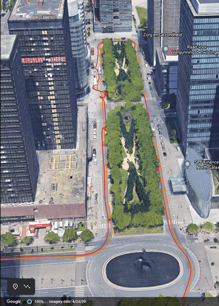
| Position stays available through a gap | No position hold failure under a bridge, in a canyon between buildings, or in a turn that blanks the antenna | Inertial dead reckoning carries the solution until GNSS measurements return |
| Integrity becomes a number you can use | Independent sensor inputs cross-check the GNSS solution, so a degradation is detectable before it becomes a mission failure | Fusion plus receiver-side integrity monitoring rather than a filter that assumes its inputs are correct |
| Output stops jumping | Fewer spikes on the map, less twitch in gimbal and heading commands | Multi-sensor combination smooths the solution, and multipath mitigation keeps reflected signals out of it |
| Attitude comes from the navigation solution | Heading, pitch and roll available for gimbal pointing, antenna steering and payload geometry | GNSS plus inertial output, instead of attitude inferred only from track over ground |
Table 1 — Operational effects of GNSS-aware fusion on a UAV programme.
What goes in and what comes out on an airframe
FUSE+ takes GNSS receiver measurements, IMU data, vehicle velocity information and additional motion inputs, and outputs position, velocity, heading, pitch and roll. The last of those columns is where most UAV integrations gain something they did not have before.
| Input | Source on a typical airframe | Practical note |
|---|---|---|
| GNSS measurements | Receiver and antenna(s) | Measurement quality is assessed before fusion, not after |
| IMU data | Inertial unit inside the receiver or a companion unit | Rigid mounting and vibration isolation decide how usable it is |
| Vehicle velocity | Wheel or motor speed where relevant, or another odometry source | Multi-rotors often have none — confirm what the configuration expects |
| Additional motion inputs | Airframe-dependent | Supported inputs vary by receiver model and interface set |
Table 2 — Feeding the engine on a UAV. Availability of each input depends on the receiver and the airframe.
Attitude without an INS: dual-antenna heading on a drone
A large share of UAV programmes that start asking about fusion actually need orientation, not outage bridging. A mapping aircraft flying a lawnmower pattern needs the camera axis known to a fraction of a degree — at 3 m/s that information cannot be reconstructed from the direction of travel alone, and it certainly cannot be reconstructed while hovering.
Two antennas on a fixed baseline solve it geometrically. Heading comes from the vector between the antennas, so it is valid when the aircraft is stationary and does not care about the airframe’s steel or carbon around it. With 1 m of separation the heading figure is 0.15°, with pitch or roll available at the same time on a two-axis configuration.
- HB10 — compact dual-antenna RTK receiver powered by Septentrio AsteRx-m3 Pro, built for drone and unmanned integrations.
- HB56H — mosaic-H dual-antenna heading receiver with SD card logging, useful when you want to record raw data while you tune the installation.
- HB56 — single-antenna mosaic-X5 receiver for position-critical work where the heading comes from elsewhere.
Which of these is right depends on the flight profile rather than the datasheet, and the deeper comparison of moving-baseline versus dual-antenna approaches is in GNSS heading and attitude determination for UAVs.
Mounting and integration checklist for aircraft
- Rigid, damped, and measured. Mount the receiver or inertial unit on structure, not on a flexible tray, and record the offset from the antennas before the first flight. Vibration you can feel in the frame reaches the accelerometers as signal.
- Baseline on the airframe axis. Dual-antenna heading is only as good as the geometry it is told about. Measure the antenna separation and direction, and re-check after any mechanical change.
- Antenna placement around the props. Blade shadowing at high RPM is a real source of intermittent measurement loss. Test hover with props fitted, not on the bench.
- Time synchronisation. Position, attitude and camera timestamps have to agree for mapping work. Confirm the PPS and time-tag path rather than assuming it.
- Log the commissioning flights. Raw SBF logging on board turns a claim about what happened into data you can replay, and is the fastest way to distinguish an installation problem from a receiver problem.
- Keep the interference side clean. Fusion improves how measurements are used; it does not make a jammed band usable. Antenna choice and interference filtering still set the floor — see AIM+ anti-jamming and resilient GNSS.
Picking the receiver for a UAV programme
| Requirement | Receiver class | Notes |
|---|---|---|
| Continuity and attitude through signal loss | Septentrio GNSS/INS family with FUSE+ (AsteRx-i3 D Pro, RBi3) | Fused position, velocity and full attitude; discuss weight and interface fit with us before committing |
| Attitude from GNSS alone, no INS | HB10, HB56H | Heading valid at standstill, no drift, no alignment time |
| Position plus raw logging | HB56 (mosaic-X5) | SD card logging for post-processing and fault-finding |
| Corrections for the whole fleet | HB62 reference station | Your own base, independent of a subscription network |
Table 3 — Receiver classes against UAV requirements.
For programme-level context, see UAV and drone GNSS RTK, robotics and autonomous navigation, and the ROS side in Septentrio GNSS and ROS integration. Swarm and eVTOL applications, where attitude and timing requirements compound, are covered in GNSS for eVTOL and drone swarms.
Questions we get from airframe teams
Does my autopilot not already fuse GNSS with the IMU?
It fuses the GNSS solution it receives with its own inertial sensors. What it cannot do is assess the internal quality of that GNSS solution, because it never sees the measurements. GNSS-aware fusion works upstream of the estimator and improves what arrives there.
Will fusion improve absolute position accuracy?
No. Absolute accuracy comes from the GNSS solution, including the corrections behind it. Fusion improves availability, smoothness, attitude and recovery speed, and it stops poor measurements from being carried into the solution at full weight.
How long can a UAV keep position without GNSS?
Seconds to tens of seconds in practice, and the number moves with inertial grade, mounting quality and how aggressively the aircraft manoeuvres in the gap. Any figure quoted without those conditions should be checked against the datasheet for your specific configuration.
Do I need an IMU to get heading?
No. A dual-antenna receiver measures heading from the antenna baseline, at any speed including zero, with no drift. An IMU becomes necessary when you also need continuity through a signal gap, or rate data faster than the GNSS output rate.
Is FUSE+ a replacement for RTK?
No, they solve different problems. RTK gives centimetre-level absolute accuracy while corrections are available. Fusion keeps the navigation solution alive and stable when those corrections or the signals themselves are interrupted.
What airframe constraints should I check first?
Weight and power budget, antenna real estate for a dual-antenna baseline, mounting rigidity for any inertial unit, and whether the flight controller expects attitude from the receiver or computes it internally. Those four decide the receiver class before any specification detail matters.
Send us the airframe and the failure
Describe the platform, where it flies, and what goes wrong — a fix that drops under structures, heading that wanders in hover, gimbal pointing that disagrees with the map, or a return-to-point that misses. That tells us whether the answer is a fused GNSS/INS receiver, a dual-antenna heading receiver, or a change to the installation.
Email sales@uav-gnss.com with your airframe, flight profile and the symptom you want gone.
Image credits. The two photographs in this article come from Septentrio’s FUSE+ technology page (original source), which is also where the FUSE+ description, inputs and outputs originate. Tables 1–3 and the airframe checklist are ours.