In April 2026, EHang Egret flew 22,580 drones over Luogang Park in Hefei, China – a Guinness World Record for the CMG Spring Festival Gala, beating the 15,947-drone record from Liuyang six months earlier. Two months later, on June 10, 2026, the FAA and EASA issued revised harmonized eVTOL certification guidance, narrowing technical gaps without changing either agency’s safety target.
These events look unrelated – one is entertainment at planetary scale, the other the rigorous birth of urban air mobility – but both are GNSS problems at heart. A 22,580-drone show works only if every aircraft knows its position to a few centimeters and shares one common clock with every other. A certified eVTOL reaches the market only if its navigation can prove to a regulator that position errors – and misleading outputs – are bounded to probabilities of one in 100 million, or one in a billion, per flight hour.
This guide explains the two capabilities that set these applications apart: GNSS time synchronization for mega-swarms and positioning integrity for certified flight – and the receiver requirements behind them.
What a 22,580-Drone Show Teaches Us About GNSS
Drone light shows have doubled in scale roughly every two years: 3,051 drones over Shenzhen in 2020, 10,197 in 2024, 15,947 in Liuyang in late 2025, 22,580 in Hefei in April 2026. Each doubling rested on three GNSS fundamentals, not better batteries or brighter LEDs.
Centimeter-level relative positioning (RTK)
Show drones fly in grids with horizontal separation of typically 1.5 to 3 meters and vertical separation around 2.5 meters. Standalone GPS drifts 3 to 5 meters under good conditions – enough for neighbors to swap positions or worse. Real-Time Kinematic (RTK) positioning holds every aircraft to 1 to 3 cm of its assigned coordinate, so a 22,580-drone formation moves like a rigid object across the sky.
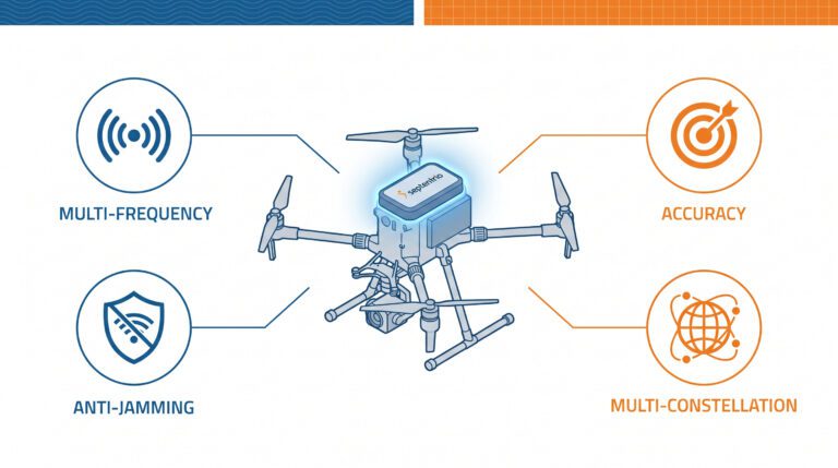
RTK removes errors common to a local area: a base station on a surveyed point broadcasts corrections (RTCM over 900 MHz radio or 4G/5G) to every rover. Because all drones share one correction source, their relative accuracy beats their absolute accuracy – exactly what formations need. Multi-constellation, multi-frequency tracking (GPS L1/L2/L5, Galileo E1/E5/E6, BeiDou, GLONASS) holds the fix through marginal geometry; mosaic-X5-class receivers resolve RTK across 448 channels with sub-second reconvergence.
One clock for the whole fleet
Position is only half the story. A drone show is a 4D animation: every drone follows a time-coded trajectory (X, Y, Z, t), and its LEDs follow a frame-accurate light script. If two drones reach a formation vertex 50 ms apart, or switch color 30 ms apart, the audience sees a blur instead of an image.
GNSS time is the invisible backbone that prevents this. Every GNSS receiver derives UTC from the satellite atomic clocks it tracks; the Septentrio mosaic-X5, for example, outputs a pulse-per-second (PPS) signal aligned to UTC within tens of nanoseconds. When every drone disciplines its flight controller and LEDs to GNSS time, the fleet shares one clock with microsecond-level agreement – no dependence on radio-link latency, no drift over a 15-minute show. The ground station pushes 4D waypoint files before launch and streams a heartbeat in flight; the onboard GNSS clock keeps choreography, LED frame rates (30-60 fps), and synchronized landings aligned.
Update rate matters too: show-grade receivers output position at 10-100 Hz with under 20 ms latency, so controllers react to the real trajectory. Most consumer chips cap at 5-10 Hz – one reason professional shows use professional receivers.
The RF environment is hostile
A show field is an electromagnetic nightmare: thousands of phones, broadcast trucks, wireless mics, and other drones competing for spectrum. GNSS signals arrive at roughly -125 to -130 dBm – a billion times weaker than a phone signal – so interference a car radio ignores can blind a drone. Professional receivers embed countermeasures like Septentrio’s AIM+: notch filtering for continuous-wave interference, pulse blanking, wideband mitigation, and live spectrum monitoring so operators see an attack as it starts.
Deliberate jamming and spoofing are no longer hypothetical at public events. Operators run pre-show RF surveys and redundant dual-band links; receivers that report interference rather than silently degrading let a director abort early.
Failure containment at 22,580 aircraft
Even the Hefei fleet launched 22,600 aircraft and 20 did not take off – by design. Pre-flight validation is the real safety system: every drone must confirm an RTK fixed solution, battery health, and LED readiness before the show file is armed. In the air, any drone deviating more than a few centimeters is automatically hovered and landed; geofences and a global kill switch contain cascading failures. The receiver makes those decisions trustworthy – a fixed RTK solution at high update rate, with interference awareness, lets software distinguish normal flight from imminent collision.
eVTOL: When GNSS Must Be Certified, Not Just Accurate
Drone shows push GNSS to its limits of scale and synchronization; eVTOL pushes it to its limits of trust. An air taxi over a city cannot tolerate a navigation system that is merely “usually right” – and regulators have built their frameworks around that.
Two regulators, two safety targets
The FAA certifies powered-lift aircraft such as Joby’s S4 and Archer’s Midnight to a catastrophic failure rate of 10^-8 per flight hour (one in 100 million), consistent with its safety-continuum approach for comparable helicopters. EASA’s SC-VTOL Enhanced category requires 10^-9 – one in a billion, the standard of commercial jetliners – because it treats a passenger-carrying VTOL over a congested city as an airliner-level risk regardless of size. The UK CAA, in its CAP 3169 delivery model of late 2025, sided with EASA, and the UAE’s GCAA aligns closely with EASA standards – decisive for any operator planning Middle East networks.
The June 2026 FAA-EASA harmonization narrowed technical gaps and unified airworthiness language but did not change the thresholds. For suppliers the implication is clear: build to the stricter regime – a 10^-9-class program validates down to 10^-8, never the reverse.
Accuracy is not integrity
This is the most important concept in aviation GNSS. Accuracy describes how close a position is to the truth on average. Integrity describes whether the system knows when its position cannot be trusted – and says so before the error becomes hazardous, within a bounded time to alert.
Aviation navigation is specified in protection levels: the receiver continuously computes an error bound the true position will not exceed without detection, and declares the solution unusable when that bound crosses the alert limit for the flight phase. RAIM and its advanced form ARAIM detect faults from redundant satellite measurements, while standards such as RTCA DO-384 and EASA ETSO-C220 formalize integrity for GNSS-aided inertial systems. The eVTOL integrator needs continuous, honest state output – solution type, protection levels, fault flags, degraded modes – not just a position.
No certified standard yet exists for fully autonomous vertiport landings, and vision navigation remains uncertifiable for primary use because its fault modes cannot be quantified. GNSS coupled with inertial navigation is therefore not one option among many for eVTOL – it is the anchor.
Authentication and resilience join the stack
Urban airspace adds threats certification-era GNSS never faced at scale: aviation has logged thousands of jamming and spoofing events around the Baltic and Black Seas, and cheap personal privacy jammers now litter cities. An eVTOL cannot assume a benign RF environment.
The defense stack has three layers. First, signal authentication: Galileo’s OSNMA service, operational since July 2025, cryptographically authenticates navigation data so receivers can reject spoofed messages, with the Galileo Signal Authentication Service (SAS) extending authentication to the ranging signal itself as E6 encryption rolls out through 2026-2027. Second, interference mitigation: AIM+ class receivers keep tracking through jamming that blinds standard equipment. Third, diverse redundancy: dual independent receivers, dual-antenna heading so yaw does not depend on a magnetometer, and tightly coupled INS that coasts through brief GNSS outages. European research programs such as GAUSSIAN are demonstrating exactly this combination – authenticated Galileo signals fused with GNSS/INS – as the template for safe UAM navigation.
Urban canyons are the final exam
Vertiport approaches are the hardest GNSS environment in aviation: multipath off glass towers, obstructed sky views, vertical guidance to a pad barely larger than the aircraft. Multi-constellation tracking is not optional here – four constellations keep 20+ satellites in view where one might see six, and that geometric diversity makes centimeter-level vertical accuracy and fault detection possible.
The Shared Receiver Checklist
- Multi-constellation, multi-frequency tracking (GPS, Galileo, BeiDou, GLONASS; L1/L2/L5 and E1/E5/E6) for availability in marginal geometry.
- RTK at 1-3 cm with fast reconvergence and 10-100 Hz update rates.
- Precise GNSS time: PPS output aligned to UTC within tens of nanoseconds.
- Interference resilience: AIM+ class mitigation plus spectrum and interference reporting.
- Authentication readiness: OSNMA-capable platforms positioned for Galileo SAS.
- Dual-antenna heading where yaw accuracy matters without magnetic sensors.
- INS coupling for continuity through short GNSS outages.
Receivers That Fit Both Worlds
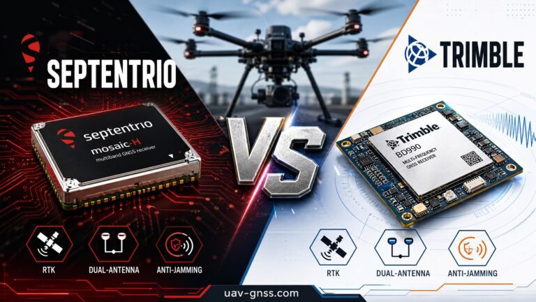
uav-gnss.com builds around the Septentrio mosaic-X5 and mosaic-G5 platforms because one receiver family spans both markets:
- HBEV322 compact RTK receiver – at 14 g, the lightest receiver in the range, built for show drones where every gram competes with battery and LED payload.
- EV322 GNSS receiver – mosaic-G5 powered, plug-and-play PX4/ArduPilot compatibility for custom show fleets and development platforms.
- HB6 Pro GNSS box with 4G – integrated LTE for NTRIP corrections; an ideal show base station or network-RTK rover.
- HB51 dual-antenna heading module – mosaic-G5 P3H with MEMS U-Fusion INS bridging; the pattern for eVTOL-grade position, heading, and coasting integration.
- HB10 dual-antenna receiver – AsteRx-m3 Pro+ with 100 Hz RTK and under 10 ms latency for dynamic platforms.
All carry AIM+ resilient GNSS technology. For eVTOL programs, no box alone is “certified avionics” – these receivers provide the raw performance and integrity outputs your integrator needs for a DO-384/ETSO-C220-class system. For swarm fundamentals, see our earlier GNSS for Drone Shows & eVTOL guide, or browse the full GNSS receiver collection.
FAQ
How do drone show drones stay synchronized with each other?
Each drone derives time from the GNSS satellites it tracks. A PPS output aligned to UTC within tens of nanoseconds gives the whole fleet one common clock, so all drones execute their 4D waypoints (X, Y, Z, time) and LED changes at the same instant, independent of radio-link latency.
Why can’t standard GPS run a drone light show?
Standard GPS drifts 3-5 meters, while show drones fly only 1.5-3 meters apart. RTK corrections from a local base bring each drone to 1-3 cm – and because all drones share one correction source, relative spacing is even tighter.
What is the difference between FAA and EASA eVTOL safety requirements?
FAA certifies powered-lift aircraft to 10^-8 catastrophic failures per flight hour; EASA’s SC-VTOL Enhanced requires 10^-9, the airliner standard. The June 2026 harmonization aligned technical criteria but kept both thresholds, and the UK CAA and UAE GCAA align with the stricter EASA standard.
Why is integrity more important than accuracy for eVTOL navigation?
Integrity means the system knows when its position cannot be trusted, within a bounded time to alert. Regulators require protection levels and fault detection (RAIM/ARAIM under DO-384, ETSO-C220) because a wrong position that looks healthy is worse than a lost signal.
What is OSNMA and why does it matter for eVTOL?
OSNMA is Galileo’s free civil authentication service (operational since July 2025). It cryptographically verifies that navigation data came from Galileo, so receivers reject spoofed signals – a core layer of urban airspace defense alongside AIM+ and redundant sensors.
Can the same receiver serve drone shows and eVTOL programs?
Yes – the mosaic-X5/mosaic-G5 family spans both. Show drones need ultra-light receivers like the HBEV322 (RTK + PPS timing); eVTOL integrators need the same tracking, integrity outputs, dual-antenna heading, and INS coupling in a redundant architecture such as the HB51.
Planning a swarm operation or an eVTOL navigation stack? Browse the GNSS receiver range or contact us to discuss receiver selection for your platform.