Earthmoving is in the middle of a quiet revolution — and by 2026 it is fully mainstream. GNSS machine control, once reserved for large infrastructure firms with deep pockets, is now standard practice on competitive job sites, from suburban housing developments to major highway corridors. In 2026, 2D grade control ships as standard equipment on many new excavators and dozers, and full 3D machine control is being integrated at the factory: Komatsu’s IMC 3.0, Liebherr’s Generation 8 with Leica sensors, CASE’s in-house 3D system, and John Deere SmartGrade all arrive pre-installed from the OEM. The question for contractors is no longer whether to adopt machine control, but which level fits their fleet — and what it takes to keep it running at centimeter accuracy all day, every day.
This guide explains how RTK GNSS machine control works on real job sites — the positioning chain from satellite to bucket teeth, the accuracy you can actually expect, the failure modes that plague budget systems, and what to look for in a construction-grade GNSS receiver.
What Is GNSS Machine Control?
GNSS machine control — also called grade control or 3D machine guidance — uses real-time satellite positioning to track the exact location and elevation of a machine’s cutting edge (the blade tip of a dozer or grader, the bucket teeth of an excavator) and compares it against a digital design model of the finished surface. The operator sees a color-coded cut/fill map in the cab: blue for fill, red for cut, green for on-grade. No stakes, no string lines, no waiting for a survey check.
2D Grade Control: Simple, Sensor-Based, Standard
2D systems guide the operator to a target depth or slope using machine sensors and an in-cab display — no GNSS required. They are ideal for repetitive work with a consistent cross-section: utility trenching, drainage installation, residential foundations, and road preparation. By 2026, 2D grade control is standard on many new machines from Cat, Komatsu, Develon, Hyundai, and Liebherr, and it remains the fastest way to eliminate manual grade checks on simple earthwork.
3D Machine Control: GNSS Meets the Digital Site Model
3D machine control adds GNSS positioning and a digital terrain model (DTM) or engineering design surface, guiding the machine anywhere on the job site — variable slopes, road crowns, swales, pond bottoms, and graded terraces — with no physical infrastructure on the ground beyond a correction source. This makes it the go-to technology for large-scale earthmoving, commercial site development, highway construction, and mining. Operators work directly from design files (LandXML, DWG, DXF), placing material to final grade without stakes or grade hubs.
How RTK GNSS Works on a Construction Job Site
From Raw Satellites to a Centimeter Fix
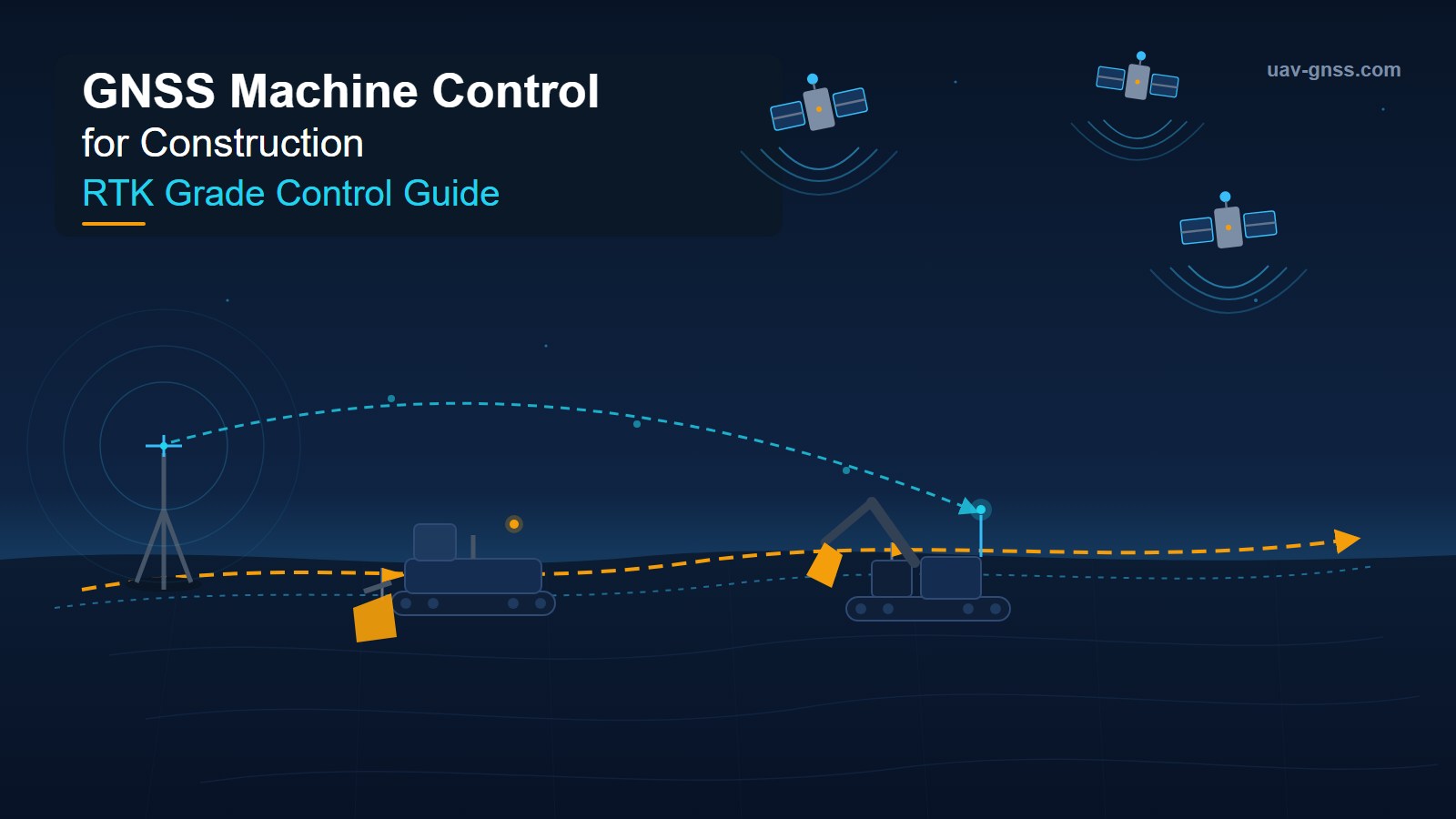
Raw GNSS alone is accurate to roughly 1–3 meters — far too coarse for grade control. Real-Time Kinematic (RTK) closes the gap to centimeters. A fixed base station with a known surveyed position calculates atmospheric and satellite-orbit errors, then broadcasts correction data (RTCM) to the rover receivers on each machine. The rover combines those corrections with its own raw measurements to compute a position accurate to 2–3 cm horizontally and 3–5 cm vertically in real time — repeatedly, at 10–20 Hz or faster.
Local Base Station vs. Network RTK
Two correction architectures dominate construction:
- Local base station + UHF radio. A base at a known control point on or near the site broadcasts corrections to every machine by radio. This is the classic setup for isolated job sites — no cellular coverage needed, and all machines share one correction source, maximizing relative accuracy across the fleet.
- Network RTK (NTRIP/VRS/CORS). Correction data is delivered over cellular to each machine individually, computed from a network of permanent reference stations. Subscription costs typically run $1,500–$3,500 per machine per year — a fraction of the savings generated — and coverage now spans most metro areas and many rural regions.
Many production contractors run a hybrid: a permanent site base station (or a subscription network) feeding rovers that blend both sources for maximum availability.
IMU Fusion: Finding the Bucket Teeth
An excavator’s bucket sits at the end of a three-segment linkage — boom, stick, and bucket — whose geometry changes constantly under dynamic loading. Computing bucket-tip position requires knowing each segment’s angle in real time: IMUs on the boom and stick track angle to within 0.05–0.1 degrees, while one or two GNSS antennas on the cab establish the machine’s absolute XYZ position and heading. The fused solution keeps the bucket referenced to grade even when the machine works on a 30-degree side slope — no manual leveling required.
Heading: The Dual-Antenna Advantage
Dozers, graders, and excavators need reliable machine orientation, and construction sites are magnetic nightmares: steel structures, power lines, and heavy equipment corrupt magnetometers. Dual-antenna GNSS computes heading from carrier-phase differences between two antennas — accurate to 0.1–0.2 degrees and completely independent of magnetic conditions — which is why it is standard on serious machine control installations.
Machine Control Accuracy: What You Can Expect
| Correction method | Horizontal accuracy | Vertical accuracy | Infrastructure |
|---|---|---|---|
| Raw GNSS (no correction) | ±1–3 m | ±2–5 m | None |
| SBAS (WAAS/EGNOS) | ±1–3 m | ±3–5 m | None |
| Local RTK base station | ±10–20 mm | ±15–25 mm | Base + radio |
| Network RTK (VRS) | ±10–20 mm | ±15–25 mm | Cellular |
| RTK + IMU hybrid | ±8–15 mm | ±10–20 mm | Base or network |
A well-calibrated system on an open site with a good RTK signal routinely holds ±12–15 mm vertically, meeting or exceeding the ±15 mm tolerance specified on most highway and commercial grading projects. Fine grading under 1 cm tolerance still benefits from a laser or sonic tracker blended with the GNSS solution — but the vast majority of earthmoving is handled comfortably by RTK alone.
Why Job-Site GNSS Fails — and How to Prevent It
Generators, welders, high-voltage power lines, radio towers, and even the machine’s own alternator emit radio-frequency interference (RFI) in bands that overlap GNSS signals. Add multipath reflections off excavator booms, steel buildings, and stockpiles, plus partial sky occlusion in deep cuts — and you have the recipe for the dreaded “RTK Float” or “No Fix” alarm, meaning the blade just lost its grading reference.
Consumer-grade or older-generation survey receivers desensitize quickly in these conditions, and re-acquiring carrier-phase lock can take 30 seconds to several minutes on a moving machine — during which the operator is effectively working blind. Premium receivers solve this at the RF level:
- Advanced multipath mitigation (APME+): Septentrio algorithms distinguish direct line-of-sight signals from reflections by analyzing correlation-peak shape, discarding contaminated measurements before they degrade the fix.
- Active anti-jamming (AIM+): adaptive notch filtering and narrowband interference excision reject continuous-wave interferers up to ~80 dB above the noise floor — well beyond what typical survey receivers handle.
The result: Septentrio-powered receivers hold a fixed RTK solution next to a running generator, under a high-voltage transmission line, and alongside reflective steel structures that send lesser units into float. On a real site, that means fewer interruptions, less rework, and more productive machine hours per shift.
2026 Trends Reshaping Machine Control
Factory-Integrated 3D
The biggest shift of 2026 is integration at the OEM level. Komatsu’s IMC 3.0 adds in-field design, auto swing, swing-to-line, travel-along-line, 3D boundary control, and auto stop — with over-the-air updates. CASE brings its in-house 3D system to large excavators in Q3 2026, including aftermarket kits. Liebherr Generation 8 machines ship with Leica sensor chains, and most mid-size Deere, Develon, and Hyundai excavators now come 2D-standard with a factory-ready path to 3D. The barrier to entry has never been lower.
Hybrid Positioning: Total Station + GNSS
On busy sites, vehicles and equipment can block line-of-sight between robotic total stations and the machine-mounted prism. Topcon’s Hybrid Lock answers by automatically switching between local positioning system (LPS) tracking and GNSS tracking when line-of-sight is lost — excavation continues uninterrupted instead of halting while the robot reacquires.
Automation and Semi-Autonomous Operation
Blade and bucket control is moving from guidance to supervised automation: the system drives the hydraulics against the design surface while the operator manages the line. Komatsu has deployed semi-autonomous dozer swarms on quarry and mining sites, and Cat’s Command for Dozing extends remote and autonomous operation beyond mining toward civil construction.
The Digital Construction Loop
Design models that once traveled to site as paper now flow from BIM/Civil 3D straight into the cab, and as-built data flows back to the office at the end of every shift. On large projects it is now routine to fly a daily drone survey, compare the resulting point cloud to the design surface, and push updated progress data back to the machines — a closed loop between what was designed, what has been built, and what remains. A 3D machine control system is the live endpoint of that loop.
The ROI of GNSS Machine Control
The business case is well documented across contractor-reported data on North American and European sites:
- 30–50% reduction in survey crew costs — no more staking every grid line or repeated grade checks
- 15–25% increase in operator productivity — fewer passes, no waiting for checks, first-pass accuracy
- Near-elimination of over-excavation rework — the biggest cost driver in earthmoving (material, hauling, compaction, time)
- Payback in 4–6 months on a dozer or excavator running 8+ hours per day
- Up to 50% time savings on some operations, plus reduced fuel burn and machine wear
- A narrower operator skill gap — clear cab guidance brings mid-level operators close to veteran performance
Every minute a machine loses RTK lock works directly against that ROI — which is why receiver reliability, not just sticker accuracy, is the real purchase criterion.
Site Surveying with GNSS: The Other Half of the Workflow
Machine control and site surveying are two halves of the same digital loop. Surveyors establish the site control network and stake-out that the machines work from, then verify as-built surfaces against the design at acceptance. GNSS has transformed this side too: RTK rovers resolve centimeter positions in seconds without line-of-sight to a total station, drone photogrammetry and LiDAR scanning produce daily progress surfaces, and the machine’s own GNSS-tracked path gives the surveyor a verified record of what was actually built — with data that survives the shift, unlike a chalk mark on a stockpile.
For contractors running both disciplines, one receiver platform can serve both: a rugged rover for survey and layout tasks, and the same RTK engine family inside the machine control installation — simplifying training, spares, and correction infrastructure.
Choosing a GNSS Receiver for Machine Control
Every receiver below is powered by Septentrio silicon — multi-constellation, multi-frequency tracking, AIM+ interference mitigation, and fast RTK convergence — in form factors suited to machines, site bases, and OEM integration:
| Product | Module | Key features | Best for |
|---|---|---|---|
| HB62 Rugged Reference Station | Mosaic-X5 | IP67, NTRIP, 64 GB logging, 100 Hz output, 0.6 cm + 0.5 ppm | On-site base stations and CORS |
| HB6 Pro GNSS Box Receiver | Mosaic-X5 | 4G LTE, dual-antenna heading, AIM+, 45 g | Machine rovers receiving NTRIP corrections |
| HB3 Rugged RTK Box Receiver | AsteRx-m3 Pro+ | IP67, 4G + UHF radio, L-band, 32 GB storage | Remote sites without cellular; base + rover roles |
| HB6 GNSS Box Receiver | Mosaic-X5 | AIM+, dual-antenna heading, IP67, USB/UART/Ethernet | Embedded machine control and test rigs |
| HB51 Positioning & Heading Module | Mosaic-G5 P3H | Dual-antenna heading, IMU, geomagnetic sensor | Dozer/excavator heading and grade integration |
| HB59 Multi-Function OEM Receiver | AsteRx-m3 Pro+ | Base or rover, Ethernet, 100 Hz RTK, dual-antenna heading | OEM machine control systems |
Learn more about AIM+ anti-jamming technology or browse the full GNSS receiver collection.
Building a Reliable Job-Site GNSS Architecture
- Commission the correction source as infrastructure. A permanent base station (or a local NTRIP subscription) with documented coordinates beats ad-hoc setups — all machines share one reference, and RTK availability goes up.
- Audit the RF environment. Walk the site with a spectrum analyzer to identify interference sources. Two hours of analysis tells you which receivers will hold fix and which will struggle.
- Pilot before fleet rollout. Fit one dozer or excavator and run it for two weeks alongside conventionally staked operations, comparing productivity and rework rates before committing the fleet.
- Design for GNSS denial. Fuse GNSS with IMU so machines coast through brief outages under bridges, in cuts, or during interference events instead of dropping out of grade.
- Demand interference visibility. A receiver that detects, logs, and reports jamming turns an invisible RF event into documented evidence — invaluable when a system underperforms and nobody can explain why.
- Keep the design data loop tight. Ensure the cab display software imports LandXML/DWG/DXF and stays synchronized with design revisions; an outdated surface model is as dangerous as a bad fix.
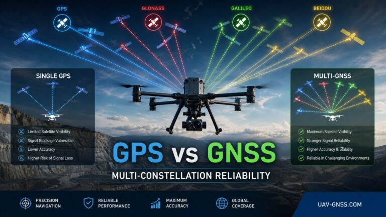
- Future-proof with multi-constellation tracking. GPS, GLONASS, Galileo, and BeiDou together provide the satellite diversity that keeps fixes available in cuts, yards, and near structures — and ready you for Galileo HAS and OSNMA as they mature.
Frequently Asked Questions
Q: What is GNSS machine control?
A: GNSS machine control uses real-time satellite positioning (typically RTK) to track a machine’s cutting edge — dozer blade, grader moldboard, or excavator bucket teeth — against a digital design model, giving the operator live cut/fill guidance in the cab. It replaces grade stakes and manual checks with centimeter-accurate, model-driven earthmoving.
Q: What accuracy can I expect from RTK machine control?
A: Typically ±10–20 mm horizontal and ±15–25 mm vertical with RTK; ±8–15 mm horizontal with RTK fused to IMU. On an open site with good corrections, most systems hold ±12–15 mm vertical — enough to meet the ±15 mm tolerance on most highway and commercial grading specs. Fine grading under 1 cm still uses laser or total station blending.
Q: Should I use a local base station or network RTK?
A: Local base stations suit isolated sites and maximize relative accuracy across the fleet. Network RTK (NTRIP/VRS/CORS) over cellular removes base-station logistics and covers large areas, at $1,500–$3,500 per machine per year. Many contractors run both: a site base plus a network subscription for machines working beyond radio range.
Q: Why does my machine control system lose fix on site?
A: Three causes dominate: multipath (signal reflections off the boom, steel buildings, and stockpiles), radio-frequency interference (generators, welders, power lines, radio towers), and sky occlusion in deep cuts or near structures. Receivers with advanced multipath mitigation and active anti-jamming — like Septentrio’s AIM+ — hold RTK lock in conditions that make standard survey receivers drop to float.
Q: Can I retrofit RTK machine control to existing equipment?
A: Yes. Modern systems are modular retrofits: a GNSS receiver, cab display with machine control software, IMU tilt sensors, and an electro-hydraulic valve interface. Installation takes one to two days per machine and works across all major brands — Cat, Komatsu, Deere, Hitachi, Kobelco, and Volvo — with no structural modification.
Q: How does GNSS compare to laser or total station grading?
A: RTK GNSS excels at large-area earthmoving and complex 3D surfaces with no line-of-sight constraints, and keeps working in dust, fog, and darkness where lasers fail. Lasers stay superior for fine-grade flatwork; robotic total stations handle tight-tolerance and obstructed-sky work. In 2026 the trend is hybrid: systems like Topcon’s Hybrid Lock switch automatically between total station and GNSS tracking to keep machines working through line-of-sight interruptions.
Related GNSS Products
- HB62 Rugged GNSS Reference Station — IP67 CORS/base station with NTRIP for permanent site corrections
- HB6 Pro GNSS Box Receiver — 4G LTE rover with AIM+ anti-jamming for machine control
- HB3 Rugged RTK Box Receiver — IP67 with UHF radio and 4G for remote sites
- HB51 RTK Positioning & Heading Module — dual-antenna heading for dozers and excavators
- AIM+ Anti-Jamming Technology — how interference mitigation protects machine control ROI
Further Reading
- Septentrio mosaic-G5 Pixhawk Integration Guide — wiring, PX4 and ArduPilot setup for RTK dual-antenna receivers
- AIM+ Anti-Jamming Technology — how interference mitigation protects machine control ROI
- Technical Papers & Research — GNSS integration guides and datasheets
- All GNSS Receivers — browse the full Septentrio-powered lineup